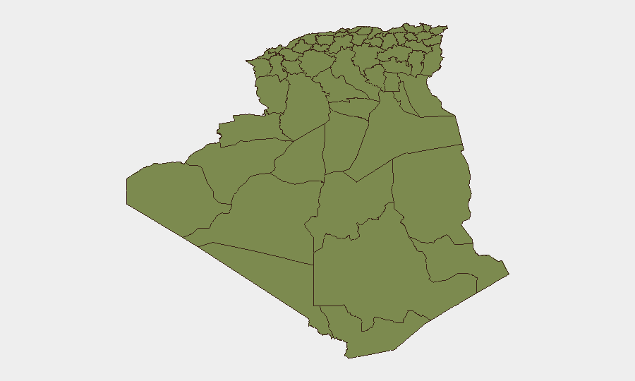
Situation Summary
Algeria remains at composite threat rank #74 globally with a score of 16, reflecting a volatile but contained security environment. The country faces persistent terrorist and kidnapping risk in southern and eastern border regions, elevated civil-unrest potential in urban centers, and routine criminal threats in major cities. Current trajectory shows structural rather than acute escalation, with wildfire disruptions now adding localized mobility and air-quality concerns to the operational picture.
Key Developments
- Nationwide wildfires, 24-hour period reported 2026-07-14 – The General Directorate of Civil Protection documented 119 active wildfires across Algeria; 114 were extinguished and 4 remain under surveillance, including an ongoing forest fire in Guelma (northeastern Algeria). Risk of short-notice road closures and smoke impacts near fire lines.
- Guelma forest fire, ongoing as of 2026-07-14 – A significant forest fire in the wilaya of Guelma remains active and under close watch by Civil Protection, with potential for movement restrictions in and around the affected area.
- Criminal assassination event, 2026-07-15 – A single assassination incident was recorded in the latest 24-hour reporting window; no location-specific details or victim identity have been released by open sources, and verification of motive and scope is pending.
- Authority rejection action, 2026-07-13 – Authorities issued a rejection or denial action; context and subject matter are not detailed in available open-source reporting.
- Border-region security posture, ongoing as of mid-July 2026 – Military and security forces maintain elevated alert and increased presence across southern and eastern border regions (Tébessa, southern approaches, and approaches to Tunisia, Libya, Niger, Mali, and Mauritania) in response to sustained terrorist and kidnapping threat.
- Friday prayer-related demonstrations, ongoing as of mid-July 2026 – Spontaneous civil gatherings continue to occur in urban areas including Algiers, particularly after Friday prayers, with potential for traffic disruption and occasional violence despite official bans.
- Urban violent crime, ongoing as of mid-July 2026 – Armed robbery and violent crime persist after dark in Algiers recreational areas and beaches, with Ben Aknoun Park specifically noted as a risk location.
Highest-Risk Areas
Bordj Bou Arreridj dominates the sub-national ranking with a composite risk score of 31.9—significantly higher than all other tracked regions and reflecting concentration of criminal or organized activity. In Salah (risk 5.6) follows at considerable distance, likely driven by southern border proximity and resource-extraction activity. The remaining ten tracked regions cluster at risk 1.9, indicating distributed but lower-intensity threat across the Saharan south, border areas, and major urban centers including Algiers. Risk is heavily weighted toward southern and eastern border zones and rural/mountainous terrain outside major northern cities.
How GeoBit Would Assist
Security teams should deploy AOI Monitoring & Early Warning on Bordj Bou Arreridj, border wilayas, and Guelma to catch emerging incidents and wildfire progression in near-real time. Intel Sweep and OSINT fusion (X/Twitter, Telegram, multi-language sources, and cross-corroboration) would clarify the 2026-07-15 assassination and 2026-07-13 authority action, assess actor networks, and track Friday demonstration patterns. Routing & Network Analysis would enable alternative journey planning for teams in high-risk areas during wildfire operations and around active security cordons.
7-Day Outlook
Wildfire activity is expected to persist and potentially fluctuate with weather; Guelma and surrounding regions should be monitored for containment updates and secondary road-access impacts. Border-region security operations are likely to continue at current elevated tempo. Urban civil unrest risk remains low-to-moderate but episodic, tied to Friday prayer cycles and spontaneous grievance mobilization; no major escalation is signaled in current open-source reporting.
Highest-Risk Areas — Ranked
| # | State / Region | Risk |
|---|---|---|
| 1 | Bordj Bou Arreridj | 31.9 |
| 2 | In Salah | 5.6 |
| 3 | Bechar | 1.9 |
| 4 | Beni Abbes | 1.9 |
| 5 | Adrar | 1.9 |
| 6 | Bordj Badji Mokhtar | 1.9 |
| 7 | El Bayadh | 1.9 |
| 8 | Ghardaia | 1.9 |
| 9 | Saïda | 1.9 |
| 10 | Algiers | 1.9 |
| 11 | Boumerdes | 1.9 |
| 12 | Tizi Ouzou | 1.9 |
Previous Daily Briefs
A new Algeria brief is written every day — each with its own risk map and downloadable CSV. Here's the last week; use the calendar to go further back.
📅 Browse every day by calendar →
Highlighted days have a brief. Tap a day for that day's map & analysis, or “csv” for that day's dataset ($5).
Atlas — our AI intelligence desk — emails them this snapshot personally. Nothing else, no list.