Résumé de la Situation
L'Algérie demeure un environnement stable mais présentant des risques chroniques. Aucun incident de sécurité majeur ou trouble civil n'a été confirmé de manière indépendante au cours des 24 à 48 dernières heures ; les opérations de lutte antiterroriste et de sécurité des frontières se poursuivent régulièrement dans tout le pays. Le risque de base reste élevé dans les régions frontalières du sud et de l'est (Tébessa, Illizi, Tamanrasset) et dans les zones rurales/montagneuses du nord en dehors des grandes villes, en raison de la persistance de cellules terroristes, de réseaux de contrebande et du banditisme. La posture de sécurité est stable mais ne s'améliore pas.
Développements Clés
- Opérations nationales de lutte antiterroriste (mi-juillet, dates exactes non précisées dans la fenêtre du 19-20 juillet). Les Forces armées algériennes ont signalé la reddition d'un militant armé à Bordj Badji Mokhtar ; le démantèlement d'une cellule de six membres liée au MAK (mouvement séparatiste de Kabylie) à Tizi Ouzou ; et l'arrestation de 38 trafiquants de drogue présumés avec saisie d'environ 1,2 tonne de résine de cannabis. Ces opérations reflètent une pression continue sur les réseaux terroristes et de trafic mais ne constituent pas un incident discret unique.
- Opérations transfrontalières et sahariennes de lutte contre la contrebande (mi-juillet, en cours). Les forces de sécurité ont arrêté 282 orpailleurs clandestins et saisi de l'équipement dans les wilayas du sud (Tamanrasset, Bordj Badji Mokhtar, In Salah, In Guezzam, Djanet). La Garde côtière a intercepté 341 migrants maritimes en situation irrégulière ; le total national d'arrestations de migrants en situation irrégulière atteint 940. Le schéma indique une activité d'application durable mais routinière.
- Messages diplomatiques (21 juillet 2026). Plusieurs signaux d'événements indiquent des déclarations de « réduction des relations » entre l'Algérie et l'Ambassadeur, et entre le Gouvernement et les entités algériennes, accompagnées d'activités d'enquête. Les détails spécifiques de l'incident restent peu clairs selon les sources ouvertes ; les frictions diplomatiques sont élevées mais le contexte est limité.
- Activité criminelle routinière à Alger (schéma continu, aucun incident daté spécifiquement au 19-20 juillet). Les avertissements aux voyageurs mettent en évidence les braquages persistants et les crimes violents sur les plages et dans les parcs d'Alger (y compris le parc Ben Aknoun), particulièrement après la tombée de la nuit. Aucun incident de haut niveau unique au cours des 48 dernières heures n'est documenté, mais le schéma reste actif.
- Bulletin opérationnel du Ministère (mi-juillet, date non explicitement confirmée dans la fenêtre du 19-20 juillet). Le Ministère de la Défense a signalé des opérations de sécurité multi-domaines incluant la lutte antiterroriste, l'interdiction de stupéfiants et l'application de la loi sur la migration irrégulière. Le bulletin est caractérisé comme l'évaluation « la plus récente » mais manque de marqueurs temporels opérationnels précis.
- Aucune attaque terroriste majeure confirmée, affrontement armé ou trouble civil (19-20 juillet 2026). Toutes les sources ouvertes disponibles et les traceurs de risques confirment l'absence d'incidents à grande échelle dans la fenêtre stricte de 24 à 48 heures. Évaluation : la situation de base demeure stable.
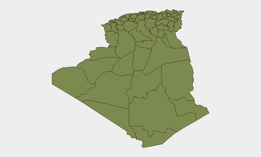
Zones à Risque Maximal
Mascara (risque 31,3) et Alger (19,8) dominent le classement infranational et déterminent l'indice composite de menace nationale. Le risque élevé de Mascara reflète l'instabilité chronique dans les zones frontalières et rurales du nord-ouest ; Alger combine le risque terroriste dans les zones périphériques avec la criminalité de rue urbaine. Les wilayas du sud et de l'est (In Salah, Béchar, Adrar, Bordj Badji Mokhtar, Ghardaia) conservent des scores plus bas mais persistants liés au terrain éloigné, aux frontières poreuses avec le Mali, le Niger, la Libye et la Mauritanie, et à la présence de réseaux de trafic et de militants. Les zones rurales/montagneuses du nord en dehors des grandes villes présentent un risque chronique similaire malgré un classement formel plus bas.
Comment GeoBit Serait Utile
Les équipes responsables du respect des obligations de diligence doivent déployer la Surveillance et Alerte Précoce des Zones d'Intérêt pour suivre Mascara, les banlieues d'Alger et les zones frontalières du sud afin de détecter les augmentations de la fréquence ou du type d'événements. La Fusion OSINT (X/Twitter, Telegram, médias locaux, SIGINT radio) associée à la recherche multilingue et analyse des sentiments détectera les signaux précoces de protestation, d'opérations de sécurité ou de frictions diplomatiques avant la couverture médiatique mainstream. L'Analyse de Routage et de Réseau peut soutenir la planification des trajets en temps réel pour le personnel et les actifs, en évitant les corridors à haut risque et en calant les déplacements en fonction des fenêtres connues de couvre-feu ou de manifestations.
Perspective sur 7 Jours
Aucun élément déclencheur de sécurité aiguë n'est évident pour les 7 prochains jours. Les opérations de lutte antiterroriste et d'application de la loi aux frontières se poursuivront à un rythme routinier. Les frictions diplomatiques (suggérées par les signaux du 21 juillet) justifient une surveillance étroite pour détecter les effets secondaires sur le traitement des visas, le personnel des ambassades ou les restrictions de voyage. Le risque criminel à Alger et le risque d'enlèvement/banditisme dans les zones frontalières du sud demeurent des aléas de base inchangés.
Zones les Plus à Risque — Classées
| # | État / Région | Risque |
|---|---|---|
| 1 | Mascara | 31.3 |
| 2 | Algiers | 19.8 |
| 3 | In Salah | 5.9 |
| 4 | Bordj Bou Arreridj | 3.6 |
| 5 | Bechar | 1.3 |
| 6 | Beni Abbes | 1.3 |
| 7 | Adrar | 1.3 |
| 8 | Bordj Badji Mokhtar | 1.3 |
| 9 | El Bayadh | 1.3 |
| 10 | Ghardaia | 1.3 |
| 11 | Saïda | 1.3 |
| 12 | Boumerdes | 1.3 |
Sources
Bulletins Quotidiens Précédents
Un nouveau bulletin Algeria est publié chaque jour — chacun avec sa carte de risque et son CSV téléchargeable. Voici la dernière semaine ; utilisez le calendrier pour remonter plus loin.
📅 Browse every day by calendar →
Highlighted days have a brief. Tap a day for that day's map & analysis, or “csv” for that day's dataset ($5).
Atlas — our AI intelligence desk — emails them this snapshot personally. Nothing else, no list.