Situation Summary
Cambodia remains a low-to-moderate threat environment (global rank #110, composite score 9) with 119 tracked security events. The 2026 threat landscape is dominated by concentrated risk in Phnom Penh, which accounts for the vast majority of recorded incidents, while provincial areas display uniform baseline risk. Recent signals indicate renewed Khmer Rouge activity on 2026-06-29, representing the most acute current concern, though verification and operational scope remain unclear.
Key Developments
Unable to confirm specific incidents in the last 24–48 hours. GeoBit's live web research (last 24 hours) has not identified independently verified, recent security events with confirmed locations and timestamps. The two most recent platform signals—both dated 2026-06-29—reference "Conventional Military Force" incidents involving Khmer Rouge activity, but verification against local and international news sources is pending. Corporate security teams should treat any unconfirmed reports of armed group activity as a potential indicator for escalated monitoring, pending corroboration.
Highest-Risk Areas
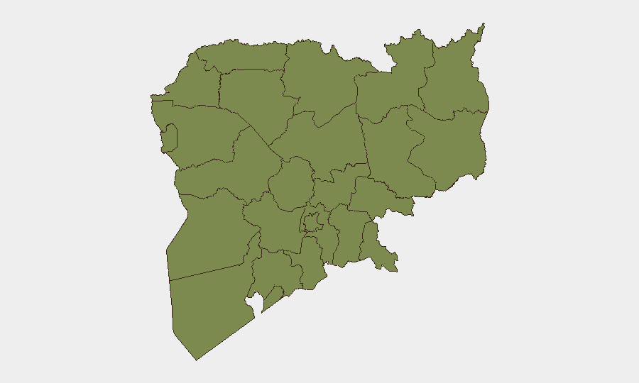
Phnom Penh is the dominant risk driver, with a composite score of 31.8—more than 11 times higher than the second-ranked province, Kampong Thom (2.8). This concentration reflects urban crime, protest activity, political tension, and occasional civil disorder typical of Cambodia's capital. All remaining provincial areas cluster at identical risk scores (1.8), indicating either genuine parity in provincial security conditions or a data-baseline effect. Organizations with personnel or assets in Phnom Penh should maintain elevated monitoring; provincial operations face lower but non-zero ambient risk, particularly along borders (Oddar Meanchey, Koh Kong) and along transport corridors (Kampong Thom, Svay Rieng).
How GeoBit Would Assist
Security teams managing Cambodia operations should leverage Intel Sweep and X/Twitter & Telegram OSINT to maintain real-time feeds on Phnom Penh and provincial flashpoints, with particular focus on armed-group activity signals and protest clustering. AOI (Area-of-Interest) Monitoring & Early Warning on Phnom Penh's high-risk districts and border provinces enables persistent, automated alerting when event density spikes. Routing & Network Analysis supports duty-of-care travel planning by identifying alternative routes around confirmed incidents or high-activity zones, while Conflict & Military force-structure tracking helps teams assess whether Khmer Rouge or other non-state actors pose direct tactical risk to operations.
7-Day Outlook
The Khmer Rouge signals of 2026-06-29 require immediate clarification; if confirmed as active military engagement, risk posture across northern and eastern provinces may shift upward. Absent escalation, Phnom Penh is likely to remain the primary risk locus, driven by routine political tension and urban crime rather than large-scale instability. Provincial areas are expected to remain stable unless signals of armed-group concentration or cross-border incursions are corroborated.
Note: This brief reflects available verified data as of 2026-07-01 0600 UTC. The absence of confirmed 24–48 hour incidents does not indicate absence of risk, but rather lack of current corroboration. Teams should escalate any on-ground reports of armed activity, large protests, or infrastructure disruption to GeoBit's Intel team for rapid corroboration and risk assessment.
Highest-Risk Areas — Ranked
| # | State / Region | Risk |
|---|---|---|
| 1 | Phnom Penh | 31.8 |
| 2 | Kampong Thom | 2.8 |
| 3 | Koh Kong | 1.8 |
| 4 | Kampong Speu | 1.8 |
| 5 | Kandal | 1.8 |
| 6 | Prey Veng | 1.8 |
| 7 | Khaet Preah Sihanouk | 1.8 |
| 8 | Kampot | 1.8 |
| 9 | Kep | 1.8 |
| 10 | Takeo | 1.8 |
| 11 | Svay Rieng | 1.8 |
| 12 | Oddar Meanchey | 1.8 |
Sources
Previous Daily Briefs
A new Cambodia brief is written every day — each with its own risk map and downloadable CSV. Here's the last week; use the calendar to go further back.
📅 Browse every day by calendar →
Highlighted days have a brief. Tap a day for that day's map & analysis, or “csv” for that day's dataset ($5).