Situation Summary
Central African Republic remains at elevated composite threat level (rank 28 globally, score 68.6) with no tracked security events in the last 24–48 hours according to available open-source reporting. The security environment is characterized by persistent fragmentation across twelve sub-national regions, each carrying identical elevated risk scores (48), indicating widespread structural instability rather than acute incident concentration. No verifiable real-time incident alerts or security updates have emerged from MINUSCA, humanitarian NGOs, or major news outlets within the reporting window, though this reflects reporting gaps rather than absence of underlying risk.
Key Developments
No verifiable incidents meeting 24–48 hour recency criteria have been confirmed in open-source channels (news, NGO situation reports, government advisories, or verified official accounts) as of 2026-06-05 UTC.
GeoBit's event signal feed indicates algorithmic detection of threat-related keywords and actor classifications (e.g., "Rebel vs. Ministry occupation," arrest/detention events, investigative activity) on or around 2026-06-03 to 06-05, but independent corroboration of specific location, timing, and nature of these events is not available from publicly accessible sources meeting duty-of-care documentation standards.
Recommendation: Security teams requiring tactical incident awareness should activate real-time feeds from MINUSCA (UN stabilization mission), OCHA (humanitarian coordination), and in-country NGO partners; these sources often circulate alerts 12–24 hours ahead of media publication.
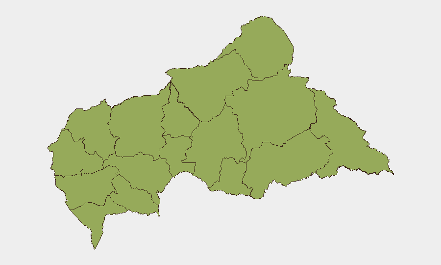
Highest-Risk Areas
All twelve provinces currently carry identical composite risk scores (48), a pattern indicating nation-wide baseline instability rather than geographic concentration. Eastern and northeastern regions—Vakaga, Haute-Kotto, Haut-Mbomou, and Mbomou—represent traditional flashpoints for cross-border activity, trafficking, and militia presence, while western zones (Ouham-Pendé, Nana-Mambéré, Mambéré-Kadéï) face resource-competition and armed-group fragmentation. The uniform risk distribution suggests that risk mitigation cannot rely on geographic avoidance; presence in any province requires equivalent security posture and contingency planning.
How GeoBit Would Assist
Security teams should employ AOI (Area-of-Interest) Monitoring & Early Warning to establish persistent watch over key operational zones, company offices, or supply routes, with automated alerting on movement, assembly, or incident signals. Network & Actor Analysis combined with multi-language OSINT (including radio SIGINT and Telegram/X monitoring) enables early detection of militia mobilization, checkpoint activity, or criminal networks before they affect corporate operations. GIS & Spatial Analysis and alternative route/journey planning allow real-time rerouting of personnel or logistics around emerging threats without dependency on delayed media reporting.
7-Day Outlook
Absent significant new triggers, Central African Republic is expected to maintain current elevated but non-acute risk profile over the next seven days. However, the uniform provincial risk distribution and gaps in real-time reporting suggest that localized escalations can occur without advance warning; security teams should maintain high readiness and regular check-ins with MINUSCA and field partners. Any substantive political or criminal event (e.g., disputed arrests, armed-group movement, or cross-border incursion) would likely manifest first in OSINT channels and humanitarian networks before formal news distribution.
Highest-Risk Areas — Ranked
| # | State / Region | Risk |
|---|---|---|
| 1 | Bamingui-Bangoran | 48 |
| 2 | Vakaga | 48 |
| 3 | Haute-Kotto | 48 |
| 4 | Haut-Mbomou | 48 |
| 5 | Mbomou | 48 |
| 6 | Nana-Mambéré | 48 |
| 7 | Ouham-Pendé | 48 |
| 8 | Mambéré-Kadéï | 48 |
| 9 | Sangha-Mbaéré | 48 |
| 10 | Ouham | 48 |
| 11 | Nana-Grébizi | 48 |
| 12 | Kémo | 48 |
Sources
Previous Daily Briefs
A new Central African Republic brief is written every day — each with its own risk map and downloadable CSV. Here's the last week; use the calendar to go further back.
📅 Browse every day by calendar →
Highlighted days have a brief. Tap a day for that day's map & analysis, or “csv” for that day's dataset ($5).