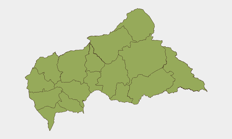
Situation Summary
Central African Republic remains under persistent insurgent and armed-group pressure, particularly in the mineral-rich northeastern prefectures. Intelligence assessments this week indicate preparation for a coordinated cross-border incursion involving up to 1,300 fighters, reportedly disrupted by Central African Armed Forces (FACA) operations supported by Russian personnel. Meanwhile, economic hardship stemming from recent fuel-price increases has triggered planned civil unrest in Bangui, creating a dual security picture of external military threat and internal political friction.
Key Developments
- Vakaga Prefecture, October 10–11: FACA, reportedly with Russian support, conducted airstrikes and ground operations to disrupt an armed-group offensive near the Chad–Sudan–CAR border. The operation targeted a coalition allegedly preparing simultaneous attacks on Vakaga and Bamingui-Bangoran prefectures.
- Vakaga and Bamingui-Bangoran, reported October 11: Intelligence sources assessed that armed groups spent approximately two months preparing an incursion capable of fielding up to 1,300 fighters, with operations expected later in October. This represents a significant force-concentration risk in the two highest-threat prefectures.
- Bangui, October 12: Civil-society organizations (iGwé, OGDC) executed a "dead city" transport shutdown from 04:00 to 17:00, protesting a ~12% diesel-price increase and disrupting taxi, bus, and motorcycle-taxi services across the capital.
- Bangui, October 8: Prime Minister Félix Moloua Ngamana publicly urged residents to reject the October 12 shutdown, signaling government concern over the scale and potential trajectory of economic discontent.
- Bangui, October 8: President Faustin-Archange Touadéra inaugurated an integrated database for crimes and wanted persons at the Ministry of the Interior, designed to improve police-gendarme information-sharing and identify crime trends. This represents incremental institutional strengthening under UN backing.
- Ngaoundaye, Lim-Pendé Prefecture, October 6: Local authorities reported more than 30 deaths from deliberate ingestion of agricultural herbicide, characterized as mass poisoning or self-harm rather than armed violence. The incident reflects acute livelihood stress in rural areas.
- Chad–CAR border, October 6: Chad reportedly pressed Bangui to facilitate the return of three rebel-group leaders currently based in Chad, with potential repatriation discussed for November. No movement occurred during the review period.
Highest-Risk Areas
Vakaga (risk 95) and Bamingui-Bangoran (92) drive the national threat composite, reflecting sustained armed-group presence, cross-border infiltration networks, and mineral-extraction competition. These northeastern prefectures remain ungoverned or loosely administered, creating sanctuary for insurgent planning and staging. Haute-Kotto (88) and Haut-Mbomou (85) similarly present high risk from armed activity and state-capacity gaps. Risk declines southward and westward; Bangui (78) remains elevated due to density, economic friction, and criminal networks, but poses lower terrorism risk than the northeast. The southern prefectures (Sangha-Mbaéré, 68; Ombella-M'Poko, 62) are substantially more permissive for corporate operations.
How GeoBit Would Assist
Teams operating in or transiting CAR should employ AOI Monitoring & Early Warning on Vakaga and Bamingui-Bangoran to detect force movement and staging activity; Intelligence & OSINT (Intel Sweep, multi-language OSINT, entity extraction, sentiment analysis) to track armed-group communication, recruitment, and pre-attack signaling; and Routing & Network Analysis to identify secure alternative transport corridors during civil unrest or incursion events. Conflict & Military (battle mapping, force-structure tracking) capabilities enable real-time assessment of FACA and Russian-supported operations and their reach.
7-Day Outlook
The disrupted October incursion appears to have degraded but not eliminated the cross-border threat; renewed armed-group action is likely within two to four weeks. Civil unrest in Bangui is expected to remain episodic and economically driven rather than politically revolutionary, but fuel-price pressures will sustain underlying friction and mobility risk in the capital. Northeast prefectures warrant heightened alert posture through mid-November.
Highest-Risk Areas — Ranked
| # | State / Region | Risk |
|---|---|---|
| 1 | Vakaga | 95 |
| 2 | Bamingui-Bangoran | 92 |
| 3 | Haute-Kotto | 88 |
| 4 | Haut-Mbomou | 85 |
| 5 | Mbomou | 82 |
| 6 | Ouham-Pendé | 79 |
| 7 | Bangui | 78 |
| 8 | Nana-Mambéré | 75 |
| 9 | Sangha-Mbaéré | 68 |
| 10 | Ouham | 65 |
| 11 | Ombella-M'Poko | 62 |
| 12 | Kémo | 58 |
Sources
Previous Weekly Briefs
A new Central African Republic brief is written every Monday, covering the week — each with its own risk map and downloadable CSV. Use the calendar to go further back.
- October 5, 2026
- September 28, 2026
- September 22, 2026
- September 15, 2026
- September 8, 2026
- September 2, 2026
- September 1, 2026
📅 Browse past briefs by calendar →
Highlighted days have a brief. Tap a day for that day's map & analysis, or “csv” for that day's dataset ($5).
Atlas — our AI intelligence desk — emails them this snapshot personally. Nothing else, no list.