Situation Summary
Colombia remains at moderate overall threat level (#42 globally, composite score 35.3), with 162 tracked events. Multiple signals on 2026-06-05 indicate elevated political tension and labor unrest, including presidential statements, administrative sanctions, and worker demonstrations. Sub-national risk is heavily concentrated in Meta Department and the southern border region, driven by armed-group activity, trafficking, and Venezuela-Colombia tensions. The security environment is dynamic but not acutely destabilizing at the national level.
Key Developments
- 2026-06-05 · Venezuela–Colombia tension: Recorded rejection statement by Venezuela versus Colombia; potential diplomatic or border escalation signal requiring monitoring of cross-border movement and rhetoric.
- 2026-06-05 · Presidential administrative action: Administrative sanctions issued by Colombian government; context and scope not yet detailed; monitor official statements for policy or personnel changes affecting security posture.
- 2026-06-05 · Labor unrest: Worker demonstration/rally event recorded on 2026-06-05; location and scale unknown; potential for disruption to transport, commerce, or public order in urban centers.
- 2026-06-05 · Government threat escalation: Authorities and government entities recorded threats; suggests possible escalation in rhetoric or posture toward specific actors (armed groups, criminal networks, or political opposition).
- 2026-06-05 · Investigative action: Attorney office initiated investigation; subject and scope unconfirmed; may relate to administrative or criminal matter.
- 2026-06-05 · Expulsion/deportation: Presidential action to expel or deport recorded; geopolitical or migration dimension likely; monitor border and consular channels.
*Note: Detailed incident narratives, locations, and casualty counts are not available in current signal data; escalation monitoring recommended.*
Highest-Risk Areas
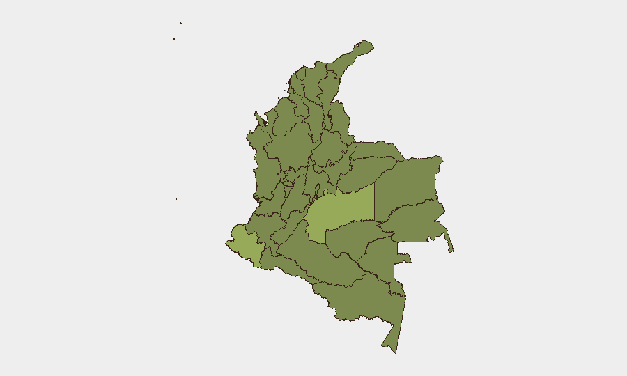
Meta Department (54.7) and Nariño (40.4) drive sub-national risk substantially above the national mean, followed by the Capital District (36.9). Meta's elevated score reflects persistent armed-group territorial control and drug-trafficking logistics in the southern Llanos region; Nariño faces similar pressures along the Ecuador and Venezuela borders, with trafficking and dissident factions active. The Capital District concentrates urban crime, protest activity, and political tension. Together, these three regions account for a disproportionate share of kidnapping, extortion, armed confrontation, and cross-border spillover risk. Northern departments (Antioquia, Santander) and western zones (Valle del Cauca, Risaralda) remain moderately elevated due to criminal-organization presence and gang violence.
How GeoBit Would Assist
Security teams protecting personnel or assets in Colombia should employ AOI Monitoring & Early Warning to track Meta, Nariño, and the Capital District for emerging activity signals in real time, with conflict mapping and force-structure analysis to understand armed-group positioning and capability changes. OSINT fusion (X/Telegram, public statements, multi-language feeds) and network & actor analysis enable rapid corroboration of political and labor signals and attribution of threats to specific organizations. Alternative routing and network analysis support rapid adjustment of movement plans for staff in high-risk departments during escalation windows.
7-Day Outlook
Expect continued political and diplomatic messaging around Venezuela–Colombia tensions and domestic governance actions; labor unrest may persist if underlying grievances remain unaddressed. Armed-group activity in Meta and Nariño is likely to remain at current levels, with seasonal trafficking and territorial maintenance operations. No indicators of imminent major escalation, but border volatility and urban protest risk warrant sustained monitoring.
Highest-Risk Areas — Ranked
| # | State / Region | Risk |
|---|---|---|
| 1 | Meta Department | 54.7 |
| 2 | Nariño | 40.4 |
| 3 | Capital District | 36.9 |
| 4 | Bolívar Department | 32.3 |
| 5 | Cundinamarca Department | 31.4 |
| 6 | Antioquia Department | 30.2 |
| 7 | Risaralda Department | 29.7 |
| 8 | Santander Department | 26.4 |
| 9 | Tolima Department | 26.4 |
| 10 | La Guajira | 25.5 |
| 11 | Valle del Cauca Department | 25.5 |
| 12 | Cesar Department | 25.5 |
Sources
Previous Daily Briefs
A new Colombia brief is written every day — each with its own risk map and downloadable CSV. Here's the last week; use the calendar to go further back.
📅 Browse every day by calendar →
Highlighted days have a brief. Tap a day for that day's map & analysis, or “csv” for that day's dataset ($5).