Situation Summary
Comoros remains in a stable security environment with no verified incidents reported in the last 24–48 hours. Open-source monitoring shows baseline activity consistent with normal operations across the three-island archipelago, though structural risks—including political fragmentation, localized crime, and infrastructure vulnerabilities—persist at endemic levels. The sub-national threat profile reflects significant variance, with Anjouan Island assessed as substantially higher-risk than Moheli.
Key Developments
No discrete security, crime, unrest, or travel-risk incidents have been verified in Comoros during the 24–48 hour reporting window (2026-07-22 to 2026-07-24).
A planned water-supply interruption affecting Dzoumogné, Anjouan Island (announced for 7 July; exact year unclear) represents the only Comoros-specific infrastructure notice surfaced; this is scheduled maintenance, not an emergency event, and falls outside the strict current window.
Broader regional African security feeds and news wires report no Comoros incidents in the stated timeframe.
The GeoBit situational signal feed notes "no actionable thesis at this time" for Comoros, with 19 events logged over the past 7 days but no emergent trend or acute threat cluster identified.
Highest-Risk Areas
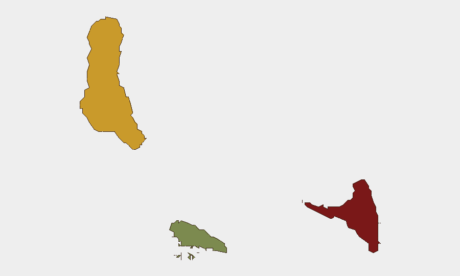
Anjouan (risk score 88) is the primary concern, reflecting longstanding political tensions, limited state capacity, and reported localized criminal activity. Grande Comore (risk score 72), the capital island, carries secondary but material risk linked to urban crime and periodic political friction. Moheli (risk score 35) is assessed as substantially lower-risk. The concentration of threat in Anjouan and Grande Comore reflects both historical separatist grievances on Anjouan and the capital's role as the administrative and commercial hub, where crowd events, petty crime, and occasional inter-communal tensions occur. Organizations with personnel or assets in Anjouan should apply heightened due-diligence protocols; those in Moheli face baseline precautions.
How GeoBit Would Assist
Intel Sweep, OSINT fusion, and multi-language event monitoring would establish real-time baseline awareness of localized crime, political meetings, port/maritime activity, and infrastructure disruptions across all three islands. AOI monitoring with alerting on Anjouan's administrative centers and Grande Comore's commercial zones would provide early warning of crowd gatherings, demonstrations, or security force movements. Routing and network analysis would support contingency travel planning for personnel requiring movement between islands or to evacuation points, particularly during periods of political tension. Satellite and imagery analysis can track infrastructure status (ports, airports, roads) to assess mobility and supply-chain continuity.
7-Day Outlook
No acute escalation is anticipated over the next 7 days based on current open-source signals. However, the absence of recent reporting does not exclude localized incidents; monitoring cadence should remain consistent to detect emerging tensions early, particularly on Anjouan where political and administrative friction has historically materialized with limited warning.
Highest-Risk Areas — Ranked
| # | State / Region | Risk |
|---|---|---|
| 1 | Anjouan | 88 |
| 2 | Grande Comore | 72 |
| 3 | Moheli | 35 |
Sources
Previous Daily Briefs
A new Comoros brief is written every day — each with its own risk map and downloadable CSV. Here's the last week; use the calendar to go further back.
📅 Browse every day by calendar →
Highlighted days have a brief. Tap a day for that day's map & analysis, or “csv” for that day's dataset ($5).
Atlas — our AI intelligence desk — emails them this snapshot personally. Nothing else, no list.