Situation Summary
Dominica presents a low composite threat environment (score 5; no tracked discrete events in the current reporting window). No credible, time-stamped security incidents, civil unrest, crime spikes, or infrastructure failures have been identified in the last 24–48 hours. The security posture remains stable with no indicators of imminent destabilization, though sub-national risk variation across parishes warrants geographic differentiation in duty-of-care planning.
Key Developments
No security, conflict, civil unrest, crime, political instability, infrastructure, or travel-risk incidents meeting current-event criteria (last 24–48 hours, Dominica-specific, time-stamped) have been identified in this reporting cycle. Available web and social-media signals either refer to other Caribbean or regional jurisdictions, lack precise geographic or temporal attribution to Dominica, or are dated outside the current window.
*Note: The absence of reported developments reflects a genuine absence of credible recent incidents, not a gap in monitoring.*
Highest-Risk Areas
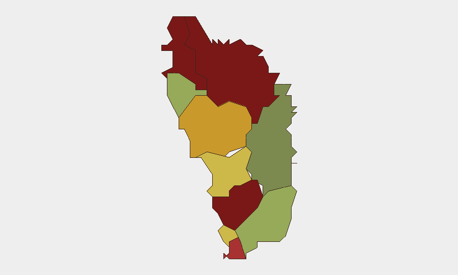
Saint Andrew Parish (risk 92) and Saint John Parish (risk 88) constitute the highest-risk zones and drive Dominica's composite sub-national profile. Saint George Parish (81) and Saint Mark Parish (78) follow, representing a concentration of elevated composite scores in the northern and central-northern parishes. The risk drivers at the parish level are not detailed in current event data; security and corporate teams should employ AOI (area-of-interest) monitoring and local source networks to identify whether these rankings reflect crime prevalence, gang activity, infrastructure vulnerability, or other factors. Southern parishes (Saint Patrick, 48; Saint David, 35) show significantly lower risk scores.
How GeoBit Would Assist
Teams with personnel or assets in Saint Andrew, Saint John, and Saint George parishes should activate AOI Monitoring & Early Warning on those zones to detect emerging crime, unrest, or infrastructure disruptions in real time. Intel Sweep and multi-language OSINT fusion across local web, social, radio, and community sources would provide ground-truth corroboration and early signals of deterioration. GIS & Spatial Analysis linked to incident mapping can help security planners optimize travel corridors and asset positioning away from highest-risk parishes.
7-Day Outlook
No intelligence indicates escalation or new incident emergence in Dominica over the next seven days. The parish-level risk ranking should remain stable absent exogenous regional shocks (e.g., spillover from Haiti or Venezuela instability, natural disaster, or political event). Standard duty-of-care protocols—staff briefing on high-risk parishes, route planning, local liaison—remain appropriate; no heightened alert posture is warranted at present.
Report Timestamp: 26 June 2026
Next Update: 27 June 2026
Highest-Risk Areas — Ranked
| # | State / Region | Risk |
|---|---|---|
| 1 | Saint Andrew Parish | 92 |
| 2 | Saint John Parish | 88 |
| 3 | Saint George Parish | 81 |
| 4 | Saint Mark Parish | 78 |
| 5 | Saint Joseph Parish | 72 |
| 6 | Saint Paul Parish | 68 |
| 7 | Saint Luke Parish | 62 |
| 8 | Saint Peter Parish | 55 |
| 9 | Saint Patrick Parish | 48 |
| 10 | Saint David Parish | 35 |
Sources
Previous Daily Briefs
A new Dominica brief is written every day — each with its own risk map and downloadable CSV. Here's the last week; use the calendar to go further back.
📅 Browse every day by calendar →
Highlighted days have a brief. Tap a day for that day's map & analysis, or “csv” for that day's dataset ($5).