Situation Summary
Eswatini remains a stable, low-threat environment with a composite global threat ranking of 151 and no tracked security events in the current reporting window. No civil unrest, infrastructure disruption, crime escalation, or political instability has been reported in the past 24–48 hours. The security baseline is consistent with travel advisories and open-source assessments describing the country as secure for normal business and humanitarian operations, though sub-national variance exists across regions.
Key Developments
No discrete security, conflict, civil-unrest, crime, political-instability, infrastructure, or travel-risk events were confirmed in Eswatini during the 24–48 hour window (2026-07-16 to 2026-07-18). Available open-source monitoring did not surface any incidents with verified timestamps in this period. A homicide in Somnjalose was reported on 2026-07-11 but falls outside the current reporting window and does not reflect an ongoing pattern or escalation.
Highest-Risk Areas
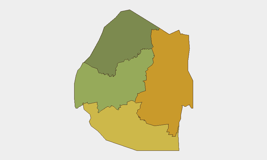
Lubombo Region (risk score 72) and Shiselweni Region (risk score 68) rank as the country's highest-risk sub-national areas, followed by Manzini Region (55) and Hhohho Region (35). The concentration of risk in the southern and eastern regions—Lubombo and Shiselweni—reflects historically elevated crime, cross-border trafficking exposure, and limited state presence in rural areas. Manzini's moderate risk likely reflects urbanization, economic activity, and associated street crime. Organizations with personnel or assets in Lubombo and Shiselweni should maintain elevated awareness and duty-of-care protocols, though baseline threat remains low.
How GeoBit Would Assist
For ongoing Eswatini monitoring, security teams would deploy AOI (Area-of-Interest) Monitoring & Early Warning focused on Lubombo and Shiselweni regions to detect spontaneous unrest, crime clusters, or border incidents in real time. Multi-language OSINT (X/Twitter, Telegram, local news feeds) and sentiment analysis would capture emerging civil discontent or localized instability before mainstream reporting. Routing & Network Analysis supports contingency planning and alternative journey routes for staff in high-risk regions, reducing exposure to known incident corridors.
7-Day Outlook
No indicators point to a near-term escalation in Eswatini's security posture over the next seven days. Routine vigilance for spontaneous protests, localized crime, or border-related activity in southern regions remains warranted. The security environment is expected to remain stable unless regional or international developments (e.g., cross-border spillover, political events) materially alter conditions.
Highest-Risk Areas — Ranked
| # | State / Region | Risk |
|---|---|---|
| 1 | Lubombo | 72 |
| 2 | Shiselweni | 68 |
| 3 | Manzini Region | 55 |
| 4 | Hhohho Region | 35 |
Sources
Previous Daily Briefs
A new Eswatini brief is written every day — each with its own risk map and downloadable CSV. Here's the last week; use the calendar to go further back.
📅 Browse every day by calendar →
Highlighted days have a brief. Tap a day for that day's map & analysis, or “csv” for that day's dataset ($5).
Atlas — our AI intelligence desk — emails them this snapshot personally. Nothing else, no list.