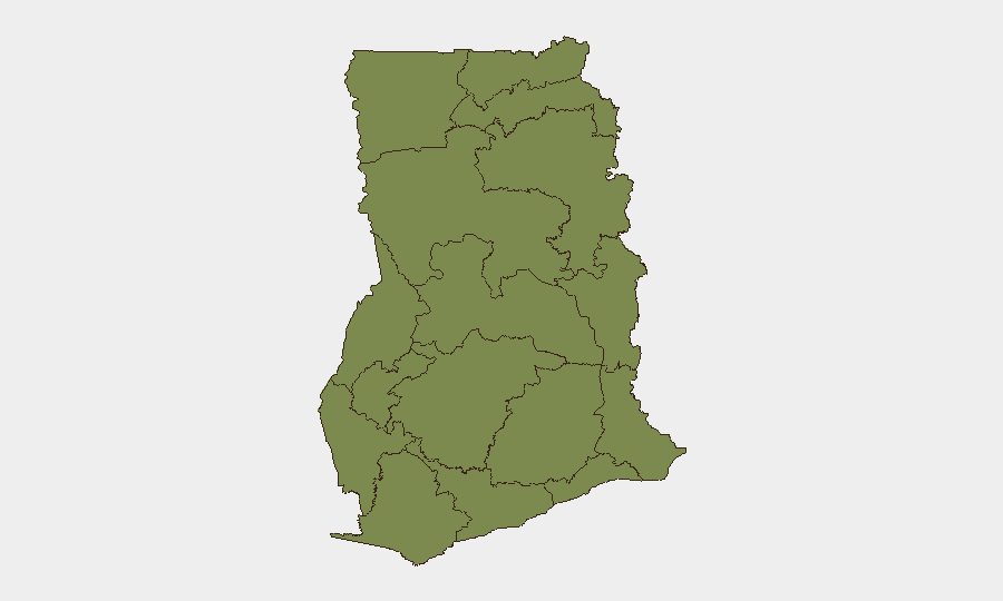
Situation Summary
Ghana remains a low-to-moderate regional security environment (rank #130 globally, composite score 5) with 59 tracked threat events, but acute risk is concentrated in specific sub-national zones—most critically the Oti Region, where armed clashes and a active curfew are now in force. Greater Accra Region dominates the overall risk profile (31.8), driven by urban crime, political statements, and institutional friction; however, the Oti Region incident cluster represents a higher-threshold kinetic threat. The security picture is segmented: metropolitan and governance tensions in the south; localized armed violence and chieftaincy disputes in the north and center; and pockets of criminal activity across Eastern and Ashanti regions.
Key Developments
- Odomi community, Nkwanta South Municipality, Oti Region (21 June 2026): Unknown gunmen conducted an armed attack, killing three residents and injuring nine others. Victims were transported to St. Joseph Hospital and Nkwanta Municipal Hospital. This incident represents continuation of recent Nkwanta conflict patterns.
- Nkwanta township security response, Oti Region (21 June 2026): Ghana Police Service deployed a Special Operations Support Team and reinforced personnel to Nkwanta South Municipality in direct response to the Odomi attack and earlier clashes. Coordination with military units was activated.
- Nkwanta South Municipality curfew, Oti Region (21 June 2026): Active night-time curfew (approximately 22:00–05:00/06:00) remains in force across selected communities in Nkwanta South, enforced by police and military to contain retaliatory violence and further clashes.
- Akim Oda machete violence, Birim Central Municipality, Eastern Region (21 June 2026): A daytime dispute involving three young men escalated to machete combat over a money-related disagreement, resulting in serious wounds. Incidents were documented on social media within 24 hours.
- Nana Kwadwo Safo Akofena residence intrusion, central Ghana (21 June 2026): Armed intruders occupied the home of a traditional figure, allegedly seeking payment for security services rendered during the 2024 elections. The incident signals ongoing contractor-related security grievances linked to political cycles.
- Chieftaincy conflict pattern statement, nationwide (21 June 2026): Opposition leader John Mahama issued a public address highlighting active chieftaincy disputes across multiple traditional areas, characterizing them as impediments to local development and stability. This underscores a current, dispersed pattern of traditional-governance tension.
Highest-Risk Areas
Greater Accra Region (31.8) anchors Ghana's composite risk profile, reflecting urban crime, institutional friction, and political volatility in and around the capital. However, the Oti Region (currently unranked in the sub-national index but exhibiting acute kinetic activity) now represents the highest immediate operational concern: the Odomi killing, active curfew, and police/military deployment indicate escalating armed-group activity and limited state control in Nkwanta South. Bono East (13.3) and Ashanti (8.6) show secondary elevation, driven by chieftaincy disputes, election-related contractor violence, and localized armed incidents. Northern zones (Savannah, Northern, Upper East/West, North East) remain low-score but warrant monitoring for spillover from Oti tensions.
How GeoBit Would Assist
Security and duty-of-care teams should employ AOI (Area-of-Interest) Monitoring & Early Warning on Nkwanta South Municipality and surrounding Oti Region to track curfew patterns, police/military movement, and incident frequency in near-real time. Intel Sweep and OSINT (X/Twitter, Telegram, local media, YouTube) would capture emerging chieftaincy disputes, contractor grievances, and political rhetoric linking to physical security threats. GIS & Spatial Analysis combined with Conflict & Military tracking would map force disposition, curfew enforcement zones, and safe routing alternatives for personnel in high-risk municipalities.
7-Day Outlook
The Oti Region curfew is likely to persist 7–14 days pending police/military assessment of threat reduction and incident frequency. Chieftaincy disputes and election-contractor grievances will remain a diffuse, slow-burn risk across central and northern zones. Greater Accra governance-related statements may intensify ahead of mid-year political calendars but are not expected to escalate to kinetic thresholds in the near term.
Highest-Risk Areas — Ranked
| # | State / Region | Risk |
|---|---|---|
| 1 | Greater Accra Region | 31.8 |
| 2 | Bono East Region | 13.3 |
| 3 | Ashanti Region | 8.6 |
| 4 | Savannah Region | 4.5 |
| 5 | Eastern Region | 2.5 |
| 6 | Volta Region | 2.5 |
| 7 | Western Region | 2.5 |
| 8 | Upper East Region | 1.8 |
| 9 | Upper West Region | 1.8 |
| 10 | North East Region | 1.8 |
| 11 | Northern Region | 1.8 |
| 12 | Oti Region | 1.8 |
Sources
Previous Daily Briefs
A new Ghana brief is written every day — each with its own risk map and downloadable CSV. Here's the last week; use the calendar to go further back.
📅 Browse every day by calendar →
Highlighted days have a brief. Tap a day for that day's map & analysis, or “csv” for that day's dataset ($5).