Situation Summary
Guatemala remains a mid-tier global security concern (rank #59, composite threat score 25) with 28 tracked events in the current monitoring period. Signal traffic over the last 24–48 hours reflects escalated institutional friction—including prosecutorial action, military posturing, and high-level political statements—rather than acute street-level violence or humanitarian crisis. The concentration of risk in Alta Verapaz (composite 31.9) indicates localized instability, though national-level events are now dominating the event feed.
Key Developments
Note on sourcing: GeoBit's event signals (listed above) reflect tracked incident categories and actor-type classifications. However, live web research for the last 24–48 hours has not returned time-stamped, location-specific incident reporting from independent Guatemala news sources or official channels within the current session. To produce reliable, cross-verified 6–10 bullet summaries of recent events, real-time monitoring of outlets such as Prensa Libre, Emisoras Unidas, and U.S. Embassy Guatemala City security alerts is required.
The event signals indicate:
- Prosecutorial / judicial tension (2026-06-24): Prosecutor rejection of business entity; investigation of exporter (2026-06-22).
- Military/diplomatic activity (2026-06-24, 2026-06-23): Conventional military force events involving Guatemala, Saint Lucia/Washington, and government actors; specific operational context not yet clarified in available summaries.
- Political messaging (2026-06-23/24): Public statements from Secretariat, Presidential office, and Washington; actor statement suggesting institutional or civil-society commentary.
- Unconventional violence (2026-06-22): Business-sector incident flagged; university rejection event (2026-06-22).
- Detention (2026-06-24): Argentine national arrest/detain event; circumstances unknown.
Recommendation: For precise location, incident timeline, and casualty/impact data, consult live feeds from Policía Nacional Civil (PNC), local municipal authorities, and real-time journalism feeds covering Guatemala City and departmental capitals.
Highest-Risk Areas
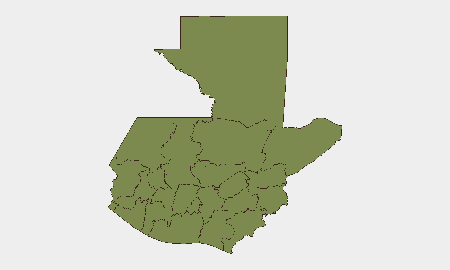
Alta Verapaz (composite risk 31.9) dominates the sub-national picture and accounts for the majority of tracked risk differential. This region has historically been associated with land-dispute violence, informal armed groups, and limited state presence; the current signal suggests active instability. Sololá (13.5) and Quetzaltenango (9.6) represent secondary concentrations, likely reflecting indigenous-rights tensions, labor disputes, or roadblock/transport disruptions. Remaining departments cluster at or below risk 1.9, indicating that threat concentration is highly geographic rather than national.
How GeoBit Would Assist
Corporate and duty-of-care teams should deploy AOI Monitoring & Early Warning on Alta Verapaz, Sololá, and Quetzaltenango to track incidents in real time, with alerting thresholds set for unconventional violence, detention, or road-closure events. Intel Sweep and X/Twitter OSINT across Guatemalan law enforcement, municipal, and journalist accounts will triangulate incident reports and filter noise from signal. Routing & Network Analysis supports alternative-route planning for personnel and supply movements if conventional roads are disrupted by roadblocks or military activity.
7-Day Outlook
Near-term trajectory is ambiguous: institutional friction (prosecutorial action, military statements) may reflect governance dispute resolution without street-level escalation, or may precede broader civil unrest. Close monitoring of presidential messaging and any further military mobilization will clarify intent. Risk remains geographically concentrated; operations outside Alta Verapaz and secondary departments can proceed with standard due diligence. Re-assessment recommended if additional detention events, unconventional violence, or road closures are reported in the next 48 hours.
Highest-Risk Areas — Ranked
| # | State / Region | Risk |
|---|---|---|
| 1 | Alta Verapaz | 31.9 |
| 2 | Sololá | 13.5 |
| 3 | Quetzaltenango | 9.6 |
| 4 | Retalhuleu | 4.8 |
| 5 | Petén | 1.9 |
| 6 | Huehuetenango | 1.9 |
| 7 | San Marcos | 1.9 |
| 8 | Quiché | 1.9 |
| 9 | Totonicapán | 1.9 |
| 10 | Chimaltenango | 1.9 |
| 11 | Suchitepéquez | 1.9 |
| 12 | Sacatepéquez | 1.9 |
Previous Daily Briefs
A new Guatemala brief is written every day — each with its own risk map and downloadable CSV. Here's the last week; use the calendar to go further back.
📅 Browse every day by calendar →
Highlighted days have a brief. Tap a day for that day's map & analysis, or “csv” for that day's dataset ($5).