Situation Summary
Guinea remains a moderate-risk environment (global ranking #130; composite threat score 10) with localized instability concentrated in the eastern Kankan Region. No confirmed security incidents, civil unrest, or travel disruptions have been reported in the last 24–48 hours. The security picture is characterized by endemic regional crime, periodic administrative friction, and cross-border trafficking activity rather than acute conflict or mass civil mobilization.
Key Developments
No credible, time-stamped security incidents for Guinea have been confirmed in the last 24–48 hours. Open-source reporting and web searches do not surface recent attacks, protests, arrests, or movement restrictions affecting corporate or expatriate operations in Guinea proper. Event signals appearing in automated feeds (e.g., "Public Statement," "Arrest/Detain") are largely attributed to Papua New Guinea and unrelated jurisdictions.
Older background context (provided for operational awareness):
- Kankan Region has experienced cross-border trafficking, artisanal mining disputes, and sporadic intercommunal tensions over the past 6–12 months.
- Conakry remains susceptible to petty crime, street robbery, and occasional labor action affecting port and transport sectors.
- Administrative sanctions and governance reviews (e.g., OECD tax-transparency peer reviews) are ongoing but do not constitute acute security events.
Highest-Risk Areas
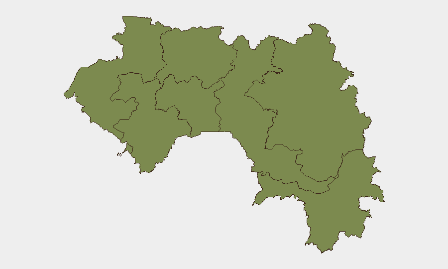
Kankan Region (composite risk 34.1) dominates the threat landscape—driven by porous borders with Mali and Côte d'Ivoire, informal gold mining, and arms trafficking corridors. Conakry (risk 13.3) ranks second, primarily due to urban crime, gang activity, and port-related security friction. The remaining regions (Boké, Labé, Kindia, Mamou, Faranah, Nzérékoré) carry uniform, lower baseline risk (4.1 each), reflecting rural instability and weak state capacity but limited organized violence or high-profile incidents. Risk in Guinea is sub-national, dispersed, and endemic rather than acute or mobilizing.
How GeoBit Would Assist
Security teams with personnel or assets in Guinea should employ Intel Sweep and multi-language OSINT to monitor Kankan and Conakry in real time, capturing trafficking, crime, and administrative developments before they escalate. AOI Monitoring & Early Warning on key transport corridors (ports, mining areas, border crossings) and Network & Actor Analysis of trafficking and criminal groups provide continuous, location-specific visibility. Routing & Network Analysis helps identify safer travel corridors and alternative supply-chain routes during periods of heightened local friction.
7-Day Outlook
No imminent spike in conflict, civil unrest, or travel restrictions is forecast for Guinea in the next seven days. Baseline risks (crime, trafficking, mining disputes) will persist in Kankan and Conakry; monitor administrative communications and port status for disruptions affecting business continuity. Escalation is possible but unlikely without a major triggering event (e.g., political transition, regional spillover from Mali or Côte d'Ivoire, or resource-sector shock).
Data as of 2026-06-23. Next update: 2026-06-24.
Highest-Risk Areas — Ranked
| # | State / Region | Risk |
|---|---|---|
| 1 | Kankan Region | 34.1 |
| 2 | Conakry | 13.3 |
| 3 | Boké Region | 4.1 |
| 4 | Labé Region | 4.1 |
| 5 | Kindia Region | 4.1 |
| 6 | Mamou Region | 4.1 |
| 7 | Faranah Region | 4.1 |
| 8 | Nzérékoré Region | 4.1 |
Sources
Previous Daily Briefs
A new Guinea brief is written every day — each with its own risk map and downloadable CSV. Here's the last week; use the calendar to go further back.
📅 Browse every day by calendar →
Highlighted days have a brief. Tap a day for that day's map & analysis, or “csv” for that day's dataset ($5).