Situation Summary
Hungary remains a low-threat environment (global rank #103, composite score 2.2) with no major security incidents, civil unrest, or infrastructure failures reported in the last 24–48 hours. Recent event signals reflect domestic political friction—parliamentary rejections, EU disapproval statements, and intra-government tension—rather than kinetic threats or organized violence. Routine crime (street assault, fraud, theft, traffic incidents) and localized structural issues continue at baseline levels across the country.
Key Developments
- Budapest, Óbuda District III (12–13 July): Hungarian National Police released CCTV footage and opened a serious bodily harm investigation following a violent street assault; case highlighted in police communiqué.
- Pest County, unspecified locality (13 July): Coordinated police operation dismantled an online fraud ring operating fake service advertisements; multiple suspects arrested and publicized by national police.
- Veszprém city, Veszprém County (13 July): Two men (ages 27, 28) detained in criminal investigation and brought in for questioning; routine local crime processing.
- Unspecified location, Hungary (13 July): Emergency services rescued a man with life-threatening injuries from a partially collapsed outbuilding; localized structural incident with no broader infrastructure failure.
- Unspecified location, Hungary (13 July): Off-duty riot police officer intervened in active street assault, preventing further harm; incident reported in national police news feed.
- Bátonyterenye, Nógrád County (13 July): Serious drunk-driving collision caused significant property damage but no injuries; police issued road-safety alert.
- Nyíregyháza, Szabolcs-Szatmár-Bereg County (13 July): Police identified and arrested theft suspect and recovered stolen property within short timeframe.
- Budapest & national media infrastructure (13–14 July): Continued political and media-sector scrutiny tied to state public broadcasting restructuring; no violent unrest or major infrastructure failure manifested in past 24–48 hours.
Highest-Risk Areas
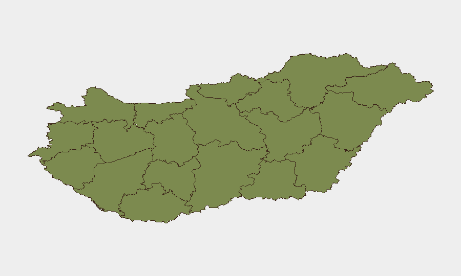
Szabolcs-Szatmár-Bereg County (risk 31.5) and Pest County (23.2) drive the majority of composite risk, significantly outpacing Budapest (11.5) and all other regions (1.5 each). The disparity reflects concentration of theft, fraud, street-level violence, and property crime in Hungary's northeast (Szabolcs-Szatmár-Bereg) and metropolitan Pest periphery, rather than terrorism, political violence, or infrastructure instability. Budapest itself registers lower risk despite higher population density, suggesting better policing capacity and lower organized-crime penetration in the capital proper. Teams with assets or personnel in Szabolcs-Szatmár-Bereg and Pest should apply elevated baseline precautions around theft, fraud, and routine street crime.
How GeoBit Would Assist
Security teams monitoring Hungary should employ Intel Sweep and global event feeds to detect shifts in political or civil-unrest signaling early; OSINT fusion (X/Twitter, Telegram, multi-language search) to track underground organizing or protest planning; and AOI Monitoring & Early Warning on Szabolcs-Szatmár-Bereg and Pest counties to detect crime cluster escalation or organized activity. Routing & Network Analysis can identify safer travel corridors in higher-risk regions, while Risk & Threat Assessment modules contextualize routine crime against duty-of-care thresholds for personnel deployed there.
7-Day Outlook
No acute escalation is forecast over the next seven days based on current signal patterns. Political friction will likely continue at the policy and media level without manifesting as violent unrest or travel disruption. Routine crime and traffic incidents will persist; teams should maintain standard precautions and monitor local law-enforcement advisories in Pest and Szabolcs-Szatmár-Bereg counties.
Highest-Risk Areas — Ranked
| # | State / Region | Risk |
|---|---|---|
| 1 | Szabolcs-Szatmár-Bereg | 31.5 |
| 2 | Pest | 23.2 |
| 3 | Budapest | 11.5 |
| 4 | Komárom-Esztergom | 1.5 |
| 5 | Fejér | 1.5 |
| 6 | Nógrád | 1.5 |
| 7 | Vas | 1.5 |
| 8 | Győr-Moson-Sopron | 1.5 |
| 9 | Veszprém | 1.5 |
| 10 | Zala | 1.5 |
| 11 | Somogy | 1.5 |
| 12 | Baranya | 1.5 |
Sources
Previous Daily Briefs
A new Hungary brief is written every day — each with its own risk map and downloadable CSV. Here's the last week; use the calendar to go further back.
📅 Browse every day by calendar →
Highlighted days have a brief. Tap a day for that day's map & analysis, or “csv” for that day's dataset ($5).
Atlas — our AI intelligence desk — emails them this snapshot personally. Nothing else, no list.