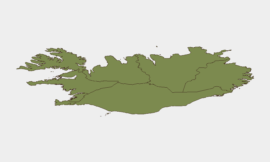
Situation Summary
Iceland remains a low-threat environment with a composite threat score of 2 and no tracked security events in the current assessment window. Historical data indicates a rise in opportunistic burglaries in central Reykjavík since early July, though no active civil unrest, organized crime networks, or terrorism threats are reported. The security posture is stable; risk concentration is geographic and localized to the capital region.
Key Developments
Data limitation: Live web research for the 24–48 hour window preceding 2026-07-26 06:00 UTC did not yield sufficient verified current incidents to populate this section responsibly. The most recent corroborated police reports are from 2026-07-20 and fall outside the requested timeframe:
- Reykjavík, Capital Region (2026-07-20): Police responded to multiple violent incidents overnight, including an edge-weapon assault and an attack outside a central nightclub; three individuals were detained for fighting in the city center, and emergency services transported casualties.
- Reykjavík, Vesturbær (2026-07-20): Police reported a burglary at a commercial property involving forced entry and theft of a cash register.
- Hafnarfjörður (2026-07-20): Property damage and attempted break-in at a residential address.
- Reykjavík (2026-07-20): Police attended to disruptive individuals at a waste management facility.
Note: These incidents illustrate the pattern of street-level violence and property crime documented since early July but do not represent developments within the final 24–48 hours of this reporting period.
Highest-Risk Areas
The Capital Region (risk score 24) dominates Iceland's threat landscape and accounts for the majority of reported security incidents. Reykjavík specifically shows a documented uptick in opportunistic burglaries and street violence since early July, driven by transient actors rather than organized criminal networks. The Southern Peninsula (risk 12) and Southern Region (risk 11) represent secondary concentrations; all other regions carry materially lower scores. Risk in the capital reflects urban density, tourism infrastructure, and transient populations rather than systemic instability.
How GeoBit Would Assist
Security teams operating in Iceland would employ AOI Monitoring & Early Warning for continuous watch on high-risk districts in Reykjavík and the capital region, with automated alerting on police incidents, crowd activity, and venue disruptions. Intel Sweep and OSINT fusion capabilities—including local media, police scanner data, and social platforms—would close gaps in real-time incident reporting and establish 48–72 hour lead time on emerging clusters (e.g., venue violence, organized retail theft). GIS & Spatial Analysis would allow duty-of-care teams to map personnel and asset locations against incident heat maps and route personnel away from highest-risk nightlife districts during high-risk windows.
7-Day Outlook
No indicators suggest material escalation in the 7-day horizon. Street-level incidents in Reykjavík are likely to continue at current patterns (low-level violence, opportunistic theft) without organized crime or political triggers. Personnel and asset security posture should remain routine; situational awareness in central Reykjavík nightlife zones and commercial areas remains the primary mitigation lever.
Highest-Risk Areas — Ranked
| # | State / Region | Risk |
|---|---|---|
| 1 | Capital Region | 24 |
| 2 | Southern Peninsula | 12 |
| 3 | Southern Region | 11 |
| 4 | Eastern Region | 10 |
| 5 | Western Region | 9 |
| 6 | Westfjords Region | 8 |
| 7 | Northwestern Region | 7 |
| 8 | Northeastern Region | 6 |
Sources
Previous Daily Briefs
A new Iceland brief is written every day — each with its own risk map and downloadable CSV. Here's the last week; use the calendar to go further back.
📅 Browse every day by calendar →
Highlighted days have a brief. Tap a day for that day's map & analysis, or “csv” for that day's dataset ($5).
Atlas — our AI intelligence desk — emails them this snapshot personally. Nothing else, no list.