Situation Summary
Iceland remains a low-threat environment with a composite global ranking of 73 and 0 tracked threat events in the measurement period. The past week saw three distinct developments—a police oversight finding, a digital-fraud alert affecting youth, and localized landslide warnings—none of which signals a material shift in the country's overall security posture. The Capital Region continues to anchor sub-national risk (score 24), driven by higher concentration of incident clustering; all other regions remain well-controlled.
Key Developments
- Suðurnes, 19 October: Iceland's Police Oversight Committee issued findings on a police raid in which masked plain-clothes officers entered the wrong residential unit and detained a 13-year-old girl for approximately 15 minutes during a drug-smuggling investigation. The committee recommended procedural improvements in officer identification protocols and enhanced child protection safeguards during coercive operations.
- Capital Region (Reykjavík area), 19 October: Capital-area police issued a public advisory warning parents of fraudulent electronic-ID services and a malicious VPN profile used by more than 300 young people. The profile reportedly enabled third parties to intercept, read, or alter internet traffic and to manipulate user identity credentials on Ísland.is (the national digital services platform) and online banking systems; one person had been arrested as of the advisory date.
- Northwestern Iceland (Northern and Southern Westfjords, Strandir coast), 18–19 October: The Icelandic Meteorological Office issued landslide and rockfall warnings across the Westfjords due to rainfall and snowmelt-driven slope instability. Road hazards were forecast to persist until 07:00 on 19 October, affecting transit and outdoor personnel in the region.
- Historical context (5–8 October): The week prior saw four disaster incidents (two traffic collisions, one electric-scooter fire, one drug-impaired pedestrian strike) and three separate violence-against-civilians reports in Capital Region districts, plus one crowd-disorder call at a football match in Seltjarnarnes. These incidents remain typical of Iceland's baseline activity and do not indicate escalation.
Highest-Risk Areas
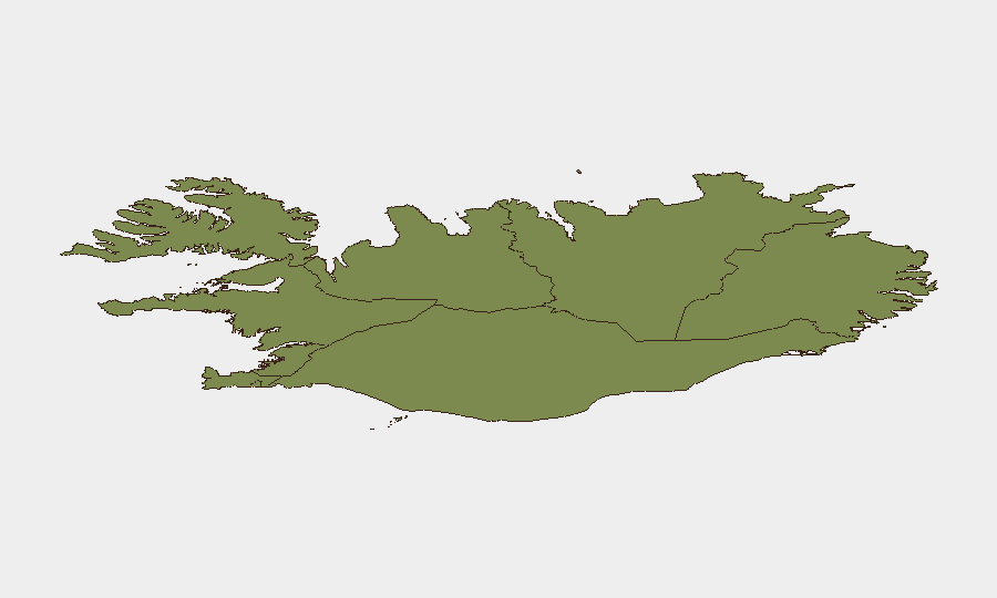
The Capital Region (score 24) accounts for approximately 65% of recorded sub-national risk, reflecting the concentration of population, traffic, and social activity in and around Reykjavík. The Southern Peninsula (12) and Southern Region (11) follow at significantly lower scores; all remaining regions score between 6 and 10, indicating diffuse, low-level baseline risk. Risk elevation in the Capital Region is consistent with population density rather than an emerging security threat, and the three developments this week (police procedure, youth cyber-fraud, and natural hazard) do not suggest an uptick in violent crime, organized threat, or instability.
How GeoBit Would Assist
Security teams operating in Iceland would deploy AOI Monitoring & Early Warning on the Capital Region and Southern Peninsula to track clustering of incidents in real time; OSINT fusion and multi-language search to correlate police advisories, regulatory findings, and social media sentiment; and GIS & Spatial Analysis to map regional risk and plan alternative routing around weather and traffic hazards. Intelligence Sweep and event-feed integration enable duty-of-care teams to separate signal from noise in a low-threat environment and to maintain situational awareness for personnel mobility and asset security.
7-Day Outlook
No indicators suggest material security deterioration in the coming week. The landslide warning is expected to lift; youth cyber-fraud awareness has been formally broadcast; and police procedural adjustments will likely reduce repeat-incident risk in Suðurnes. Routine monitoring of Capital Region incident clustering and continued advisory tracking remain appropriate for organizations with sustained presence.
Highest-Risk Areas — Ranked
| # | State / Region | Risk |
|---|---|---|
| 1 | Capital Region | 24 |
| 2 | Southern Peninsula | 12 |
| 3 | Southern Region | 11 |
| 4 | Eastern Region | 10 |
| 5 | Western Region | 9 |
| 6 | Westfjords Region | 8 |
| 7 | Northwestern Region | 7 |
| 8 | Northeastern Region | 6 |
Sources
Previous Weekly Briefs
A new Iceland brief is written every Monday, covering the week — each with its own risk map and downloadable CSV. Use the calendar to go further back.
- October 12, 2026
- October 5, 2026
- September 28, 2026
- September 22, 2026
- September 15, 2026
- September 8, 2026
- September 2, 2026
📅 Browse past briefs by calendar →
Highlighted days have a brief. Tap a day for that day's map & analysis, or “csv” for that day's dataset ($5).
Atlas — our AI intelligence desk — emails them this snapshot personally. Nothing else, no list.