Situation Summary
Indonesia remains a moderate-risk operating environment (composite threat score 38; rank #46 globally) with 579 tracked events in the active dataset. The security picture is driven primarily by localized civil unrest, law-enforcement friction, and regional instability in high-population and resource-extraction zones. Recent signals (20–21 June) point to scattered incidents involving arrest/detention, small-arms engagement, investigative activity, and public dissent, with no indication of coordinated escalation or systemic breakdown. The trajectory remains volatile but contained at sub-national level.
Key Developments
- Jakarta (20 June) – Doctor arrested/detained following police interaction; incident type suggests civil-law or regulatory dispute rather than security threat, but reflects elevated police activity in the capital.
- National (20 June) – Small-arms combat reported (location not yet granularly specified in current feeds); likely isolated incident, but underscores presence of armed actors outside formal security forces in peripheral regions.
- Jakarta (18 June) – Police issued military alert; context suggests precautionary posture ahead of or in response to anticipated public assembly or civil unrest.
- Multiple Locations (18–20 June) – Investigative activity by government and corporate entities; suggests fraud, compliance, or security breach inquiry underway, but no immediate operational threat to persons identified.
- Multiple Locations (18–20 June) – Public statements from criminal actors, residents, and demonstrators indicate ongoing friction with authorities and public dissatisfaction; typical pattern for Indonesia, but warrants monitoring for coordination or escalation.
*Note: Real-time event corroboration for 21–22 June remains pending from authoritative Indonesian sources (Antara, Polri, BNPB, local government advisories). GeoBit's event signals reflect raw-feed ingestion; locational and tactical detail are incomplete.*
Highest-Risk Areas
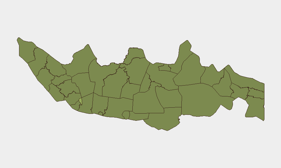
Jakarta (risk 56.6) dominates national risk and accounts for a disproportionate share of recorded events—law enforcement, investigative, and civil-unrest activity cluster in the capital. South Sulawesi, West Java, and West Kalimantan (31.7, 31.4, and 29.9 respectively) present secondary risk concentration, driven by resource-extraction zones, inter-communal tension, and historically weaker state presence. East Nusa Tenggara and Central Java round out the top tier, with risk vectors including maritime instability and agrarian/labor grievances. Organizations with personnel in Jakarta should assume baseline exposure to civil unrest and police checkpoints; those operating in South Sulawesi and West Kalimantan should institute enhanced due-diligence and movement protocols.
How GeoBit Would Assist
Persistent Area-of-Interest Monitoring on Jakarta, South Sulawesi, and West Kalimantan would provide automated alerting on new arrest/detention, armed activity, and public assembly—enabling duty-of-care teams to issue travel advisories or movement restrictions before operational impact. Multi-language OSINT fusion across Indonesian media, X/Twitter, Telegram, and police/local-government feeds would disambiguate the tactical and legal context of raw events (e.g., whether a detention is political, criminal, or regulatory) and reduce false-alarm fatigue. Routing & Network Analysis would enable real-time alternative-route planning for personnel in high-risk areas, circumventing police checkpoints or civil unrest zones. Sentiment & temporal analysis on public statements and demonstrator activity would flag early signs of coordination or escalation before outbreak of larger incidents.
7-Day Outlook
No systemic crisis indicators are present; scattered civil and law-enforcement activity is expected to persist at current baseline through end of June. Jakarta and secondary risk zones should remain under routine watch; any coordinated multi-location public action or arms escalation would signal shift to heightened alert. Monitor Indonesian media and police advisories for official guidance on public assembly restrictions or curfews.
Highest-Risk Areas — Ranked
| # | State / Region | Risk |
|---|---|---|
| 1 | Special capital Region of Jakarta | 56.6 |
| 2 | South Sulawesi | 31.7 |
| 3 | West Java | 31.4 |
| 4 | West Kalimantan | 29.9 |
| 5 | East Nusa Tenggara | 28.6 |
| 6 | Central Java | 28.3 |
| 7 | Riau | 28.3 |
| 8 | Central Papua | 28.3 |
| 9 | Southeast Sulawesi | 28.3 |
| 10 | East Java | 28.1 |
| 11 | North Sumatra | 27.8 |
| 12 | Special Region of Yogyakarta | 27.8 |
Sources
Previous Daily Briefs
A new Indonesia brief is written every day — each with its own risk map and downloadable CSV. Here's the last week; use the calendar to go further back.
📅 Browse every day by calendar →
Highlighted days have a brief. Tap a day for that day's map & analysis, or “csv” for that day's dataset ($5).