Situation Summary
Jamaica's composite threat score of 50 reflects persistent but non-acute security challenges, with 7 tracked events in the current monitoring cycle. Law enforcement and emergency-service incidents on 2026-08-01—including multiple military-force engagements involving firefighters and an arrest related to immigration status—suggest operational strain but no systemic breakdown. Saint Elizabeth's markedly elevated sub-national risk score (31.3) signals concentrated vulnerability in one parish; the remainder of the island shows baseline operational risk (1.3–2.5). Current trajectory is stable absent escalation signals.
Key Developments
- 2026-08-01 · Multi-agency incidents across Jamaica: Seven discrete events recorded involving law enforcement (military-force deployments, arrest/detain operations) and emergency services (firefighter engagements with military force). Exact locations and casualty figures not yet confirmed from independent sources; requires corroboration.
- 2026-07-29 · Bushy Park, St. Catherine: A 42-year-old man (Andrew Edwards) shot multiple times by gunmen in a white Toyota Axio near OJ Plaza; transported to hospital in serious condition. Incident consistent with gang-related violence pattern but lacks confirmation of motive or suspect identity.
- 2026-07-29 · Bog, Westmoreland: Three fatalities reported during an alleged police confrontation; security forces recovered an AK-type rifle at scene. Details on civilian vs. suspect status and circumstances remain incomplete pending official statement.
- 2026-07-27–29 · St. Andrew South Police Division: 48-hour curfew imposed in sections of the division was extended by police. Extension suggests ongoing threat assessment by local command but no new escalation reported within the 24–48 hour window.
Highest-Risk Areas
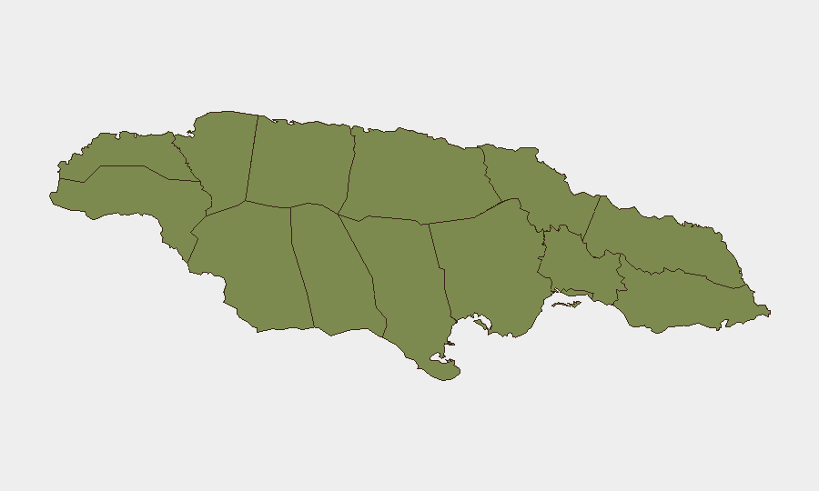
Saint Elizabeth's risk score of 31.3—roughly 12× the island median—dominates Jamaica's sub-national profile and warrants immediate attention. Saint Thomas (2.5) and the remaining ten parishes cluster tightly at 1.3, indicating either controlled baseline risk or, more likely, concentrated reporting/data availability in the south-central region. Corporate assets and personnel in Saint Elizabeth should be flagged for enhanced duty-of-care review; the disparity suggests either localized gang activity, border-trafficking vulnerability, or underreporting in other parishes.
How GeoBit Would Assist
Security teams should deploy AOI (Area-of-Interest) Monitoring & Early Warning on Saint Elizabeth and St. Andrew South to catch next-incident escalation in real time. OSINT Fusion (X/Twitter, Telegram, and local news feeds) paired with temporal and sentiment analysis will close the 24–48 hour intelligence gap evident in this brief and flag rumor vs. confirmed incident before duty-of-care notifications are required. Network & Actor Analysis of gangs and security-force command structures will clarify whether the 2026-08-01 incidents represent isolated clashes or coordinated operations.
7-Day Outlook
Absent new violence clusters or curfew expansions, Jamaica will likely remain in stable-baseline posture. The extension of St. Andrew South curfew may indicate police intent to hold territory; watch for secondary expansions into Kingston or neighboring divisions. Corporate travel to Saint Elizabeth should remain flagged for heightened-risk protocols through end-week pending incident-trend confirmation.
Highest-Risk Areas — Ranked
| # | State / Region | Risk |
|---|---|---|
| 1 | Saint Elizabeth | 31.3 |
| 2 | Saint Thomas | 2.5 |
| 3 | Hanover | 1.3 |
| 4 | Westmoreland | 1.3 |
| 5 | Saint James | 1.3 |
| 6 | Trelawny | 1.3 |
| 7 | Manchester | 1.3 |
| 8 | Saint Ann | 1.3 |
| 9 | Clarendon | 1.3 |
| 10 | Saint Catherine | 1.3 |
| 11 | Saint Mary | 1.3 |
| 12 | Saint Andrew | 1.3 |
Sources
Previous Daily Briefs
A new Jamaica brief is written every day — each with its own risk map and downloadable CSV. Here's the last week; use the calendar to go further back.
📅 Browse every day by calendar →
Highlighted days have a brief. Tap a day for that day's map & analysis, or “csv” for that day's dataset ($5).
Atlas — our AI intelligence desk — emails them this snapshot personally. Nothing else, no list.