Situation Summary
Kuwait is experiencing an acute security emergency following coordinated Iranian drone and missile strikes across the country over 24–48 hours (July 24–26, 2026). Multiple air-defense engagements, damage to critical energy infrastructure, border posts, and offshore oil assets, combined with temporary disruptions to aviation and cross-border traffic, indicate a sustained regional escalation. The threat environment remains elevated with ongoing ordnance-disposal operations and unclear indicators of further Iranian action or regional actor responses.
Key Developments
- Air-Defense Engagements Nationwide (July 25, 2026). Kuwait's armed forces intercepted multiple hostile drones and missiles over Kuwaiti territory; explosions from interceptions and air-raid sirens were reported in Kuwait City and wider areas. Residents and officials confirmed active air-defense operations throughout the day.
- Kuwait International Airport Suspension (July 25, 2026). Civil aviation operations were temporarily halted; Kuwait Airways rescheduled most flights due to ongoing missile and drone threats, affecting passenger and cargo traffic through at least the evening of July 25.
- Critical Infrastructure Strikes (July 25, 2026). Kuwait Fire Force brought two major fires at power and desalination installations in southern Kuwait under control following Iranian attacks; the Ministry of Electricity reported damage to multiple power transmission lines, causing localized grid disruption and requiring emergency repairs.
- Border Posts and Offshore Oil Platform Attacked (July 25, 2026). Three northern land border posts sustained material damage from attacks; a Kuwait Oil Company offshore drilling platform was struck by a hostile drone, injuring one worker and damaging the structure.
- US Military Facilities Targeted (night of July 24–25, 2026). Iran's IRGC claimed drone and missile strikes against Camp Udairi, Camp Doha, Camp Arifjan, and Ali Al Salem Air Base; US and regional reporting noted air-defense interceptions, with competing assessments of damage extent and casualties.
- Unexploded Ordnance Clearance (July 25, 2026). Kuwaiti EOD teams conducted controlled detonations and debris clearance in northern Kuwait through the evening, with residents warned of controlled explosions.
- Abdaly Border Crossing Reopening Signal (July 25, 2026). Kuwait's interior minister announced imminent reopening of the Abdaly crossing with Iraq within 48 hours, signaling partial normalization of cross-border traffic after security-related closure.
Highest-Risk Areas
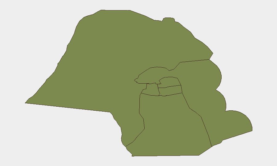
Jahra Governorate carries the highest composite risk score (31.3) and represents the primary concern; its geographic proximity to Iraq and northern border infrastructure makes it particularly vulnerable to transnational attack and ordnance hazard. The remaining governorates—Ahmadi, Farwaniya, Hawalli, Mubarak al-Kabir, and Capital—register markedly lower scores (1.3 each), reflecting concentrated risk in the north and a sharp geographic gradient. Farwaniya's inclusion in the ranking reflects Kuwait International Airport operations and aviation-related disruption risk.
How GeoBit Would Assist
Corporate security teams should deploy AOI Monitoring & Early Warning on Jahra Governorate, critical energy facilities, and border crossing zones to track resumption of hostile activity or infrastructure damage progression. Conflict & Military capabilities (force structure, weapons-capability tracking, and battle mapping) paired with OSINT fusion (X/Twitter, Telegram, multi-language feeds) enable real-time tracking of Iranian capability posture and regional military repositioning. Aviation & Maritime tracking and alternative routing & network analysis support duty-of-care planning for personnel movement and supply-chain continuity as airports and border crossings stabilize.
7-Day Outlook
The next 72 hours will be critical in determining whether Iranian strikes have concluded or represent an opening volley in a sustained campaign. Regional military posture, US response signaling, and any statements from Tehran will shape escalation probability. Expect continued infrastructure-damage assessment, gradual restoration of aviation and border services, and heightened vigilance for secondary attacks or retaliatory actions by regional actors through early August.
Highest-Risk Areas — Ranked
| # | State / Region | Risk |
|---|---|---|
| 1 | Jahra Governorate | 31.3 |
| 2 | Ahmadi Governorate | 1.3 |
| 3 | Farwaniya Governorate | 1.3 |
| 4 | Hawalli Governorate | 1.3 |
| 5 | Mubarak al-Kabir Governorate | 1.3 |
| 6 | Capital Governorate | 1.3 |
Sources
Previous Daily Briefs
A new Kuwait brief is written every day — each with its own risk map and downloadable CSV. Here's the last week; use the calendar to go further back.
📅 Browse every day by calendar →
Highlighted days have a brief. Tap a day for that day's map & analysis, or “csv” for that day's dataset ($5).
Atlas — our AI intelligence desk — emails them this snapshot personally. Nothing else, no list.