Situation Summary
Moldova remains at moderate composite risk (rank #58 globally, score 25) with airspace integrity as the primary near-term exposure. The 13 July Geran-2 drone incursion into southern Moldova—the 34th recorded violation since Russia's Ukraine war began—has triggered formal diplomatic protest, forensic investigation, and domestic political criticism of the government's security posture. Risk is concentrated in Criuleni district (composite score 31.8) and the capital, while broader airspace and border vulnerabilities persist across the southern corridor. Trajectory shows sustained low-to-moderate tension with episodic spike risk around further drone/missile transits.
Key Developments
- Copanca village, Căușeni district (13 July, night) – Geran-2/Shahed-136 explosive drone crashed and detonated near the village after crossing from Ukraine direction; authorities cordoned the area and initiated forensic investigation; no casualties reported.
- Chișinău, Ministry of Foreign Affairs (14 July) – Moldova formally summoned Russian Ambassador Oleg Ozerov and lodged diplomatic protest over the airspace violation; Foreign Ministry publicly condemned the overflight as "serious and unacceptable" and linked the device to Russian strikes on Odesa.
- Southern Moldova, near Copanca (14–17 July, ongoing) – Law-enforcement and military forensic teams continued technical examination of drone debris and flight path to establish origin, payload specification, and security implications.
- Chișinău, political sector (mid-July, post-incident context) – Opposition parties intensified criticism of government security measures and demanded strengthened air defense; some opposition discourse called for early parliamentary elections, framing the incident as evidence of state vulnerability.
- National airspace status (14–18 July cumulative) – Moldovan officials confirmed 34 recorded airspace violations (drones and ballistic missiles) since Ukraine war onset; government advocacy for NATO/EU air-defense and counter-drone system support intensified.
Highest-Risk Areas
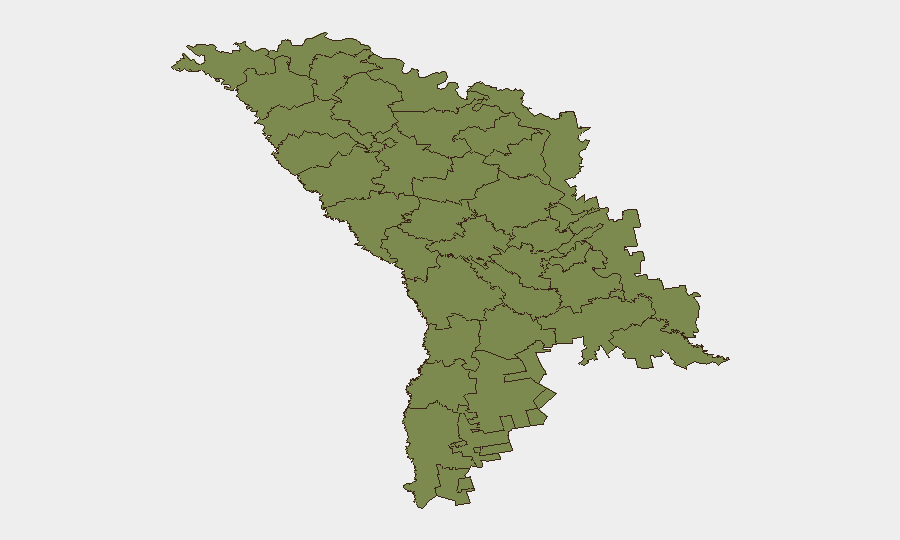
Criuleni district dominates the sub-national ranking (31.8), reflecting its proximity to the Dnestr River corridor and Transnistrian security dynamics. Chișinău (2.3) registers elevated risk due to political/institutional concentration and potential secondary targeting; the capital's airspace and critical infrastructure remain exposed to the same violation pattern affecting the south. Northern districts (Briceni, Edineț, Ocnița, Dondușeni, Drochia, Rîșcani, Glodeni, Fălești, Bălți, Sîngerei; all 1.8) show baseline risk, suggesting the primary threat vector is south-central airspace and the Russian-Ukraine border proximity rather than broad territorial instability.
How GeoBit Would Assist
Security teams should deploy AOI Monitoring & Early Warning on Criuleni and southern airspace corridors to generate real-time alerts on drone/missile signatures and flight-path anomalies. Conflict & Military capabilities—force structure and weapons-capability tracking—combined with Satellite & Imagery Analysis enable teams to monitor Transnistrian and Russian staging areas and corroborate official incident reporting. Intel Sweep and multi-language OSINT fusion across Telegram, X, and local media provide early signals of political friction, opposition rhetoric shifts, and air-defense posture changes before they affect duty-of-care decisions.
7-Day Outlook
Further drone transits remain probable given ongoing Ukrainian operations in Odesa region and unmitigated airspace corridors. Domestic political pressure on the government to demonstrate air-defense capability may accelerate NATO/EU engagement timelines. No indicative shift to direct kinetic escalation or territorial incursion is signaled; risk remains concentrated on airspace sovereignty and political legitimacy friction.
Highest-Risk Areas — Ranked
| # | State / Region | Risk |
|---|---|---|
| 1 | Criuleni | 31.8 |
| 2 | Chișinău | 2.3 |
| 3 | Briceni | 1.8 |
| 4 | Edineț | 1.8 |
| 5 | Ocnița | 1.8 |
| 6 | Dondușeni | 1.8 |
| 7 | Drochia | 1.8 |
| 8 | Rîșcani | 1.8 |
| 9 | Glodeni | 1.8 |
| 10 | Fălești | 1.8 |
| 11 | Bălți | 1.8 |
| 12 | Sîngerei | 1.8 |
Sources
Previous Daily Briefs
A new Moldova brief is written every day — each with its own risk map and downloadable CSV. Here's the last week; use the calendar to go further back.
📅 Browse every day by calendar →
Highlighted days have a brief. Tap a day for that day's map & analysis, or “csv” for that day's dataset ($5).
Atlas — our AI intelligence desk — emails them this snapshot personally. Nothing else, no list.