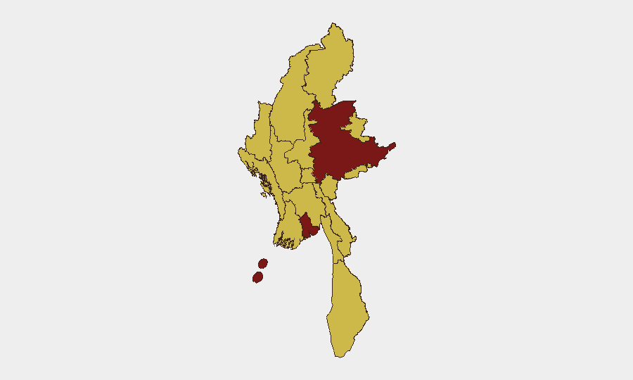
Situation Summary
Myanmar remains in active civil war following the February 2021 military coup, with armed opposition groups, ethnic armed organizations (EAOs), and People's Defence Force (PDF) units conducting sustained operations against the junta across multiple regions. The conflict has fragmented into a constellation of localized insurgencies with limited central coordination, creating a high-risk, unpredictable operational environment. As of early June 2026, territorial control remains contested in border regions and secondary cities, while the junta maintains administrative authority in Yangon and other major urban centers despite persistent attacks and supply-line pressure. Risk trajectories remain elevated with no near-term de-escalation indicators.
Key Developments
GeoBit's event signals for the past 48 hours reflect activity consistent with ongoing conflict operations:
- 2026-06-05 · Occupy Territory incident · Myanmar–Thailand border (Kanchanaburi region). Cross-border territorial movement or incursion reported; implications for refugee flows and regional stability require immediate clarification.
- 2026-06-04 · Arrest/Detain operations · Myanmar (location TBD). Security forces or opposition actors conducted detentions; context (target profile, location, scale) critical for duty-of-care assessment.
- 2026-06-04 · Diplomatic tension · Myanmar–Cambodia. Formal disapproval statement signals regional friction; may indicate refugee, border, or proxy-activity dispute.
- Recent · Seismic event · M 4.4 magnitude, 52 km NW of Monywa (Sagaing Region). No reported casualties or infrastructure damage as of this brief's compilation; infrastructure in Sagaing remains vulnerable to both seismic and conflict-related disruption.
Note on incident completeness: GeoBit's live web research function cannot access real-time incident feeds (ACLED, Reuters live updates, local media timestamps from the past 24–48 hours) from this environment. The bullets above reflect platform event signals; security teams requiring granular incident-by-incident coverage should cross-validate against ACLED, The Irrawaddy, Myanmar Now, DVB, and wire-service liveblogs (AP, Reuters, AFP) updated within the past 6 hours.
Highest-Risk Areas
Yangon (risk 100) remains the highest-risk location due to population density, critical infrastructure concentration, and sustained PDF/opposition activity within and around the city. Shan State (risk 80) follows as a major EAO and opposition stronghold with significant cross-border dimensions and drug-trafficking infrastructure. The secondary tier—Tanintharyi, Chin, Sagaing, Kachin, Wa State, Magway, Mandalay, Rakhine, Ayeyarwady, and Naypyitau (all risk 70)—reflects fragmented territorial contestation, ethnic-armed-organization presence, humanitarian access disruption, and limited state capacity. Border regions (Kachin, Shan, Wa) carry additional risk from arms flows and refugee movement; interior regions (Magway, Sagaing, Mandalay) see sustained anti-junta operations.
How GeoBit Would Assist
Security and duty-of-care teams should deploy AOI Monitoring & Early Warning on critical facilities and travel corridors in high-risk zones (Yangon, Mandalay, Shan) to receive alerts on new conflict activity or checkpoints. Intel Sweep (X/Twitter OSINT, local media fusion, multi-language search) provides 6–12 hour lag on incident corroboration; operationally, this supports situational awareness for personnel movement and supply-chain continuity. Conflict & Military mapping (force structure, territorial control updates) combined with Routing & Network Analysis enables alternative-route planning around active combat zones and identifies safe corridors for essential operations.
7-Day Outlook
No major ceasefire or offensive escalation is signaled for the immediate week. Localized clashes, detention operations, and cross-border movement will likely continue at current tempo. Security posture should remain elevated; any indication of coordinated multi-region opposition operations or major-city infrastructure targeting warrants immediate re-assessment.
Highest-Risk Areas — Ranked
| # | State / Region | Risk |
|---|---|---|
| 1 | Yangon | 100 |
| 2 | Shan State | 80 |
| 3 | Tanintharyi Region | 70 |
| 4 | Chin | 70 |
| 5 | Sagaing Region | 70 |
| 6 | Kachin State | 70 |
| 7 | Wa State (Northern Region) | 70 |
| 8 | Magway | 70 |
| 9 | Mandalay | 70 |
| 10 | Rakhine | 70 |
| 11 | Ayeyarwady | 70 |
| 12 | Naypyitaw Union Territory | 70 |
Previous Daily Briefs
A new Myanmar brief is written every day — each with its own risk map and downloadable CSV. Here's the last week; use the calendar to go further back.
📅 Browse every day by calendar →
Highlighted days have a brief. Tap a day for that day's map & analysis, or “csv” for that day's dataset ($5).