Situation Summary
Namibia remains a low-threat operating environment with a composite national threat score of 2 and minimal tracked security events. No major incidents, civil unrest, or conflict-related activity have been independently corroborated in the last 24–48 hours. Wildfire activity in central and northern regions continues to warrant monitoring for infrastructure and supply-chain impact, but represents an environmental rather than security threat.
Key Developments
- No independently verified security, crime, civil-unrest, or travel-risk incidents in the last 24–48 hours. Available source material does not support time-stamped major incidents within the current reporting window.
- Wildfire activity ongoing in central/northern Namibia (recent, date-unspecified). Multiple active wildfire events reported across the country; operational impact on transportation, power, and air quality possible but not yet quantified in available reporting.
- Military demonstration/rally activity flagged 2026-07-23. Minimal detail available; routine drill or commemoration activity appears most likely, with no indication of broader security concern.
- Chronic, low-level crime signals in Windhoek and northern regions. Police reported five robbery cases between 17–19 July (outside current 48-hour window); pattern consistent with ongoing urban crime rather than surge activity.
Highest-Risk Areas
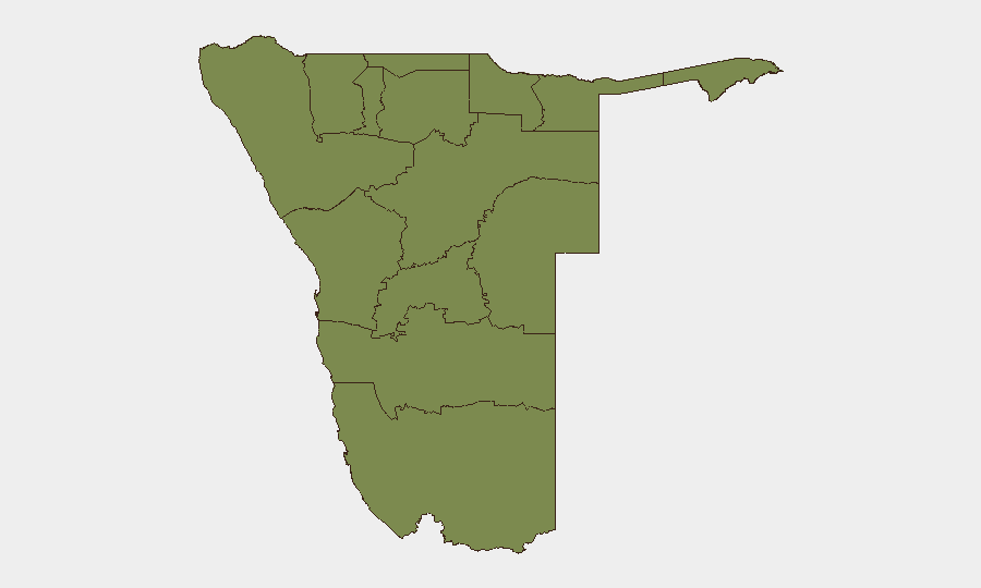
Khomas Region (Windhoek and surrounding areas) carries substantially elevated risk (31.3) relative to all other provinces, driven primarily by urban crime concentration, population density, and commercial/diplomatic infrastructure. All other regions score uniformly low (1.3), indicating that security risk is heavily localized to the capital and its immediate surroundings. Border regions and remote northern areas show no elevated threat signals. For companies with staff or assets in Windhoek, standard urban security protocols remain the primary mitigation; travel outside Khomas poses minimal incremental risk from conflict, unrest, or organized crime.
How GeoBit Would Assist
AOI Monitoring & Early Warning provides persistent watch of Khomas and northern regions for sudden escalation in crime, unrest, or environmental threats (e.g., wildfire spread to populated areas or key supply routes). Intel Sweep and multi-source OSINT fusion enable duty-of-care teams to rapidly corroborate incident reports from local media, government, and social-media channels, distinguishing signal from noise in a low-event environment. GIS & Spatial Analysis combined with Satellite & Imagery analysis can track active wildfire zones and assess impact on roads, power corridors, and logistics nodes in real time.
7-Day Outlook
No major escalation in security conditions is forecast over the next seven days. Wildfire activity may persist, particularly if dry-season conditions continue; environmental impact on transportation and air quality should be tracked. Routine crime in Windhoek is expected to remain at baseline chronic levels with no organized threat to corporate operations.
Brief prepared: 2026-07-25 | Confidence level: Medium (limited local-source corroboration available in current reporting window) | Next update: 2026-07-26
Highest-Risk Areas — Ranked
| # | State / Region | Risk |
|---|---|---|
| 1 | Khomas | 31.3 |
| 2 | Kunene Region | 1.3 |
| 3 | Omusati | 1.3 |
| 4 | Ohangwena | 1.3 |
| 5 | Oshana | 1.3 |
| 6 | Oshikoto | 1.3 |
| 7 | Kavango West | 1.3 |
| 8 | Otjozondjupa | 1.3 |
| 9 | Omaheke | 1.3 |
| 10 | Kavango East | 1.3 |
| 11 | Erongo Region | 1.3 |
| 12 | Zambezi | 1.3 |
Previous Daily Briefs
A new Namibia brief is written every day — each with its own risk map and downloadable CSV. Here's the last week; use the calendar to go further back.
📅 Browse every day by calendar →
Highlighted days have a brief. Tap a day for that day's map & analysis, or “csv” for that day's dataset ($5).
Atlas — our AI intelligence desk — emails them this snapshot personally. Nothing else, no list.