Situation Summary
New Zealand remains a low-threat environment (global rank #165, composite score 3.0) with no major security incidents or civil unrest reported in the past 48 hours. However, weather-related emergency activity—particularly flooding across the South Island and isolated structure fires—has elevated operational tempo for Fire and Emergency services. Government and regulatory bodies have issued recent public statements, but these reflect routine administrative activity rather than acute security deterioration. Overall trajectory remains stable with localized, manageable hazards.
Key Developments
- Gisborne, Harris Street (21 June, 21:40): Fatal single-vehicle road crash reported by New Zealand Police; one fatality confirmed with ongoing investigation. Short-term localized disruption to Harris Street traffic expected during investigation and recovery operations.
- Christchurch, Linwood (19 June, 00:01 onwards): Structure fire callout logged by Fire and Emergency New Zealand in early hours; incident extended over subsequent hours, contributing to elevated weekend emergency-services activity and localized access disruption in the Linwood district.
- Auckland, Northcote Retail Centre (20–21 June): Toilet block fire prompted evacuation of shops within retail centre; Fire and Emergency responded and no serious injuries were publicly reported, though retail activity and foot traffic disrupted temporarily.
- South Island, Multiple Locations (19–21 June): Fire and Emergency New Zealand reports a surge of flooding-related callouts over 48 hours, indicating multiple active incidents across the region. Road closures and property impacts likely in affected districts; emergency-services operational tempo elevated but controlled.
- Nationwide Weather Response (20–21 June): Heavy rainfall across regions experiencing weather disturbance has sustained multi-agency emergency deployment; no critical-infrastructure failures reported but travel disruptions expected in affected areas.
- Regulatory & Government Statements (20–22 June): Multiple public statements from Ministry of Health, Police, and Government entities recorded (20–22 June), along with Ministry of Justice disapproval statement on 20 June. No acute security advisory or emergency declaration evident; routine administrative communication indicated.
- Cyber Environment (last 48 hours): No confirmed New Zealand–specific critical-infrastructure or government cyber incident detected in open-source channels. Recent discussion focuses on generic incident-reporting frameworks rather than active, targeted threats.
Highest-Risk Areas
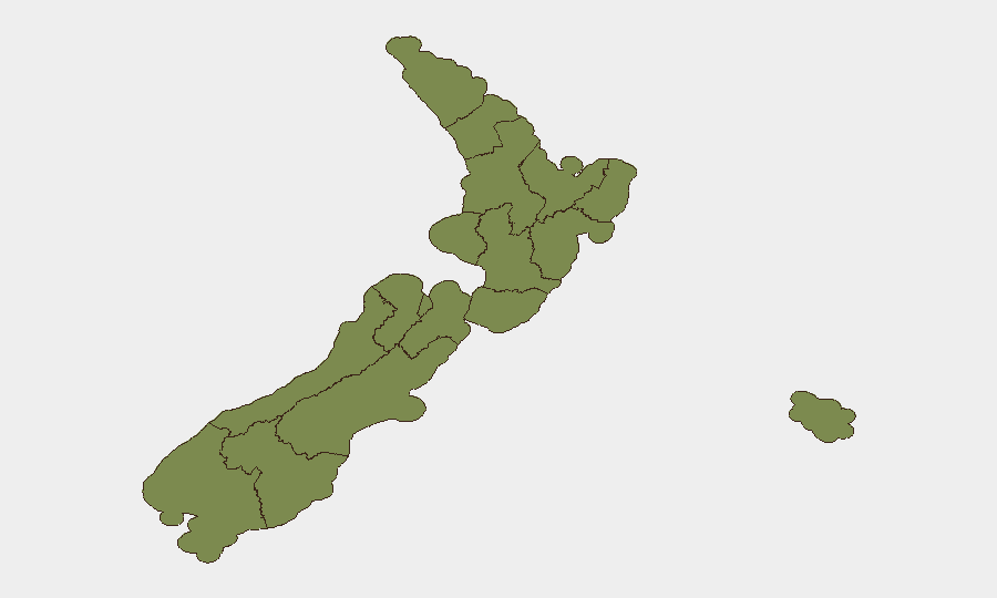
Wellington dominates sub-national risk (31.4), substantially exceeding all other regions and reflecting concentration of government, financial, and media infrastructure in the capital. Canterbury (14.9) presents secondary risk, likely driven by density and past natural-hazard exposure; West Coast (6.7) and Auckland (6.3) show elevated but manageable profiles. The disparity between Wellington and other regions suggests that political, regulatory, and economic volatility—rather than crime or civil disorder—drives the ranking. Weather-related hazards (flooding, fires) are currently the most visible operational factor nationwide, but pose temporary, localized disruption rather than systemic risk.
How GeoBit Would Assist
Security teams monitoring New Zealand should employ AOI Monitoring & Early Warning on Wellington's government and financial districts to detect regulatory, policy, or political developments that could affect operations. Risk & Threat Assessment paired with environmental & health monitoring would flag emerging weather hazards and emergency-services strain early, enabling travel and logistics planning. OSINT Fusion & Corroboration across media, government, and banking statements would disambiguate routine announcements from material security signals, reducing false-alarm overhead.
7-Day Outlook
Weather systems affecting the South Island are expected to persist or ease gradually; localized flooding and travel disruption should decline by mid-week. Emergency-services operational tempo will likely normalize as incident volume decreases. No political, civil-order, or cyber escalation is forecast; New Zealand's risk posture should remain consistent with the low global baseline.
Highest-Risk Areas — Ranked
| # | State / Region | Risk |
|---|---|---|
| 1 | Wellington | 31.4 |
| 2 | Canterbury | 14.9 |
| 3 | West Coast | 6.7 |
| 4 | Auckland | 6.3 |
| 5 | Waikato | 4.8 |
| 6 | Northland | 2.1 |
| 7 | Otago | 2.1 |
| 8 | Manawatū-Whanganui | 1.8 |
| 9 | Chatham Islands | 1.4 |
| 10 | Taranaki | 1.4 |
| 11 | Bay of Plenty | 1.4 |
| 12 | Hawke's Bay | 1.4 |
Sources
Previous Daily Briefs
A new New Zealand brief is written every day — each with its own risk map and downloadable CSV. Here's the last week; use the calendar to go further back.
📅 Browse every day by calendar →
Highlighted days have a brief. Tap a day for that day's map & analysis, or “csv” for that day's dataset ($5).