Situation Summary
Oman faces a sharp escalation in maritime security threats following Iranian attacks on commercial shipping and port infrastructure in the Strait of Hormuz on 25 June 2026. A Singapore-flagged cargo vessel was struck by a projectile near Dahit, and the Port of Duqm and nearby oil tanker were targeted, prompting the UN International Maritime Organization (IMO) to suspend its newly established evacuation corridor for the strait. Regional and international partners have coordinated a response through a GCC–U.S. ministerial statement rejecting Iranian control claims over the waterway, but traffic through the strait has largely halted, directly threatening Oman's port operations and energy exports.
Key Developments
- Strait of Hormuz attack, 7.5–8 nm SE of Dahit (25 June): Singapore-flagged cargo ship struck on starboard side by drone/projectile; bridge damaged, no casualties reported. IRGC Navy attributed responsibility by UK UKMTO and ISW; attack followed Iranian demands for ships to coordinate with Iran and use Iran-designated routes.
- IMO suspension of evacuation corridor (25 June): Following the Dahit strike, the IMO announced temporary suspension of its Oman-facilitated mechanism for guiding commercial vessels through the Strait of Hormuz, pausing a corridor that had safely transited over 50 ships earlier in the week.
- Port of Duqm and tanker attacks (25 June, confirmed): GCC Secretary-General publicly condemned recent Iranian attacks on Port of Duqm and an oil tanker off Oman's coast at a joint ministerial meeting in Manama; limited technical detail on munition type and exact timing available in open sources.
- Strait traffic halted (25 June): Hundreds of ships now at standstill in and around the Strait of Hormuz; traffic has "largely stopped" following the attack, severely impacting maritime trade and energy shipping linked to Omani ports such as Sohar and Duqm.
- GCC–U.S. ministerial response (25 June, Manama): Joint statement by GCC and U.S. ministers, including Oman's Foreign Minister Sayyid Badr Albusaidi, emphasizing "free, unconditional, and unrestricted navigation" and rejecting any Iranian tolls or control over the Strait of Hormuz.
- Iranian maritime control claims (25 June): Iranian state media reiterated demands that all ships coordinate with Iran and use traffic separation closest to Iran's coast, directly contradicting the UN–Oman-endorsed route and escalating coercive pressure on commercial and energy vessels.
Highest-Risk Areas
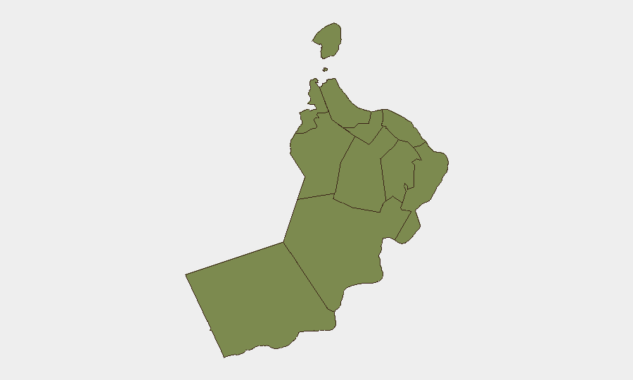
Al Wusta Governorate, which includes the Port of Duqm and surrounding waters, carries the highest composite risk score (31.9) due to confirmed recent attacks on port infrastructure and maritime assets. Al Batinah North (17.4) and Musandam (16.4) remain elevated due to proximity to the Strait of Hormuz and active shipping corridors, while Muscat Governorate (15.3)—home to Oman's largest port and capital—faces secondary risk from strait-wide disruptions. The remaining governorates score uniformly at 1.9, reflecting concentration of current maritime threats in northern coastal and offshore zones.
How GeoBit Would Assist
Security teams should deploy Maritime & Aviation tracking and AOI Monitoring & Early Warning to establish persistent watch over Omani ports (Duqm, Sohar, Salalah) and the Strait of Hormuz approaches, with alerting on vessel strikes, IRGC activity, and shipping lane closures. Routing & Network Analysis capabilities enable real-time alternative journey planning for corporate shipments and supply chains around the blocked strait. Conflict & Military tracking and Intel Sweep across regional OSINT feeds will maintain situational awareness on Iranian escalation patterns and GCC–U.S. coordination responses.
7-Day Outlook
The IMO corridor suspension is likely to remain in effect for 7–10 days pending "reconfirmation of safety guarantees," prolonging the maritime standstill and elevating insurance costs, port congestion, and energy-shipment delays. Further Iranian attacks on commercial or regional assets remain possible if de facto control demands are not met, with sustained operational risk in Al Wusta and northern strait waters.
Highest-Risk Areas — Ranked
| # | State / Region | Risk |
|---|---|---|
| 1 | Al Wusta Governorate | 31.9 |
| 2 | Al Batinah North Governorate | 17.4 |
| 3 | Musandam Governorate | 16.4 |
| 4 | Muscat Governorate | 15.3 |
| 5 | Al Buraymi Governorate | 1.9 |
| 6 | Ad Dhahirah Governorate | 1.9 |
| 7 | Al Batinah South Governorate | 1.9 |
| 8 | Ad Dakhiliyah Governorate | 1.9 |
| 9 | Ash Sharqiyah North Governorate | 1.9 |
| 10 | Ash Sharqiyah South Governorate | 1.9 |
| 11 | Dhofar Governorate | 1.9 |
Sources
Previous Daily Briefs
A new Oman brief is written every day — each with its own risk map and downloadable CSV. Here's the last week; use the calendar to go further back.
📅 Browse every day by calendar →
Highlighted days have a brief. Tap a day for that day's map & analysis, or “csv” for that day's dataset ($5).