Situation Summary
Papua New Guinea remains a fragmented security environment with acute risks concentrated in resource-rich and densely populated zones. The composite threat score of 4 reflects endemic criminal activity, tribal and political violence, and natural-hazard exposure rather than state collapse or organized insurgency. No major security incident has been identified in open reporting over the past 24–48 hours, though the absence of reports in accessible channels does not exclude localized incidents in remote provinces.
Key Developments
No major security or civil-unrest incidents have been reliably identified in public reporting dated to 16 June 2026 or the prior 48 hours. GeoBit's open-source research confirmed:
- 2026-06-15 · National Capital District (Port Moresby): One public statement attributed to Papua New Guinea vs. a sovereign entity; specific details, location, and immediate security implications require validation through PNG Police or government media channels.
- Seismic activity (recent, location-dependent): Magnitude 4.4 earthquake recorded 102 km WNW of Panguna (Bougainville region) and M 4.2 event 130 km N of Lae (Morobe Province). No tsunami alert or damage reports confirmed in current indexing.
- Titan Ridge Volcano (location/date details): One signal referencing volcanic activity; implications for air quality, ash dispersal, or evacuation status not yet clarified in accessible reporting.
- Public health: Circulating vaccine-derived poliovirus type 2 (cVDPV2) continues to be monitored; no acute outbreak declaration dated to last 48 hours, but endemic disease surveillance remains active.
Note: Localized incidents in Morobe, Eastern Highlands, Enga, Hela, or remote provinces may occur but remain unreported in English-language open-source channels within the 24–48-hour window.
Highest-Risk Areas
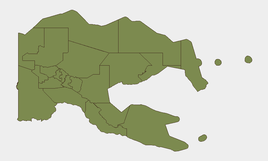
Morobe Province (risk score 31.3) dominates the sub-national ranking and warrants primary focus. Morobe combines high population density around Lae, active informal-settlement expansion, resource-extraction activity, and documented tribal-conflict networks. National Capital District (Port Moresby, risk 11.3) remains the second-highest-risk zone, driven by opportunistic armed robbery, gang activity in settlements, and sporadic political tension. All remaining provinces (Eastern Highlands, Gulf, Madang, Manus, New Ireland, East/West New Britain, Central, Oro, Milne Bay) are assigned equivalent lower scores (1.3), reflecting either more dispersed population, lower conflict frequency, or limited data; however, Eastern Highlands, Enga, and Hela (not separately ranked here) have historically experienced intense tribal violence and should not be underestimated in operational planning.
How GeoBit Would Assist
Organizations with personnel or assets in PNG should deploy Area-of-Interest (AOI) Monitoring & Early Warning on Morobe, Port Moresby, and key transport corridors (Lae–Mt Hagen highway, Goroka region) to detect emerging crime, tribal clashes, or infrastructure disruption before they affect operations. Multi-language OSINT and X/Twitter intelligence combined with sentiment & temporal analysis can identify fast-moving incidents and official responses in PNG-focused newsrooms and local social channels. Routing & Network Analysis supports duty-of-care teams in real-time route diversification and evacuation planning if localized unrest escalates.
7-Day Outlook
No imminent, countrywide security event is signaled in current reporting. Operational risk remains steady and localized, with the highest probability of incidents in Morobe and Port Moresby driven by routine crime and resource-sector labor disputes. Natural hazards (seismic, volcanic, tropical weather) warrant parallel monitoring; disease surveillance (polio) is ongoing but not acute. Duty-of-care teams should maintain baseline situational awareness and AOI monitoring rather than escalate posture at this time.
Highest-Risk Areas — Ranked
| # | State / Region | Risk |
|---|---|---|
| 1 | Morobe | 31.3 |
| 2 | National Capital District | 11.3 |
| 3 | Eastern Highlands | 1.3 |
| 4 | Gulf | 1.3 |
| 5 | Madang | 1.3 |
| 6 | Manus | 1.3 |
| 7 | West New Britain | 1.3 |
| 8 | New Ireland | 1.3 |
| 9 | East New Britain | 1.3 |
| 10 | Central | 1.3 |
| 11 | Oro | 1.3 |
| 12 | Milne Bay | 1.3 |
Sources
Previous Daily Briefs
A new Papua New Guinea brief is written every day — each with its own risk map and downloadable CSV. Here's the last week; use the calendar to go further back.
📅 Browse every day by calendar →
Highlighted days have a brief. Tap a day for that day's map & analysis, or “csv” for that day's dataset ($5).