Situation Summary
Paraguay's security environment remains stable with no major incidents reported in the past 24–48 hours. The country maintains its composite threat ranking of #95 globally, reflecting chronic underlying risks in specific border and rural regions rather than acute, active crises. The current operating picture shows no material change to corporate or traveler risk posture.
Key Developments
- No corroborated security incidents meeting duty-of-care thresholds were identified in Paraguay during the 24–48 hour reporting window across open-source monitoring, regional security feeds, and international news services.
- No civil unrest, armed engagement, infrastructure disruption, or crime-wave activity at specific locations in Paraguay were independently verified in the current reporting period, according to cross-checked security and news sources.
- Social-media and web-based reporting from Paraguay during the past two days is dominated by non-security content (World Cup football result); no parallel reports of protests, policing emergencies, or mass-casualty incidents accompany this activity.
- Security-focused travel-advisory accounts and OSINT feeds covering Paraguay show no active alerts or new advisories for the past 24–48 hours.
Highest-Risk Areas
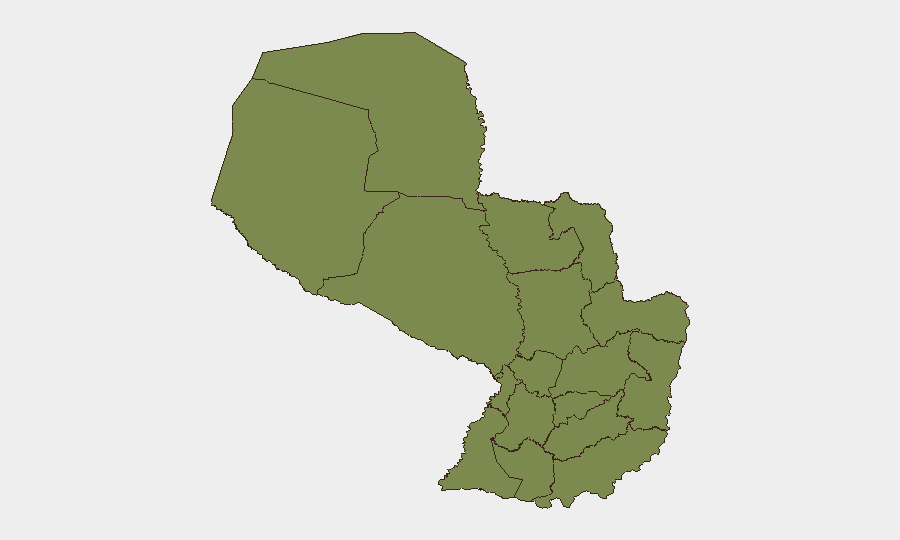
Presidente Hayes Department dominates the sub-national risk landscape with a composite score of 31.5—more than six times higher than the second-ranked region. This remote, sparsely populated Chaco region bordering Argentina has historically served as a transit corridor for contraband, narcotics trafficking, and informal mining operations; its isolation and weak state presence create structural vulnerability. Canindeyú Department (score 5.2), in the remote northeast near the Brazilian and Argentine borders, carries secondary risk tied to similar transit and trafficking dynamics. All remaining tracked departments carry scores of 1.5–1.8, indicating baseline risk typical of rural Paraguay. Corporate and traveler exposure in Asunción and the more developed eastern departments (Alto Paraná, Itapúa) remains low by regional standards.
How GeoBit Would Assist
Organizations with personnel or assets in Presidente Hayes or Canindeyú should deploy AOI Monitoring & Early Warning on known trafficking corridors and border crossing points to detect emerging activity changes before they materialize into direct threats. Intel Sweep and multi-language OSINT fusion across regional cartel communications, Telegram channels, and local news feeds would provide early signals of organized crime or civil unrest before international media coverage. GIS & Spatial Analysis combined with Routing & Network Analysis enables security teams to identify safer transit corridors and identify high-risk areas for field teams operating in remote zones.
7-Day Outlook
No acute developments are forecast for the next seven days based on current open-source indicators. The security environment is expected to remain consistent with the baseline risk profile, with highest exposure concentrated in Presidente Hayes and border regions. Duty-of-care teams should maintain standard monitoring protocols for remote operations in the Chaco and northeastern departments but have no cause to elevate alert postures based on current intelligence.
Highest-Risk Areas — Ranked
| # | State / Region | Risk |
|---|---|---|
| 1 | Presidente Hayes Department | 31.5 |
| 2 | Canindeyú Department | 5.2 |
| 3 | Boquerón | 1.8 |
| 4 | Concepción Department | 1.5 |
| 5 | San Pedro Department | 1.5 |
| 6 | Guairá Department | 1.5 |
| 7 | Amambay Department | 1.5 |
| 8 | Caaguazú Department | 1.5 |
| 9 | Alto Paraná Department | 1.5 |
| 10 | Caazapá Department | 1.5 |
| 11 | Itapúa Department | 1.5 |
| 12 | Alto Paraguay Department | 1.5 |
Sources
Previous Daily Briefs
A new Paraguay brief is written every day — each with its own risk map and downloadable CSV. Here's the last week; use the calendar to go further back.
📅 Browse every day by calendar →
Highlighted days have a brief. Tap a day for that day's map & analysis, or “csv” for that day's dataset ($5).