Situation Summary
Paraguay remains a low-threat environment (global rank #76, composite score 14) with no confirmed major security incidents, civil unrest, or infrastructure disruptions reported in the last 24–48 hours. The country's baseline risk profile reflects longstanding challenges in remote border regions, particularly Presidente Hayes Department, rather than acute active conflict or widespread criminal violence. Current political activity—including Mercosur engagement and World Cup-related presidential travel—proceeds without reported security incidents.
Key Developments
- No confirmed security incidents in Paraguay (July 5–7, 2026). Open-source and social-media monitoring has surfaced no reports of armed conflict, civil unrest, major crime events, or infrastructure disruption meeting incident thresholds in the last 24–48 hours across monitored regions.
- Diplomatic activity ongoing (Luque, Central Department; June 30 baseline). Mercosur Summit proceedings in Luque concluded without reported security incidents; regional leadership engagement and trade discussions continue at normal operational tempo.
- Presidential travel under normal security posture. Presidential movement for World Cup engagement proceeded without reported threat events or changes to security protocols.
- Baseline flood risk noted. Recent flood events documented in GeoBit's environmental monitoring require standard precautions for personnel in affected zones, but do not reflect new acute threats.
Highest-Risk Areas
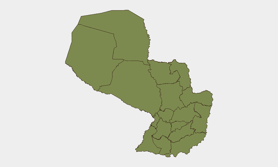
Presidente Hayes Department dominates the national risk profile (score 31.5), driven by sparse state presence, distance from capital oversight, and historical activity by transnational criminal networks in ungoverned spaces along the western border. Alto Paraguay Department registers secondary risk (8.3), reflecting similar geographic and governance constraints. All remaining departments cluster at low individual scores (1.5 each), indicating that national risk is heavily concentrated in the western Chaco region. Corporate and humanitarian personnel in these departments should maintain heightened situational awareness and communication protocols; routine travel to central and eastern departments (Central, Alto Paraná, Itapúa) carries baseline country risk only.
How GeoBit Would Assist
Teams with personnel or assets in Paraguay should employ AOI Monitoring & Early Warning for Presidente Hayes and Alto Paraguay departments to detect emerging criminal activity or cross-border incidents before they escalate; Intel Sweep and multi-language OSINT (including X/Twitter, Telegram, and regional radio) to track political statements, civil society alerts, and localized crime reporting; and Routing & Network Analysis to plan alternative travel routes and supply chains that avoid high-risk corridors. Satellite imagery analysis can monitor infrastructure integrity and unauthorized activity in remote border zones where ground reporting is sparse.
7-Day Outlook
No acute threat escalation is forecast for July 7–14. Paraguay's political calendar (post-World Cup, pre-mid-year budget cycles) and diplomatic engagement (Mercosur) are expected to proceed at normal operational tempo. Routine monitoring of Presidente Hayes and Alto Paraguay departments remains essential; flood-related infrastructure impacts should be tracked via environmental and humanitarian data feeds. Duty-of-care teams should maintain standard communication protocols and verify asset/personnel location data weekly.
Highest-Risk Areas — Ranked
| # | State / Region | Risk |
|---|---|---|
| 1 | Presidente Hayes Department | 31.5 |
| 2 | Alto Paraguay Department | 8.3 |
| 3 | Concepción Department | 1.5 |
| 4 | San Pedro Department | 1.5 |
| 5 | Guairá Department | 1.5 |
| 6 | Amambay Department | 1.5 |
| 7 | Canindeyú Department | 1.5 |
| 8 | Caaguazú Department | 1.5 |
| 9 | Alto Paraná Department | 1.5 |
| 10 | Caazapá Department | 1.5 |
| 11 | Itapúa Department | 1.5 |
| 12 | Boquerón | 1.5 |
Sources
Previous Daily Briefs
A new Paraguay brief is written every day — each with its own risk map and downloadable CSV. Here's the last week; use the calendar to go further back.
📅 Browse every day by calendar →
Highlighted days have a brief. Tap a day for that day's map & analysis, or “csv” for that day's dataset ($5).
Atlas — our AI intelligence desk — emails them this snapshot personally. Nothing else, no list.