Situation Summary
Peru faces elevated composite threat activity (rank #null globally, score 24) driven primarily by concentrated risk in Huánuco region, where the threat score (31.3) exceeds the national average by an order of magnitude. Event signals from June 21–23 indicate multi-sector friction—involving government, military, education, police, and international actors—but granular incident reporting from the last 24–48 hours remains limited in accessible sources. The security picture reflects ongoing structural pressures rather than a single acute crisis, though recent signal density warrants close operational monitoring.
Key Developments
Signal-based activity (June 21–23, unconfirmed for specific location/time):
- Military–civilian institutional tension: A demand issued by a school against military forces (June 23) and a separate conventional military force event involving Peru and Chinese actors (June 23) suggest elevated friction in the defense sector or border-related activity; exact location and nature require corroboration.
- Police blockade: A police-led blockade was reported (June 23), location unspecified; blockades typically target transport or supply routes and warrant confirmation of scope and duration.
- Student and legislative activity: Public statements by student groups and representatives against the government (June 23) indicate youth-sector and parliamentary dissent; no violence reported at signal level.
- Multi-day disapproval signals: Citizen disapproval events recorded on June 21–22 suggest sustained public dissatisfaction; demonstrates/rallies on June 22 imply organized mobilization.
- Diplomatic rejection: A foreign chancellery rejected Peru on June 23; context (trade, migration, security accord, or election dispute) requires verification.
Note on source limitations: These events are derived from GeoBit event-signal metadata rather than corroborated news reports from multiple independent sources. Operational teams should cross-check against embassy travel advisories and local government emergency notices for confirmed incident details (location, participants, scale, ongoing status).
Highest-Risk Areas
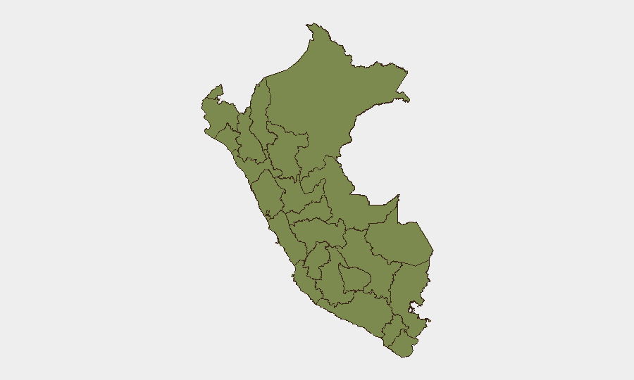
Huánuco (31.3) dominates sub-national risk by a 4:1 margin over the second-highest region (Junín, 7.6), indicating either concentrated criminal activity, resource-conflict drivers, or acute political instability in that department. Lima (4.9), while lower in absolute score, remains operationally critical due to population density, capital-city institutional exposure, and standing security advisories noting violent crime and ongoing states of emergency in Lima and Callao. Ayacucho, Arequipa, and Tacna cluster at 4.5, suggesting regional rather than localized pressure. The steep drop-off in risk beyond the top five regions indicates that Peru's security burden is geographically concentrated; corporate assets and personnel outside these zones face substantially lower threat profiles, though Lima's administrative and economic centrality means disruption there has national ripple effects.
How GeoBit Would Assist
A security team operating in Peru would deploy AOI Monitoring & Early Warning on Huánuco and Lima (persistent watch with alerting on protest, blockade, or security-force activity), Intel Sweep and multi-language OSINT fusion to track government, military, and opposition statements in real time, and Election Monitoring if the June 2026 run-off is contested or disputed. Routing & Network Analysis would support alternative route planning should major transport corridors (particularly Lima–Huánuco) experience disruption from blockades or unrest.
7-Day Outlook
Elevated signal density suggests continued institutional and public friction over the next week, with Huánuco and Lima as focal points. Without corroborated reporting of violent escalation or sustained blockades, the risk remains elevated but not imminent; however, event-signal acceleration or confirmation of blockade spread would warrant rapid reassessment. Corporate teams with personnel or assets in these regions should maintain alert-status contact protocols and verify staff safety on a 24–48 hour cycle until signal density declines.
Highest-Risk Areas — Ranked
| # | State / Region | Risk |
|---|---|---|
| 1 | Huánuco | 31.3 |
| 2 | Junín | 7.6 |
| 3 | Lima | 4.9 |
| 4 | Ayacucho | 4.5 |
| 5 | Arequipa | 4.5 |
| 6 | Tacna | 4.5 |
| 7 | Piura | 2.5 |
| 8 | Apurímac | 2 |
| 9 | Cusco | 1.8 |
| 10 | Tumbes | 1.6 |
| 11 | San Martín | 1.5 |
| 12 | Ica | 1.5 |
Sources
Previous Daily Briefs
A new Peru brief is written every day — each with its own risk map and downloadable CSV. Here's the last week; use the calendar to go further back.
📅 Browse every day by calendar →
Highlighted days have a brief. Tap a day for that day's map & analysis, or “csv” for that day's dataset ($5).