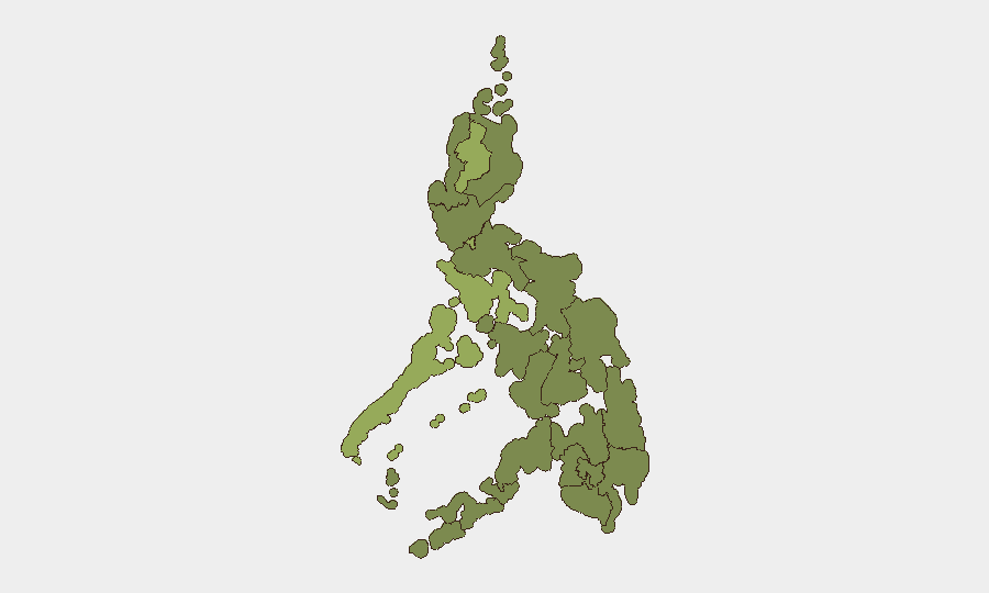
Situation Summary
The Philippines faces a compound security environment characterized by cyber intrusions against government institutions, heightened political tensions surrounding Vice President Duterte's impeachment proceedings, and ongoing humanitarian operations following a magnitude 7.8 earthquake in Mindanao that has claimed at least 47 lives. Metro Manila and Cordillera Administrative Region represent the highest composite risk areas, with the capital experiencing elevated security postures ahead of Independence Day celebrations and amid reports of destabilization concerns. Overall threat trajectory remains elevated but localized; national stability is not under acute threat, though cyber and political vectors warrant active monitoring.
Key Developments
- Manila, June 11 – The Philippine Senate's official website was defaced by a group claiming the name "Nullsec Philippines." The Senate EDP-MIS office confirmed that only publicly accessible content was altered, with no indication of confidential-data compromise. The site was placed under maintenance and security protocols activated.
- Manila, June 11 – The Senate Office of the Sergeant-at-Arms implemented heightened physical security and temporary access restrictions limiting entry to essential personnel only, citing a possible threat amid ongoing leadership changes and the cyber incident.
- Metro Manila, June 11 – Authorities established heightened security posture for Independence Day celebrations (June 12), including increased police presence and security checkpoints at government and public event sites, following reports of a possible destabilization plot.
- House of Representatives, June 11 – Private prosecutors for Vice President Sara Duterte's impeachment trial were unveiled, a development linked by local media to heightened political tension and related security concerns in the capital.
- Mindanao, June 11 – Search-and-rescue and crowd-control operations continued following an earlier offshore earthquake; death toll rose to at least 47 with hundreds injured and significant population displacement, driving expanded security-force deployment to affected areas.
- Scarborough Shoal, West Philippine Sea, June 11 – The Philippine National Task Force for the West Philippine Sea reported detection of a 6×6 meter floating platform with antenna apparatus installed by China inside Scarborough Shoal (approximately 140 miles west of Luzon). Manila lodged a formal protest; U.S. intelligence is monitoring the site as a possible precursor to permanent Chinese infrastructure.
- Nationwide, June 11 – Cybersecurity monitors noted that the Senate defacement is part of a broader pattern of recent cyber incidents targeting Philippine government entities including the Department of Science and Technology, Bureau of Customs, and National Privacy Commission, highlighting an elevated cyber-threat environment.
Highest-Risk Areas
Cordillera Administrative Region (risk score 53.5) and Metro Manila (45.2) drive the national composite risk ranking. Cordillera's elevation reflects both historical insurgent activity and terrain-related operational complexity; Metro Manila's score reflects concentrated political institutions, dense population, cyber-attack surface, and current heightened security operations tied to impeachment proceedings, Independence Day events, and destabilization warnings. Mimaropa (41.8) and Central Luzon (31.2) show secondary elevation, likely reflecting maritime dispute activity and proximity to political centers respectively. The remaining regions show lower but non-negligible risk, with Bangsamoro and Zamboanga Peninsula warranting continued monitoring for criminal and separatist activity.
How GeoBit Would Assist
Security teams should employ Intel Sweep and OSINT fusion to track government-sector cyber incidents in real time and correlate defacement claims with threat-actor communications on X/Telegram. AOI Monitoring & Early Warning on Metro Manila government complexes and the Senate would provide persistent alerting on physical-security changes and access restrictions. Maritime tracking and satellite imagery over Scarborough Shoal and contested West Philippine Sea zones would enable independent verification of Chinese platform activity and trajectory monitoring.
7-Day Outlook
Independence Day celebrations (June 12–13) will likely sustain elevated police and military presence in Metro Manila and key provincial centers. Political tensions surrounding the impeachment trial and cyber-attack aftermath are expected to remain elevated; secondary cyber incidents targeting other government entities are plausible. Earthquake response operations in Mindanao will continue to strain regional security resources and should be monitored for secondary risks (disease, civil unrest, criminal activity in affected zones).
Highest-Risk Areas — Ranked
| # | State / Region | Risk |
|---|---|---|
| 1 | Cordillera Administrative Region | 53.5 |
| 2 | Metro Manila | 45.2 |
| 3 | Mimaropa | 41.8 |
| 4 | Central Luzon | 31.2 |
| 5 | Soccsksargen | 28.3 |
| 6 | Davao Region | 28.3 |
| 7 | Calabarzon | 28.3 |
| 8 | Ilocos Region | 26.4 |
| 9 | Eastern Visayas | 24.4 |
| 10 | Zamboanga Peninsula | 24.4 |
| 11 | Bangsamoro | 23.4 |
| 12 | Caraga | 23.4 |
Sources
Previous Daily Briefs
A new Philippines brief is written every day — each with its own risk map and downloadable CSV. Here's the last week; use the calendar to go further back.
📅 Browse every day by calendar →
Highlighted days have a brief. Tap a day for that day's map & analysis, or “csv” for that day's dataset ($5).