Situation Summary
Romania remains a low-threat environment globally (rank #108, composite score 11) with concentrated risk in Bucharest and select urban centers. The country faces ongoing exposure to Russian military activity along its eastern border and airspace—evidenced by drone strikes in May–June affecting Galați and Constanța—but domestic civil unrest and organized crime remain limited in scope. A nationwide extreme-heat Red Warning (temperatures >40°C) effective 29 June introduces secondary risks of wildfire escalation and utility strain, though no infrastructure failure or heat-linked unrest has been reported in the last 48 hours.
Key Developments
- Nationwide heat alert (29 June): Romania's national meteorology authority issued a Red Warning for extreme heat across nearly all regions, with temperatures forecast to exceed 40°C (104°F). Secondary risks include increased wildfire potential and strain on power and water systems, particularly in under-resourced rural areas.
- Ongoing Russian drone exposure: Since May, Romanian airspace and border regions have absorbed Russian-origin drone strikes (Galați residential strike, 29 May; maritime drone near Constanța oil terminal, 5 June). No new confirmed strikes have been reported in the last 24–48 hours, but detection and air-defense posture remain elevated.
- Domestic security measures: Romanian Ministry of Interior (MAI) drone-detection systems continue testing and deployment following the May–June incidents, with no new operational incidents reported in the immediate timeframe.
- No confirmed civil unrest, major crime, or cyber incidents in the last 24–48 hours: Open-source monitoring has not corroborated specific, time-stamped incidents of protests, organized-crime activity, or infrastructure cyberattacks clearly dated to 29–30 June.
Highest-Risk Areas
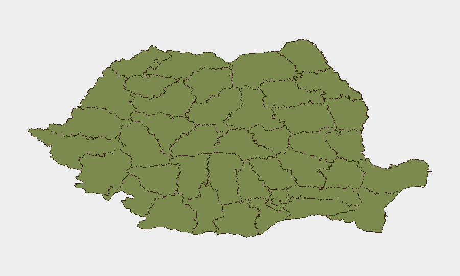
Bucharest's composite risk score (31.5) is substantially higher than all other regions, driven by its role as the national capital, concentration of government and media infrastructure, and historical attractiveness for small-scale activism and criminal activity. Brașov (19.1) ranks second and reflects its position as a major urban and commercial hub in central Romania; smaller regional cities (Cluj, Sibiu, Prahova) and rural counties show minimal to very low risk (1.5–2.4). The 13-fold gap between Bucharest and second-ranked Brașov suggests that risk mitigation should prioritize capital-region contingencies, while broader national coverage remains proportionally lighter.
How GeoBit Would Assist
Teams should deploy AOI Monitoring & Early Warning on Bucharest and Brașov to detect emerging protests, infrastructure disruptions, or crime-linked activity with sub-24-hour alerting. Intel Sweep and X/Twitter & Telegram OSINT (including Romanian-language monitoring) provide real-time detection of civil unrest, security-force activity, and unofficial announcements ahead of traditional media. Conflict & Military tracking and Maritime & Aviation monitoring offer continuous watch on Russian drone and military activity in eastern Romania and the Black Sea approaches, enabling decision-makers to update force posture and travel restrictions on an evidence-based timeline.
7-Day Outlook
The extreme-heat warning will likely persist through early July, with wildfire risk highest in central and southern forested regions; no major political or security crisis is forecast. Russian drone activity remains episodic and opportunistic rather than sustained; any escalation would depend on broader Ukraine-Russia dynamics. Corporate and NGO teams should maintain standard duty-of-care protocols in Bucharest and monitor utility/transport disruption in smaller urban centers during peak-heat days.
Highest-Risk Areas — Ranked
| # | State / Region | Risk |
|---|---|---|
| 1 | Bucharest | 31.5 |
| 2 | Brașov | 19.1 |
| 3 | Cluj | 2.4 |
| 4 | Sibiu | 2.4 |
| 5 | Prahova | 2.4 |
| 6 | Vâlcea | 1.5 |
| 7 | Bihor | 1.5 |
| 8 | Timiș | 1.5 |
| 9 | Caraș-Severin | 1.5 |
| 10 | Satu Mare | 1.5 |
| 11 | Sălaj | 1.5 |
| 12 | Arad | 1.5 |
Sources
Previous Daily Briefs
A new Romania brief is written every day — each with its own risk map and downloadable CSV. Here's the last week; use the calendar to go further back.
📅 Browse every day by calendar →
Highlighted days have a brief. Tap a day for that day's map & analysis, or “csv” for that day's dataset ($5).