Situation Summary
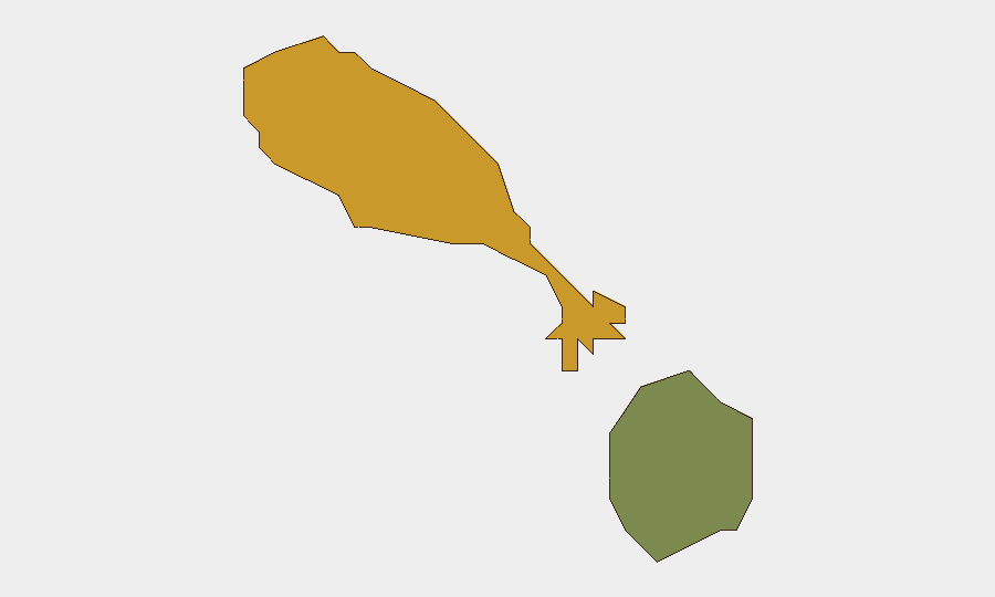
Saint Kitts and Nevis presents a low-intensity security environment with a composite threat score of 3 globally and no tracked acute events in the current 24–48 hour window. The dual-island federation exhibits marked geographic disparity in risk, with Saint Kitts (composite risk 72) substantially elevated relative to Nevis (risk 28), reflecting documented exposure to petty and violent crime concentrated in urban centers. No current civil unrest, infrastructure disruption, political instability, or travel impediment has been confirmed from recent reporting.
Key Developments
- No discrete security, conflict, crime, or infrastructure events confirmed in Saint Kitts and Nevis during the last 24–48 hours. Live web research yielded no reports of acute incidents, demonstrations, or operational disruptions affecting corporate, diplomatic, or civilian assets.
- Government travel advisory reissued (June 19) — The national government updated standing travel guidance, reiterating baseline risk advisories on petty theft, violent crime, and precautionary measures; this is routine updating, not a response to new incident.
- Biometric passport enrolment programme (ongoing, June 2026) — Mandatory biometric identity upgrade is proceeding as administrative security modernisation; no disruption to travel or services reported.
- Legislative business continues (June 18) — National Assembly approved five bills; routine parliamentary function with no bearing on security trajectory.
- Addressing system infrastructure update (June 19) — Government published routine national addressing system initiative; administrative/policy development, not a security event.
- Black Sea maritime incident (attribution only) — One vessel flagged under Saint Kitts and Nevis registry was involved in reported attack in Eastern European waters; this is a flag-state administrative link only and does not reflect in-country risk.
Highest-Risk Areas
Saint Kitts dominates the risk profile, with a composite score of 72 compared to Nevis at 28—a 2.6× differential. This concentration reflects documented street crime, gang-related violence, and property crime primarily affecting Basseterre and surrounding urban districts. Nevis's materially lower score suggests comparative stability and lower incident frequency, typical of smaller secondary islands in the federation. Risk exposure for corporate and expatriate populations remains urban-centric; remote areas and resort zones typically exhibit lower operational friction.
How GeoBit Would Assist
Corporate security teams would employ AOI Monitoring & Early Warning focused on Basseterre and key urban corridors to detect emerging crime hotspots or civil unrest with near-real-time alerting. OSINT Fusion & Corroboration across government announcements, local media, and social-media sentiment analysis would provide early signal of policy shifts, labour action, or crowd events before they operationally impact duty-of-care obligations. Routing & Network Analysis would support contingency planning and secure transit corridors for personnel and asset movement within high-risk urban zones.
7-Day Outlook
No material escalation of baseline risk is anticipated in the immediate 7-day window absent exogenous shocks (e.g. severe weather, regional instability spillover, or resource disruption). Continued routine legislative and administrative activity with no destabilising signals. Monitoring should persist on urban crime trends, climate-season preparedness, and any regional Caribbean developments that might affect maritime/aviation logistics or tourism-dependent economic stability.
Highest-Risk Areas — Ranked
| # | State / Region | Risk |
|---|---|---|
| 1 | Saint Kitts | 72 |
| 2 | Nevis | 28 |
Sources
Previous Daily Briefs
A new Saint Kitts and Nevis brief is written every day — each with its own risk map and downloadable CSV. Here's the last week; use the calendar to go further back.
📅 Browse every day by calendar →
Highlighted days have a brief. Tap a day for that day's map & analysis, or “csv” for that day's dataset ($5).