Situation Summary
Saint Lucia remains a low–threat environment globally (rank #87, composite score 14) with no corroborated security incidents, civil unrest, infrastructure disruption, or travel emergencies reported in the last 24–48 hours. The island's security posture is stable, though crime remains concentrated in the capital and northern districts. No imminent external or internal shocks are evident in current intelligence.
Key Developments
No specific, time-stamped security incidents, civil unrest, infrastructure failures, or travel-relevant events were identified in Saint Lucia during 1–3 July 2026 by corroborated sources. Web research across news outlets, social media, and regional reporting yielded no named incidents (specific locations, dates, described events) matching the 24–48 hour window. Consequently, no current developments can be reported without resort to speculation or background material falling outside the required timeframe.
Highest-Risk Areas
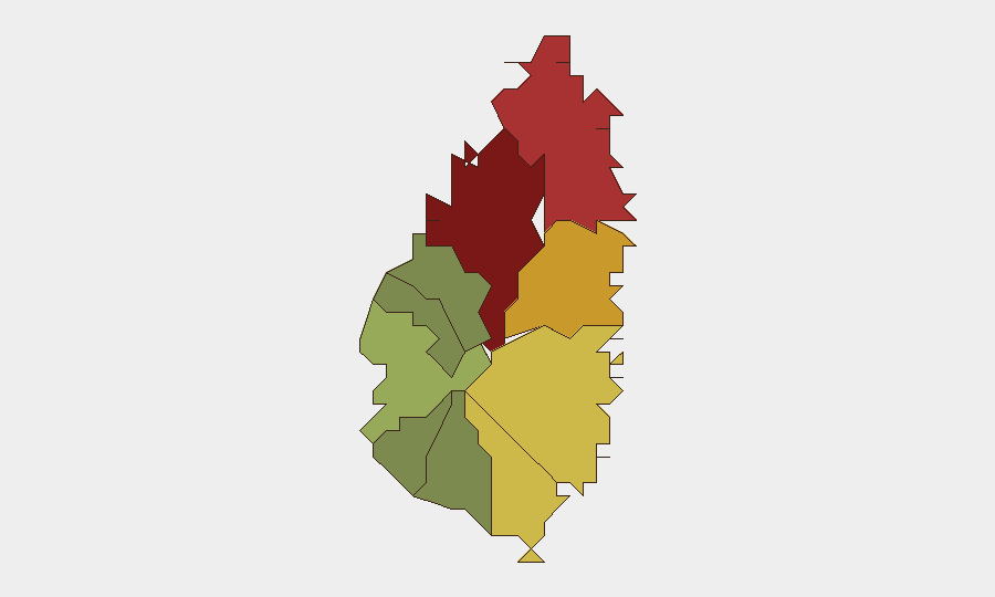
Castries (risk 95) dominates the sub-national threat landscape as the capital and primary urban center, followed by the northern parishes of Gros Islet (78) and Dennery (72), which together account for the island's highest concentration of reported crime and gang activity. Vieux Fort (68) in the south and Micoud (65) on the east coast show elevated risk but remain secondary focal points. Southern and western parishes—Soufrière, Laborie, Choiseul, Anse La Raye, and Canaries—register materially lower risk (12–42), reflecting sparser population density and lighter criminal organization presence. Risk in Saint Lucia is driven primarily by localized gang-related violence and property crime rather than political instability or large-scale conflict.
How GeoBit Would Assist
Organizations with personnel or assets in Saint Lucia should employ GeoBit's Area-of-Interest Monitoring & Early Warning capability to establish persistent watch on Castries, Gros Islet, and Dennery, with automated alerting on emerging crime clusters, protests, or infrastructure incidents. OSINT Fusion & Corroboration across news, social media (X, Telegram), and regional sources ensures that security teams receive multi-source verified alerts rather than single-source rumors. Risk & Threat Assessment combined with GIS & Spatial Analysis enables rapid mapping of safe versus restricted zones by parish, supporting duty-of-care routing and asset positioning decisions.
7-Day Outlook
No acute threats or triggering events are visible on the near-term horizon. Saint Lucia's risk profile is expected to remain stable barring an unexpected spike in gang violence, a natural hazard event, or regional escalation affecting Caribbean tourism and commerce. Continued monitoring of Castries and northern parishes for seasonal crime trends is warranted as a routine precaution.
Highest-Risk Areas — Ranked
| # | State / Region | Risk |
|---|---|---|
| 1 | Castries | 95 |
| 2 | Gros Islet | 78 |
| 3 | Dennery | 72 |
| 4 | Vieux Fort | 68 |
| 5 | Micoud | 65 |
| 6 | Soufrière | 42 |
| 7 | Laborie | 38 |
| 8 | Choiseul | 35 |
| 9 | Anse La Raye | 28 |
| 10 | Canaries | 12 |
Previous Daily Briefs
A new Saint Lucia brief is written every day — each with its own risk map and downloadable CSV. Here's the last week; use the calendar to go further back.
📅 Browse every day by calendar →
Highlighted days have a brief. Tap a day for that day's map & analysis, or “csv” for that day's dataset ($5).