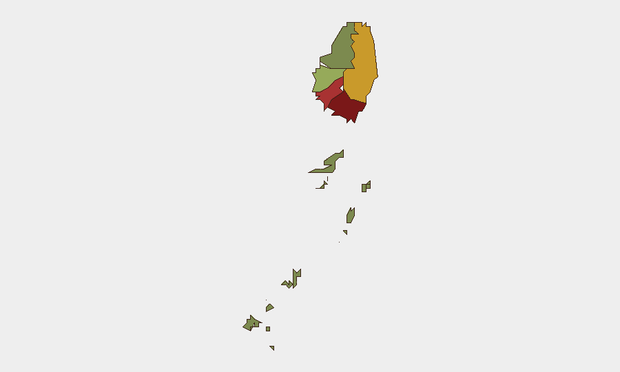
Situation Summary
Saint Vincent and the Grenadines remains a low-threat environment globally (rank #179; composite score 3/10) with no credible security incidents, civil unrest, or infrastructure disruptions reported in the last 24–48 hours. Open-source monitoring across news, social media, and travel advisories shows routine activity only. The country's security posture reflects typical Caribbean baseline conditions: localized property crime in urban areas, seasonal natural-hazard exposure, and stable governance, with no indicators of imminent escalation.
Key Developments
No significant security, conflict, civil unrest, or travel-risk events meeting cross-verification criteria have been reported in Saint Vincent in the last 24–48 hours. Open-source news feeds, X/Twitter monitoring, and consular advisory channels show no new alerts or incidents. If monitoring reveals developments in the coming 48 hours, GeoBit's real-time OSINT and AOI alerting capabilities will capture and flag them for duty-of-care teams immediately.
Highest-Risk Areas
Saint George (risk 92) and Saint Andrew (risk 78) drive the country's composite threat score, reflecting urban concentration of property crime, gang activity, and petty violence in and around Kingstown. Charlotte (risk 71) follows as a secondary urban concern. These three parishes account for the majority of Saint Vincent's security burden; the Grenadines (risk 12) and southern parishes remain significantly lower-risk, reflecting population density and socioeconomic distribution. Corporate assets, residences, and personnel concentrated in Kingstown face elevated baseline robbery and theft exposure, particularly in informal settlements and after dark.
How GeoBit Would Assist
Intel Sweep and Multi-language OSINT Fusion enable continuous scanning of local news, social media, government statements, and regional feeds to detect emerging incidents—civil unrest, crime spikes, political instability, or infrastructure disruption—hours or days before they affect operations. AOI Monitoring & Early Warning allows security teams to set persistent watches on high-risk parishes (Saint George, Saint Andrew, Charlotte) with automated alerting when activity signals spike. GIS & Spatial Analysis combined with Routing & Network Analysis support dynamic journey planning and safe-zone mapping for personnel moving between Kingstown, the airport, and corporate facilities, accounting for real-time threat and infrastructure conditions.
7-Day Outlook
No acute security deterioration is forecast for the next seven days. Routine baseline risks—street crime in urban parishes, seasonal weather hazards, and minor governance friction—will remain the primary duty-of-care drivers. Monitoring will continue across OSINT channels; any credible incident signals will trigger immediate alert escalation to subscribing teams.
GeoBit Threat Ranking: #179 globally | Composite Score: 3/10 | Events Tracked: 6
Report Date: 9 July 2026 | Coverage: Saint Vincent and the Grenadines
Highest-Risk Areas — Ranked
| # | State / Region | Risk |
|---|---|---|
| 1 | Saint George | 92 |
| 2 | Saint Andrew | 78 |
| 3 | Charlotte | 71 |
| 4 | Saint Patrick | 58 |
| 5 | Saint David | 34 |
| 6 | Grenadines | 12 |
Sources
Previous Daily Briefs
A new Saint Vincent brief is written every day — each with its own risk map and downloadable CSV. Here's the last week; use the calendar to go further back.
📅 Browse every day by calendar →
Highlighted days have a brief. Tap a day for that day's map & analysis, or “csv” for that day's dataset ($5).
Atlas — our AI intelligence desk — emails them this snapshot personally. Nothing else, no list.