Situation Summary
Slovakia remains a low-threat environment globally (rank #89, composite score 12) with no active large-scale civil unrest, terrorism, or organized violence reported in the last 24–48 hours. However, the country faces immediate and widespread weather-related disruptions, localized infrastructure damage, and ongoing IT reliability issues within state institutions. The security picture is primarily characterized by weather-induced travel risk and minor operational friction rather than malicious actors or instability.
Key Developments
- Nationwide severe thunderstorm warning – Friday, July 17, 2026, 18:00–24:00. The Slovak Hydrometeorological Institute issued a first-level alert for intense rainfall, strong winds, and hail across all regions. Risk to road and rail transport, power infrastructure, and outdoor personnel safety.
- Rail corridor disruption, Nové Zámky–Štúrovo (south Slovakia) – Thursday, July 16, 2026. ŽSR operator reported ongoing traffic interruption on this international route to Hungary following freight-train damage to track switching equipment. Knock-on delays expected for passenger and freight movements in the south.
- Bratislava urban rail delays – Wednesday, July 15, 2026. A grass snake on traction equipment caused a two-hour closure of the Bratislava hlavná stanica–Rača line, illustrating infrastructure sensitivity to minor environmental incidents.
- Slovak Armed Forces and Hydrometeorological Institute IT outage – overnight July 15–16, 2026. Dual-sector disruption of state IT infrastructure affecting both weather forecasting and defence systems. Operational implications for situational awareness and emergency response.
- National Bank of Slovakia (NBS) cryptocurrency fraud warning – mid-July 2026. NBS alert on unauthorized internet financial-services offers; ongoing regulatory action against illicit schemes targeting Slovak residents and travelers.
Highest-Risk Areas
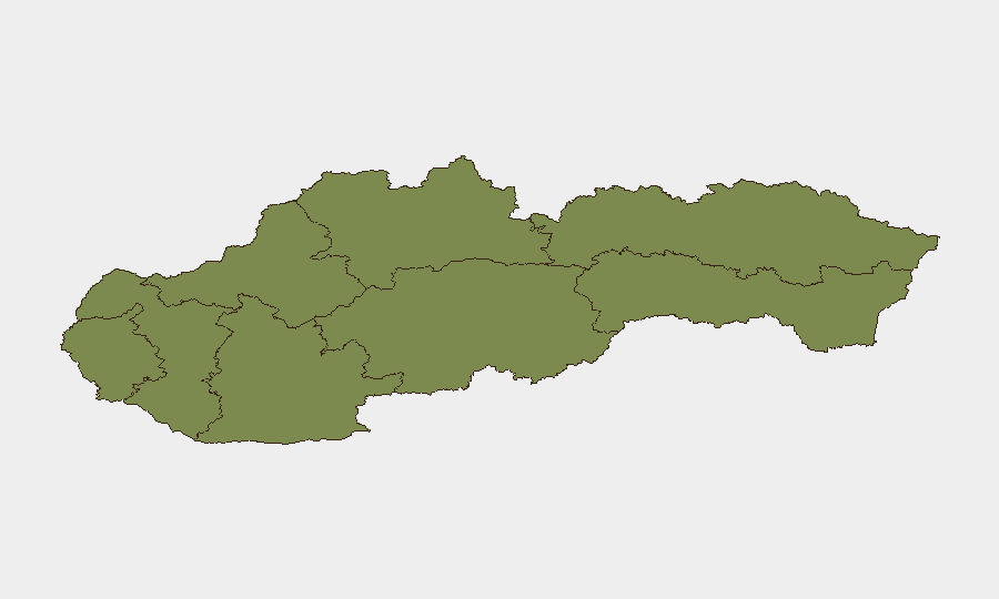
Banská Bystrica region presents a disproportionate risk profile (composite score 31.8) that significantly exceeds all other Slovak regions; the remaining seven regions cluster at scores below 3.6, with Bratislava (3.5) as the only other notable outlier. This extreme regional concentration suggests either acute localized threat drivers in Banská Bystrica (e.g., specific organized-crime networks, industrial hazards, or natural disaster exposure) or heightened event reporting density in that zone. Bratislava's secondary elevation likely reflects capital-city concentration of soft targets, financial services, and political institutions. Organizations with personnel or operations in Banská Bystrica warrant priority monitoring; Bratislava poses standard urban crime and infrastructure risks.
How GeoBit Would Assist
Security teams managing Slovakia exposure should employ AOI Monitoring & Early Warning on high-risk regions (Banská Bystrica, Bratislava) and critical infrastructure nodes (rail corridors, power distribution) to detect emerging threats and weather-related disruptions in real time. Routing & Network Analysis capabilities would enable rapid rerouting of personnel and supply movements around the active Nové Zámky–Štúrovo rail closure and storm-affected zones. Intel Sweep and multi-language OSINT fusion would provide early detection of localized unrest, cyber incidents affecting state institutions, or financial-fraud schemes targeting corporate operations.
7-Day Outlook
Weather disruptions will likely persist through the weekend with gradual clearance by early next week; rail and road networks should see normalization by July 20–21, though secondary infrastructure repairs may extend into the following week. No indicators suggest escalation from weather-induced operational friction to organized instability or malicious security incidents. Continued monitoring of IT infrastructure resilience in state systems and anomalous financial-services fraud patterns remains prudent.
Highest-Risk Areas — Ranked
| # | State / Region | Risk |
|---|---|---|
| 1 | Region of Banská Bystrica | 31.8 |
| 2 | Region of Bratislava | 3.5 |
| 3 | Region of Košice | 1.8 |
| 4 | Region of Žilina | 1.8 |
| 5 | Region of Trnava | 1.8 |
| 6 | Region of Trenčín | 1.8 |
| 7 | Region of Nitra | 1.8 |
| 8 | Region of Prešov | 1.8 |
Sources
Previous Daily Briefs
A new Slovakia brief is written every day — each with its own risk map and downloadable CSV. Here's the last week; use the calendar to go further back.
📅 Browse every day by calendar →
Highlighted days have a brief. Tap a day for that day's map & analysis, or “csv” for that day's dataset ($5).
Atlas — our AI intelligence desk — emails them this snapshot personally. Nothing else, no list.