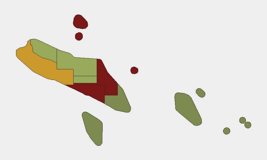
Situation Summary
Solomon Islands remains classified at composite threat level 4 globally, with no clearly corroborated security incidents occurring in the last 24–48 hours. The security environment is defined by structural governance and policing capacity challenges rather than acute active incidents; Honiara and Guadalcanal maintain significantly elevated risk profiles relative to outer provinces. The near-term trajectory reflects ongoing institutional and political management rather than imminent destabilization.
Key Developments
No reliably confirmed, location-specific security, civil-unrest, crime, political-instability, or travel-risk incidents meeting corroboration standards were identified in Solomon Islands during the 24–48 hour window ending 2026-06-20. Open-source coverage during this period has focused on governance decisions (e.g., police leadership reviews) tied to earlier 2024 incidents, and regional diplomatic commentary on security partnerships, rather than new ground-level incidents. Given the requirement to exclude historical events presented as current developments, this brief accurately reflects the absence of newly occurring acute security events in the stated timeframe.
Highest-Risk Areas
Honiara (risk 92) and Guadalcanal (risk 88) drive the overall threat profile and account for the majority of documented security volatility in Solomon Islands. Malaita (risk 85) follows, reflecting historical inter-provincial tensions and localized resource and governance disputes. The remaining provinces (Western, Choiseul, Isabel, Central, Makira-Ulawa, Rennell and Bellona, and Temotu) show materially lower composite scores; outer provinces present substantially reduced acute risk. Risk concentration in Honiara and Guadalcanal reflects urban density, policing capacity constraints, informal settlement dynamics, and historical sites of intercommunal friction.
How GeoBit Would Assist
Corporate security teams with personnel or assets in Solomon Islands should employ AOI Monitoring & Early Warning with persistent alerting on Honiara and Guadalcanal to detect emerging incidents before they reach conventional news cycles; Intel Sweep and multi-language OSINT fusion (X/Twitter, Telegram, regional forums) to corroborate and assess credibility of local reporting; and Routing & Network Analysis to maintain real-time alternative transit options for personnel in high-risk urban zones. Risk & Threat Assessment and conflict mapping capabilities enable scenario planning for duty-of-care protocols tied to subnational risk tiers.
7-Day Outlook
No acute security triggers are identifiable in near-term forecasting. Ongoing governance and security-sector institutional developments will likely continue to dominate open-source reporting; outer-province stability is expected to remain nominal. Organizations should maintain baseline awareness posture and sustain subnational risk differentiation (Honiara/Guadalcanal at elevated readiness; outer provinces at standard monitoring).
Next update: 2026-06-21 or upon material incident detection.
Highest-Risk Areas — Ranked
| # | State / Region | Risk |
|---|---|---|
| 1 | Honiara | 92 |
| 2 | Guadalcanal | 88 |
| 3 | Malaita | 85 |
| 4 | Western | 72 |
| 5 | Choiseul | 58 |
| 6 | Isabel | 52 |
| 7 | Central Province | 48 |
| 8 | Makira-Ulawa | 38 |
| 9 | Rennell and Bellona | 22 |
| 10 | Temotu | 18 |
Sources
Previous Daily Briefs
A new Solomon Islands brief is written every day — each with its own risk map and downloadable CSV. Here's the last week; use the calendar to go further back.
📅 Browse every day by calendar →
Highlighted days have a brief. Tap a day for that day's map & analysis, or “csv” for that day's dataset ($5).