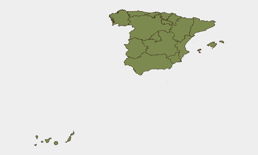
Situation Summary
Spain faces an acute, multi-region wildfire crisis coinciding with ongoing organized crime disruptions and irregular migration flows. Over 63,000 people have been evacuated from central Spain in the past 24–48 hours, with additional lockdowns in Catalonia and heightened alert status in Aragón due to extreme fire conditions and infrastructure risk. Law-enforcement operations against burglary rings and drug trafficking networks indicate sustained criminal activity, while the national composite threat score remains moderate (rank #121 globally, score 8/100); however, regional concentration in Madrid (score 31.7) and wildfire-driven displacement create near-term duty-of-care and operational continuity risks for organizations with personnel or assets in affected zones.
Key Developments
- Central Spain wildfire complex (Madrid, Toledo, Ávila) – July 28–29, 2026: Over 63,000 people evacuated following large merged wildfire. Interior Ministry has declared a national emergency and assumed operational control of firefighting and security deployments. Agricultural harvesting machinery use temporarily banned to reduce ignition risk.
- Madrid region suburban wildfires (west of capital) – July 28–29, 2026: Multiple fires have coalesced into a larger blaze, prompting tens of thousands of additional evacuations and confinement orders in adjacent municipalities. Spanish Interior Minister and regional authorities report ongoing lockdowns and large-scale security-force deployment.
- Catalonia wildfire complex (La Bisbal d'Empordà, Girona; Tiana near Barcelona) – July 28–29, 2026: Seven municipalities in Girona province placed under confinement orders; separate wildfire near Barcelona has confined a hostel and residential development. Smoke impacts metropolitan Barcelona area; multiple active fire fronts reported.
- Aragón elevated alert (six comarcas) – July 28–29, 2026: Regional government declared "alerta rojo plus" (red-plus alert) in six comarcas due to extreme wildfire risk, restricting rural activities and enabling rapid emergency-asset deployment.
- Burglary ring dismantled (Cáceres, Cuenca, Huesca, Toledo, Murcia) – July 28–29, 2026: Guardia Civil arrested ten men accused of eleven burglaries with force across five provinces, indicating coordinated multi-region property crime.
- Drug-trafficking network dismantled (Seville, Andalusia) – July 28–29, 2026: National Police completed second phase of "Operación Agila," arresting eleven individuals in dismantling of heroin and crack trafficking network. Total detainees in operation now 28.
- Irregular maritime migration (Balearic Islands) – July 29, 2026 (preceding hours): Authorities reported 128 migrants arriving in five small boats, continuing irregular maritime crossings and search-and-rescue demand on island authorities.
Highest-Risk Areas
Madrid dominates the sub-national risk ranking (31.7) and is currently the epicenter of the wildfire crisis, with multiple evacuation zones and emergency-control operations by the Interior Ministry. Castile and León (8.5) and the Valencian Community (6.8) follow at distance, reflecting baseline organized-crime and property-crime activity. Catalonia (5.6) has moved into acute risk due to current wildfire-driven lockdowns near Barcelona and Girona, affecting transportation, commercial operations, and residential confinement. The wildfire concentration in Madrid and adjacent high-altitude, dry zones (Toledo, Ávila, Aragón) will remain the primary driver of short-term security risk and business continuity impact.
How GeoBit Would Assist
Security teams should deploy AOI (area-of-interest) monitoring and alerting on Madrid, Toledo, Ávila, and Catalonia fire zones to track evacuation perimeter changes, road closures, and infrastructure damage in near-real time. GIS and spatial analysis integrated with satellite imagery enable rapid mapping of active fire lines, smoke dispersal, and safe routing for personnel and supply chains. Multi-language OSINT and X/Telegram feeds provide early warning of evacuation escalations and police operations, while routing and network analysis tools support alternative journey planning for personnel and logistics across affected regions.
7-Day Outlook
Wildfires are forecast to persist through early August given sustained heat and dry conditions across central and northeastern Spain; evacuation zones will likely expand or contract with wind and firefighting progress. Organized crime operations and irregular migration flows will continue as baseline drivers of risk but remain secondary to wildfire-driven displacement and infrastructure vulnerability. Organizations with critical operations or personnel in Madrid, Catalonia, or surrounding provinces should prioritize supply-chain contingency and personnel movement authorization protocols through the fire season.
Highest-Risk Areas — Ranked
| # | State / Region | Risk |
|---|---|---|
| 1 | Community of Madrid | 31.7 |
| 2 | Castile and León | 8.5 |
| 3 | Valencian Community | 6.8 |
| 4 | Catalonia | 5.6 |
| 5 | Balearic Islands | 4.4 |
| 6 | Galicia | 3.4 |
| 7 | Canary Islands | 2.8 |
| 8 | Andalusia | 2.7 |
| 9 | Extremadura | 1.8 |
| 10 | Castile-La Mancha | 1.8 |
| 11 | Region of Murcia | 1.8 |
| 12 | Cantabria | 1.8 |
Sources
Previous Daily Briefs
A new Spain brief is written every day — each with its own risk map and downloadable CSV. Here's the last week; use the calendar to go further back.
📅 Browse every day by calendar →
Highlighted days have a brief. Tap a day for that day's map & analysis, or “csv” for that day's dataset ($5).
Atlas — our AI intelligence desk — emails them this snapshot personally. Nothing else, no list.