Situation Summary
Togo remains a stable, low-incident environment at the national level, ranked #74 globally by composite threat score. However, structural risk is concentrated in the northern Savanes and Kara regions, where porous borders with Burkina Faso and Mali expose populations to spillover from regional militant activity and cross-border trafficking. No acute security incidents have been confirmed in Togo over the last 24–48 hours; current risk reflects endemic conditions rather than emerging crisis.
Key Developments
No confirmed security, civil-unrest, or infrastructure incidents meeting high-confidence reporting standards have occurred in Togo in the last 24–48 hours. Open-source monitoring across mainstream news, specialist outlets, and social-media signals has not surfaced any discrete events (terrorist attacks, clashes, mass protests, or major crime incidents) with reliable time-stamps in this window. Monitoring remains active; any significant development will be flagged immediately upon corroboration.
Highest-Risk Areas
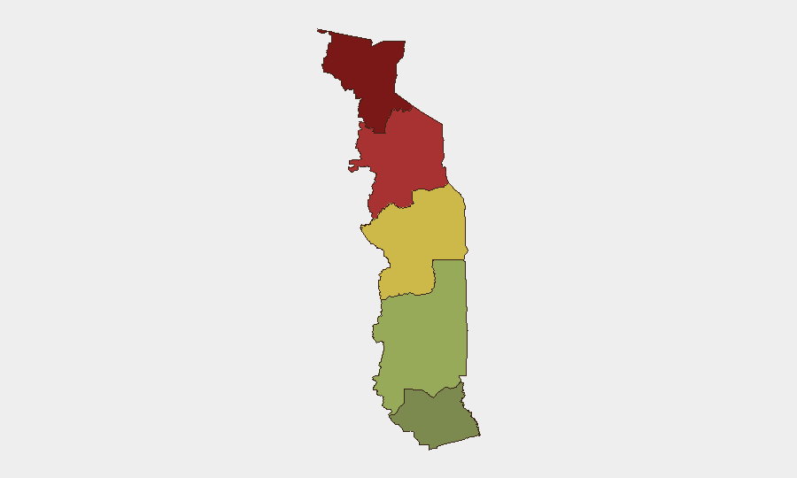
Risk is sharply north-south polarized. The Savanes Region (composite score 92) and Kara Region (78) drive country-level exposure due to proximity to armed-group activity in Burkina Faso and Mali, human-trafficking networks, and limited state presence. By contrast, the Maritime Region (28) and coastal corridor including Lomé remain comparatively secure, benefiting from stronger state control, port infrastructure, and international commerce oversight. Centrale and Plateaux regions occupy a middle band of risk, reflecting mixed security provision and road-corridor vulnerabilities. Organizations with personnel or assets in the north should maintain elevated situational awareness and communication protocols.
How GeoBit Would Assist
AOI Monitoring & Early Warning provides persistent watch over high-risk northern prefectures (Savanes, Kara) with automated alerting on movement, assembly, or incident signals. Multi-language search and OSINT fusion (French, local languages, Telegram/X signals) enables real-time tracking of cross-border militant chatter, trafficking reports, and local security developments that precede major incidents. Routing & Network Analysis supports security teams in pre-planning alternative travel corridors for personnel transiting between Lomé and northern work sites, bypassing known trafficking or ambush hotspots. Combined, these tools reduce latency in threat detection and operationalize duty-of-care protocols.
7-Day Outlook
No escalation is anticipated in the immediate term. Togo's political and security environment remains stable under President Faure Gnassingbé. Regional spillover risk from Burkina Faso and Mali will persist as a chronic, managed concern for northern operations; no specific trigger for acute deterioration is visible in current reporting. Monitoring should remain focused on cross-border militant movement, trafficking node activity, and any state-capacity changes in the Savanes Region.
Highest-Risk Areas — Ranked
| # | State / Region | Risk |
|---|---|---|
| 1 | Savanes Region | 92 |
| 2 | Kara Region | 78 |
| 3 | Centrale Region | 65 |
| 4 | Plateaux Region | 45 |
| 5 | Maritime Region | 28 |
Sources
Previous Daily Briefs
A new Togo brief is written every day — each with its own risk map and downloadable CSV. Here's the last week; use the calendar to go further back.
📅 Browse every day by calendar →
Highlighted days have a brief. Tap a day for that day's map & analysis, or “csv” for that day's dataset ($5).
Atlas — our AI intelligence desk — emails them this snapshot personally. Nothing else, no list.