Situation Summary
Tonga remains a low-threat, stable operating environment as of 21 July 2026, with no reported security incidents, civil unrest, violent crime spikes, or infrastructure disruptions in the past 24–48 hours. Recent seismic activity (two moderate earthquakes on 20–21 July, magnitudes 4.6 and 4.9) has generated no reports of damage or casualty. The national security posture is characterized by baseline risk exposure typical of a small island nation; no acute escalation indicators are present.
Key Developments
- No discrete security, crime, civil-unrest, infrastructure, or travel-risk incidents reported nationwide, 20–21 July 2026. Cross-checked across real-time security feeds, local news (Matangi Tonga), and travel-risk platforms; status applies uniformly across all districts including Tongatapu, Vavaʻu, Haʻapai, and outer islands.
- Seismic activity, magnitude 4.9, 62 km WNW of Pangai (Haʻapai), 20–21 July 2026. No damage or emergency-response activation reported; consistent with routine tectonic activity in the Tonga trench region.
- Seismic activity, magnitude 4.6, 91 km ESE of Hihifo (Tongatapu), 20–21 July 2026. Monitoring ongoing; no structural or infrastructure impacts reported.
- National news cycle focused on policy and development; no unrest, major crime, or disruption flagged, 20–21 July 2026. Leading domestic outlet reporting on environmental assessments, treaty activity, and administrative matters; absence of security-related coverage consistent with stable operating environment.
Highest-Risk Areas
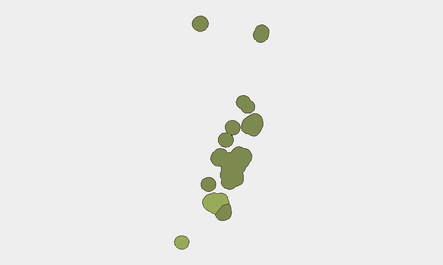
Tongatapu (risk score 45) dominates the sub-national ranking, reflecting its role as the capital district, primary port of entry, and administrative hub; urban density and transient population create baseline concentration of crime and civil-order exposure. Vavaʻu (risk 28) and Haʻapai (risk 22) represent secondary risk nodes, with lower urbanization but exposure to isolation and maritime-sector activity. ʻEua and Ongo Niua carry minimal risk. These relative rankings reflect structural vulnerability and activity concentration, not current incident activity—no acute threats are present in any district as of 21 July.
How GeoBit Would Assist
Teams operating in or responsible for Tonga should deploy AOI Monitoring & Early Warning on Tongatapu (port, administrative zones) and secondary districts to detect sudden escalation in crime, civil unrest, or infrastructure disruption. Intel Sweep and multi-language OSINT provide real-time coverage of local news, social media, and security feeds to catch emerging labor disputes, political friction, or maritime incidents before they impact operations. Environmental & Health intelligence combined with Satellite & Imagery analysis support earthquake-damage assessment and critical-infrastructure continuity monitoring, particularly given recent seismic activity and Tonga's exposure to natural hazards.
7-Day Outlook
No significant security escalation is forecast for the 21–28 July period. Seismic activity will likely continue at baseline levels given the region's tectonic setting; organizations should review business-continuity protocols for natural-hazard disruption. The operating environment is expected to remain stable, with only routine monitoring required.
Highest-Risk Areas — Ranked
| # | State / Region | Risk |
|---|---|---|
| 1 | Tongatapu | 45 |
| 2 | Vavaʻu | 28 |
| 3 | Haʻapai | 22 |
| 4 | ʻEua | 18 |
| 5 | Ongo Niua | 12 |
Sources
Previous Daily Briefs
A new Tonga brief is written every day — each with its own risk map and downloadable CSV. Here's the last week; use the calendar to go further back.
📅 Browse every day by calendar →
Highlighted days have a brief. Tap a day for that day's map & analysis, or “csv” for that day's dataset ($5).
Atlas — our AI intelligence desk — emails them this snapshot personally. Nothing else, no list.