Situation Summary
Uganda remains a composite-threat environment (global rank #105, score 9/100) with elevated risk concentrated in the Central and Western regions. Recent signal activity reflects domestic political and administrative tensions rather than acute security incidents; no major armed clashes, mass casualty events, or verified operational security breaches have been documented in the last 24–48 hours. The current trajectory is one of managed but fragile stability, with underlying vulnerability to health emergencies (Ebola regional concern), cross-border militant activity, and governance friction that warrant continuous monitoring.
Key Developments
- Ebola regional risk statement (7 Jul) – African Union and Russian Federation issued joint communiqué expressing "deep concern" about Ebola Virus Disease outbreaks in the DRC and Uganda; emphasizes need for Africa CDC support and regional surveillance. Status: Strategic health-security alert; no new confirmed case clusters reported in Uganda in the last 24–48 hours.
- Domestic fiscal/administrative messaging (date unclear, recent circulation) – Social media circulation of President Museveni correspondence to Finance Minister regarding budgetary actions, copied to senior security officials. Status: Suggests ongoing executive involvement in fiscal governance; timing of original issuance not independently verified in current 24–48 hour window.
- Media shutdown claim (unverified, social platform origin) – Unconfirmed social post alleging Chief of Defence Forces ordered shutdown of NTV Uganda, Spark TV, and Daily Monitor. Status: Lacks independent corroboration and reliable timestamp; cannot be treated as verified incident without secondary source confirmation.
- Regional conflict context reinforced (7 Jul) – Open reporting on expanding Bundibugyo Ebola outbreak in eastern DRC notes backdrop of "regional conflict involving Congo, Rwanda, Burundi, Uganda, and dozens of non-state armed groups." Status: Analytical framing of persistent regional insecurity; no new attacks inside Uganda reported.
- Kenya–Uganda trade friction (ongoing) – Kenya's Finance Act and resulting sugar trade dispute with Uganda remains a source of economic and political tension at the border. Status: Structural risk factor with potential for localized commercial and administrative friction; no acute incident in last 24–48 hours.
Highest-Risk Areas
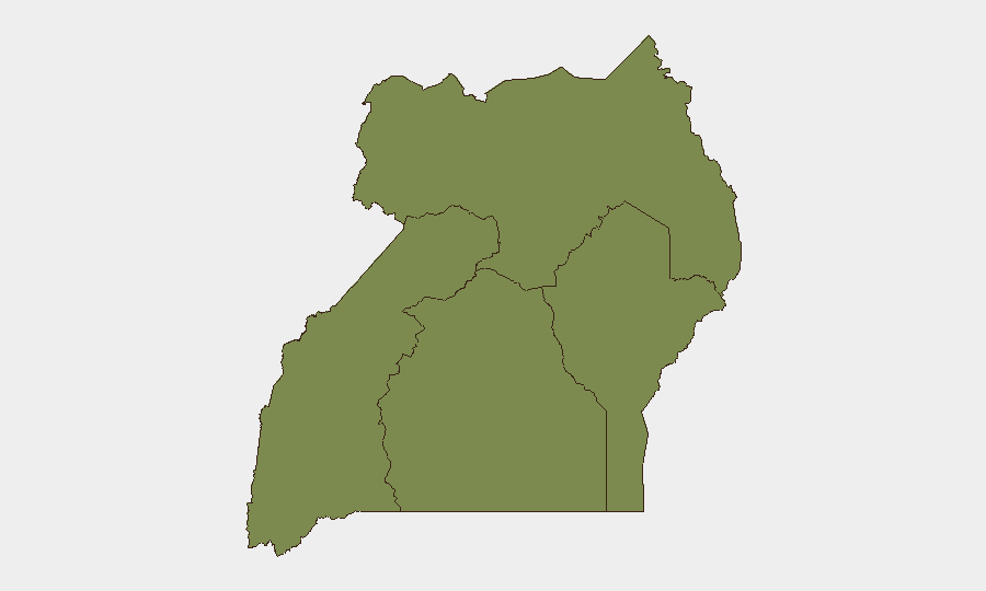
Central Region (risk score 32) and Western Region (risk score 31) dominate the threat landscape, accounting for the vast majority of tracked adverse events. Central Region's elevated score reflects urban concentration (Kampala), governance complexity, and cross-regional trafficking networks; Western Region's risk is driven by militant presence, border permeability with DRC, and recurring armed group activity. Northern Region (score 6.2) and Eastern Region (score 2) carry substantially lower but non-zero risk, primarily from residual militant cells and cross-border movement. Duty-of-care focus should remain on Kampala and the Western corridor (Mbarara, Fort Portal, border crossings).
How GeoBit Would Assist
Security teams should employ AOI Monitoring & Early Warning (persistent watch on Kampala, Gulu, Mbarara, and Fort Portal with automated alerting for new event signals); Intel Sweep and multi-language OSINT (hourly trawl of verified Ugandan news, police statements, Ministry of Health, and actor social channels to catch breaking incidents in real time); and Conflict & Military mapping (cross-reference UPDF positioning, non-state armed group presence, and border dynamics in Western Region to anticipate flashpoints). Satellite imagery and network analysis can support verification of unconfirmed claims (e.g., media shutdown orders) before operational decisions are made.
7-Day Outlook
No major escalation is forecasted in the near term; however, the combination of health emergency (Ebola) and underlying political/administrative friction means contingencies for rapid response remain essential. Monitor AU and WHO statements, Ugandan Ministry of Health daily briefs, and verified Kampala media for any confirmation of new Ebola cases or security incidents. Border-area teams should maintain heightened situational awareness given persistent regional conflict dynamics.
Highest-Risk Areas — Ranked
| # | State / Region | Risk |
|---|---|---|
| 1 | Central Region | 32 |
| 2 | Western Region | 31 |
| 3 | Northern Region | 6.2 |
| 4 | Eastern Region | 2 |
Sources
Previous Daily Briefs
A new Uganda brief is written every day — each with its own risk map and downloadable CSV. Here's the last week; use the calendar to go further back.
📅 Browse every day by calendar →
Highlighted days have a brief. Tap a day for that day's map & analysis, or “csv” for that day's dataset ($5).
Atlas — our AI intelligence desk — emails them this snapshot personally. Nothing else, no list.