Situation Summary
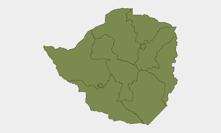
Zimbabwe remains ranked #123 globally (composite threat score 7) with concentrated risk in Harare and Midlands Province, each scoring 31.4 on the sub-national index. Current reporting shows limited verifiable on-the-ground security incidents in the past 24–48 hours; instead, the threat landscape is shaped by a planned nationwide shutdown call (scheduled 31 July) and persistent economic-grievance narratives circulating among diaspora and civic groups. The security environment is characterized more by forward-looking civil-unrest risk and property-rights concerns than by immediate violent incidents.
Key Developments
- Nationwide shutdown call – multiple cities – 4 July 2026 (planned for 31 July)
Civic and political groups circulated social-media calls for a countrywide shutdown on 31 July, citing economic hardship and governance grievances. If the mobilization gains traction, this could trigger business disruption and civil congestion across Harare, Bulawayo, and other urban centers; no confirmation of turnout or organizing structure yet available.
- Fire Marshal vs. Residents incident – location and details under investigation – 5 July 2026
GeoBit event signal flagged; details remain sparse in open reporting. Typical of lower-level civil friction but warrants monitoring for escalation pattern.
- Consulate-related public statement by Zimbabwean nationals – 5 July 2026
Signal indicates diplomatic or consular engagement; underlying grievance and scope not yet clarified in available sources.
- Zimbabwe–China diplomatic friction – 4 July 2026
Official disapproval noted; context (economic, political, or trade-related) requires further clarification. Relevant to supply-chain and investment stability.
- Regional diaspora narratives on property insecurity and economic distress – South Africa, 4 July 2026
Commentary and anecdotal reports from Zimbabwean nationals in South Africa reflect heightened concern over land seizures, forced evictions, and cross-border displacement risk, though incidents themselves occurred outside Zimbabwe.
- Web reporting gap – 4–5 July 2026
Open-source verification of specific crimes, infrastructure failures, or organized political violence inside Zimbabwe in the last 48 hours remains limited; most current signals are planned actions or diaspora commentary rather than confirmed on-the-ground incidents.
Highest-Risk Areas
Harare and Midlands Province are substantially elevated (risk 31.4 each), driven primarily by urban-concentration factors, economic hardship, and civil-organization activity. All other tracked provinces score 1.4, indicating either lower incident density or data-collection gaps in those regions. The concentration in Harare reflects both population density and the presence of government institutions, making it the focal point for planned protests and civic mobilization. Midlands' elevation warrants field-level corroboration to confirm whether risk reflects actual incidents or reporting artifacts.
How GeoBit Would Assist
Security teams managing people or assets in Zimbabwe should deploy AOI Monitoring & Early Warning on Harare and Midlands Province to track the 31 July shutdown mobilization and flag escalation signals in real time. Intel Sweep and X/Twitter & Telegram OSINT capabilities will provide continuous sentiment, actor-network, and call-to-action analysis to assess protest turnout probability and timing shifts. Routing & Network Analysis can pre-plan alternative journey and supply routes for staff and critical shipments should urban disruption materialize.
7-Day Outlook
The immediate threat trajectory is shaped by the 31 July shutdown call and its organizing momentum over the next 26 days. Short-term risk (next 7 days) remains limited to low-level friction and preparation signaling; the material civil-unrest window opens only if the planned action achieves measurable participation. Continued monitoring of diaspora narratives and cross-border displacement will provide early indicators of broader regional instability affecting Zimbabwe's external stability and labor/investment inflows.
Highest-Risk Areas — Ranked
| # | State / Region | Risk |
|---|---|---|
| 1 | Midlands Province | 31.4 |
| 2 | Harare | 31.4 |
| 3 | Mashonaland West Province | 1.4 |
| 4 | Matabeleland South Province | 1.4 |
| 5 | Masvingo Province | 1.4 |
| 6 | Matabeleland North Province | 1.4 |
| 7 | Bulawayo Province | 1.4 |
| 8 | Mashonaland Central Province | 1.4 |
| 9 | Mashonaland East Province | 1.4 |
| 10 | Manicaland Province | 1.4 |
Previous Daily Briefs
A new Zimbabwe brief is written every day — each with its own risk map and downloadable CSV. Here's the last week; use the calendar to go further back.
📅 Browse every day by calendar →
Highlighted days have a brief. Tap a day for that day's map & analysis, or “csv” for that day's dataset ($5).
Atlas — our AI intelligence desk — emails them this snapshot personally. Nothing else, no list.