Situation Summary
Comoros remains a low-frequency threat environment globally (ranked #156), but underlying vulnerabilities around maritime crime, irregular migration, and institutional fragility persist. The past week saw no verified domestic security incidents within Comoros itself; however, a Comoros-flagged vessel operating in foreign waters experienced a suspected attack, underscoring maritime risks for the nation's shipping registry. The threat picture is dominated by sub-national instability in Anjouan and Grande Comore, where governance gaps and trafficking networks create persistent risk pockets.
Key Developments
- Romanian waters, Black Sea region – 14 October 2026: The Comoros-flagged chemical tanker *Yara J* reported a fire following a suspected drone strike while in Romanian territorial waters. Crew evacuated safely and extinguished the fire; Romanian authorities initiated investigation. Causation remains unconfirmed, though the incident highlights maritime exposure for vessels under the Comoros flag.
- Moroni, Grande Comore – 4 October 2026: Seventy-three migrants were transferred to Moroni from Mohéli coastal areas as part of migration-control operations; four migrants reportedly escaped during the transfer process. The incident reflects ongoing pressures on border and coastal security capacity.
- Badjo prison, Anjouan – 8 October 2026: Five Comorian nationals were remanded on suspicion of operating or assisting a migrant-smuggling network following interception by authorities. The arrest indicates active law-enforcement response to organized transnational trafficking but also underscores the scale of migrant-smuggling operations transiting the archipelago.
No additional corroborated security events within Comoros territory were identified in the 14–20 October 2026 window.
Highest-Risk Areas
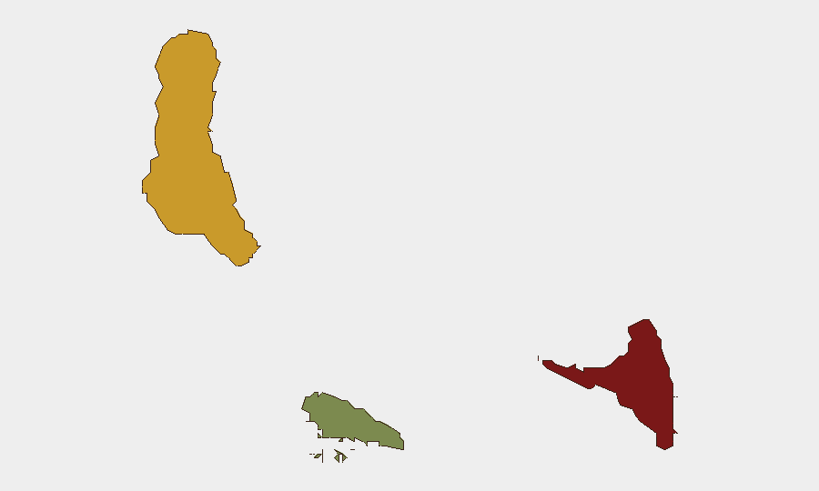
Anjouan (composite risk score 88) and Grande Comore (score 72) account for the vast majority of documented threat concentration. Anjouan's elevated risk reflects a historical pattern of governance instability, limited state capacity, and geographic positioning as a transit point for irregular migration and trafficking networks. Grande Comore, hosting the capital Moroni, faces urban crime, migrant management pressures, and institutional fragmentation. Mohéli (score 35) remains substantially lower-risk, though coastal areas have emerged as migration staging points. Organizations with personnel or assets in Anjouan should maintain heightened vigilance; Grande Comore operations require standard urban security protocols.
How GeoBit Would Assist
AOI Monitoring & Early Warning on Anjouan and Grande Comore coastlines would provide persistent watch for maritime trafficking, irregular vessel activity, and cross-border movement. Maritime & Aviation Tracking combined with OSINT fusion (social media, Telegram networks, radio SIGINT) enables detection of smuggling networks and irregular-migration routes weeks before law-enforcement intervention. Network & Actor Analysis of known trafficking and organized-crime cells supports risk profiling of contacts and operational partners, reducing exposure to complicit actors.
7-Day Outlook
No acute security deterioration is forecast for the immediate week ahead. Migrant-smuggling and associated law-enforcement activity will likely remain the dominant security driver; coastal instability in Anjouan should be assumed persistent. Organizations should maintain routine monitoring posture and ensure duty-of-care protocols remain current for staff in high-risk zones (Anjouan, central Moroni).
Highest-Risk Areas — Ranked
| # | State / Region | Risk |
|---|---|---|
| 1 | Anjouan | 88 |
| 2 | Grande Comore | 72 |
| 3 | Moheli | 35 |
Sources
Previous Weekly Briefs
A new Comoros brief is written every Monday, covering the week — each with its own risk map and downloadable CSV. Use the calendar to go further back.
- October 13, 2026
- October 6, 2026
- September 29, 2026
- September 22, 2026
- September 15, 2026
- September 8, 2026
- September 1, 2026
📅 Browse past briefs by calendar →
Highlighted days have a brief. Tap a day for that day's map & analysis, or “csv” for that day's dataset ($5).
Atlas — our AI intelligence desk — emails them this snapshot personally. Nothing else, no list.