Situation Summary
Antigua and Barbuda remains a low-threat environment with a composite threat score of 3 and no tracked security events in the current monitoring window. No credible reports of significant civil unrest, infrastructure disruption, political instability, or elevated crime spikes have emerged in the last 24–48 hours across open-source channels and social media. The security posture remains stable, though routine localized crime may occur below the threshold of public reporting.
Key Developments
- No verified security incidents reported in Antigua and Barbuda in the last 24–48 hours across international news outlets, government advisories, emergency services channels, or X/Twitter monitoring. The absence of cross-verified events reflects baseline security conditions rather than heightened risk.
Highest-Risk Areas
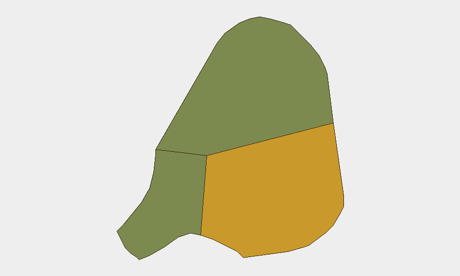
Antigua (composite risk score 72) accounts for the majority of intra-national threat concentration, reflecting the island's larger population, urban density, and economic activity centered in St. John's and the northwestern coastal zone. Barbuda (risk 18) and Redonda (risk 8) carry significantly lower risk profiles consistent with smaller populations and fewer reported security incidents. The disparity underscores that security planning and duty-of-care protocols should prioritize Antigua, particularly areas with transient populations, tourism infrastructure, and financial/commercial hubs.
How GeoBit Would Assist
Security teams with personnel or assets in Antigua and Barbuda should employ AOI Monitoring & Early Warning to establish persistent watch over key facilities, ports, and commercial districts and receive alerts on incident signals in real time. Intel Sweep and multi-language X/Twitter & Telegram OSINT capabilities enable continuous scanning for emerging civil unrest, labor actions, or localized crime spikes that may not immediately reach mainstream news. Risk & Threat Assessment and Network & Actor Analysis tools allow teams to model evolving threat actors, cross-border criminal networks, or destabilizing actors before they generate public incidents.
7-Day Outlook
No indicators suggest material change to the current low-threat baseline over the next seven days. Routine monitoring should continue to flag any unexpected developments in crime reporting, political messaging, or infrastructure status that could signal emerging risk to corporate or NGO operations.
Prepared by: GeoBit Senior Analyst
Classification: Operational
Date: 2026-07-07
Highest-Risk Areas — Ranked
| # | State / Region | Risk |
|---|---|---|
| 1 | Antigua | 72 |
| 2 | Barbuda | 18 |
| 3 | Redonda | 8 |
Sources
Previous Daily Briefs
A new Antigua and Barbuda brief is written every day — each with its own risk map and downloadable CSV. Here's the last week; use the calendar to go further back.
📅 Browse every day by calendar →
Highlighted days have a brief. Tap a day for that day's map & analysis, or “csv” for that day's dataset ($5).
Atlas — our AI intelligence desk — emails them this snapshot personally. Nothing else, no list.