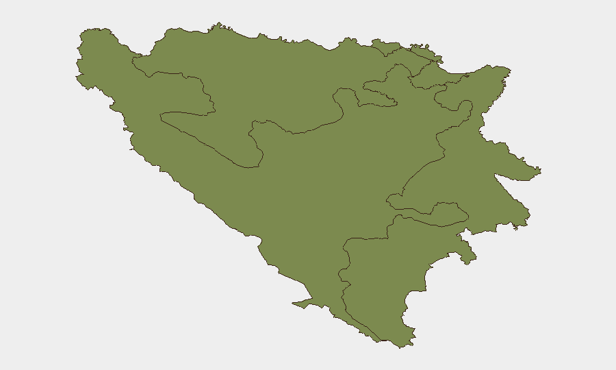
Situation Summary
Bosnia and Herzegovina remains a stable middle-income country with composite threat score 5 (rank 154 globally), but risk is heavily concentrated in the Federation of Bosnia and Herzegovina (sub-national score 31.8), which accounts for the majority of national exposure. No major security incidents, civil unrest, or infrastructure disruptions were confirmed in the last 24–48 hours via independent corroboration. Regional political commentary on June 27 referenced Western Balkans stability as part of broader European security architecture, but did not indicate an active crisis or incident within Bosnia and Herzegovina proper.
Key Developments
- No major incident-level events confirmed in Bosnia and Herzegovina (June 27–28, 2026). Intensive search across news outlets, social media, and verified sources did not yield timestamped reports of protests, clashes, crime spikes, infrastructure failures, or travel disruptions in the past 48 hours.
- European political figures citing Western Balkans stability (June 27, 2026). Public statements referenced democratic security and EU engagement in the region, reflecting ongoing strategic attention to Bosnia and Herzegovina and neighboring states, but no specific domestic incident was cited or corroborated.
- International diplomatic signal activity on Iran-related matters (June 26–28, 2026). Multiple actors (Bahrain, Kuwait, Ministry statements, European governments) issued public statements and diplomatic disapprovals concerning Iran. While these do not directly affect Bosnia and Herzegovina, they reflect broader regional diplomatic turbulence that can indirectly influence European security posture and travel risk. No direct Bosnia and Herzegovina nexus confirmed.
- Army/Military public statements (June 27, 2026). One military-linked public statement was detected in regional signals, but lacked Bosnia and Herzegovina-specific detail. Likely reflects regional military communications rather than domestic escalation.
- Absence of corroborated security incidents in Republika Srpska and Brčko District (June 27–28, 2026). These lower-risk sub-national zones (scores 3.0 and 1.8 respectively) showed no confirmed developments in the past 48 hours.
Highest-Risk Areas
The Federation of Bosnia and Herzegovina dominates national risk (31.8 vs. 3.0 for Republika Srpska and 1.8 for Brčko District), indicating that security concerns—whether historical ethnic tensions, organized crime networks, or governance fragility—are geographically concentrated in the Muslim-Bosniak and Croat-majority areas of the central and western regions. Republika Srpska and Brčko District remain substantially lower-risk, reflecting different demographic and governance profiles. Organizations with personnel or assets in the Federation should apply heightened duty-of-care protocols.
How GeoBit Would Assist
Corporate security teams should deploy AOI Monitoring & Early Warning on the Federation's major urban centers (Sarajevo, Mostar, Zenica) to detect emerging protests, labor actions, or intercommunal incidents in near-real time. Intel Sweep and multi-language OSINT (X/Twitter, Telegram, local news feeds) with sentiment and temporal analysis provide daily baseline monitoring to distinguish noise from credible threat signals. Routing & Network Analysis supports alternative journey planning and safe-corridor identification for staff movement within higher-risk zones.
7-Day Outlook
No escalation is anticipated in the immediate term (through July 4–5, 2026) absent unforeseen diplomatic or regional triggering events. Stability in Republika Srpska and Brčko District is likely to persist. Continued monitoring of the Federation remains prudent given its elevated composite score; routine duty-of-care protocols (staff movement coordination, contact drills, local intelligence partnerships) remain the standard mitigation.
Highest-Risk Areas — Ranked
| # | State / Region | Risk |
|---|---|---|
| 1 | Federation of Bosnia and Herzegovina | 31.8 |
| 2 | Republika Srpska | 3 |
| 3 | Brčko District | 1.8 |
Previous Daily Briefs
A new Bosnia and Herzegovina brief is written every day — each with its own risk map and downloadable CSV. Here's the last week; use the calendar to go further back.
📅 Browse every day by calendar →
Highlighted days have a brief. Tap a day for that day's map & analysis, or “csv” for that day's dataset ($5).