Situation Summary
Canada's composite threat score remains low globally (rank #92, score 6), but sub-national risk is concentrated sharply in Ontario (31.5), which accounts for a disproportionate share of the 312 tracked events. Recent signals include military mobilization activity, multi-agency public statements, indigenous settlement disputes, and at least one officer-involved incident in Toronto tied to a U.S. Consulate security matter. The risk profile suggests localized institutional friction and law-enforcement operational tempo rather than systemic instability.
Key Developments
- Toronto, Ontario — A Toronto police officer was killed during an operation connected to a prior U.S. Consulate shooting investigation; a second suspect remained at large and armed as of the last confirmed report. This represents an escalation in the institutional security posture and police operational response.
- Ottawa — Public statement activity flagged on 2026-06-16, suggesting federal-level communication or policy positioning; content and context not yet specified in available feeds.
- Ontario (Settlement Area) — Disapproval signals recorded between indigenous settlement and external parties (2026-06-16), indicating ongoing grievance or dispute that may affect operational access or community stability in the region.
- Canadian Military — Military mobilization flagged on 2026-06-16; scope (training exercise, readiness posture, or response deployment) not yet clarified in available signals.
- Toronto Media / Municipal — Public statement conflict recorded (2026-06-16), suggesting reputational or governance friction in Canada's largest metropolitan area.
- Toronto Police — Arrest/detain activity recorded (2026-06-15), consistent with ongoing law-enforcement operations tied to the consulate-related incident.
Note: Available open-source signals do not yet provide sufficient cross-verification of incident timelines or operational detail to confirm all events occurred within the last 24–48 hours. Corroboration from additional sources is recommended before operational decision-making.
Highest-Risk Areas
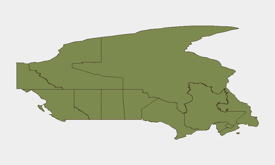
Ontario dominates the sub-national ranking (31.5), driven by Toronto's concentration of federal, diplomatic, and law-enforcement activity. The Toronto police incident, consulate security matter, and media/governance friction account for much of the signal volume. Nunavut (10.1) shows secondary risk, likely linked to remote infrastructure, resource security, or indigenous governance issues. British Columbia and Quebec (both 6.1) represent moderate, distributed risk. All other provinces remain below 3.0, indicating risk is geographic and sectoral rather than nationwide.
How GeoBit Would Assist
A corporate security team with personnel or assets in Canada should deploy AOI Monitoring & Early Warning on Toronto and Ontario hotspots to detect escalation in police/military/diplomatic activity before it affects operations. Multi-language OSINT fusion (X, Telegram, news feeds, radio SIGINT) and entity extraction on settlement disputes and indigenous governance actors would provide 48–72-hour early warning of community access restrictions or protest activity. Conflict & military force-structure tracking would clarify the scope and duration of the flagged Canadian military mobilization and inform travel/supply-chain routing decisions via alternative route planning.
7-Day Outlook
The Toronto police incident is likely to remain active through ongoing suspect manhunt and investigation, sustaining heightened police presence and potential travel disruption in central Toronto. Settlement and indigenous governance disputes may escalate to public statements or demonstrations, particularly if federal or provincial responses are perceived as dismissive. Military mobilization signals should be monitored for clarity on scope and duration within 48–72 hours.
Highest-Risk Areas — Ranked
| # | State / Region | Risk |
|---|---|---|
| 1 | Ontario | 31.5 |
| 2 | Nunavut | 10.1 |
| 3 | British Columbia | 6.1 |
| 4 | Quebec | 6.1 |
| 5 | Alberta | 5.3 |
| 6 | New Brunswick | 2.9 |
| 7 | Manitoba | 2.8 |
| 8 | Saskatchewan | 2.1 |
| 9 | Newfoundland and Labrador | 1.9 |
| 10 | Yukon | 1.5 |
| 11 | Northwest Territories | 1.5 |
| 12 | Prince Edward Island | 1.5 |
Sources
Previous Daily Briefs
A new Canada brief is written every day — each with its own risk map and downloadable CSV. Here's the last week; use the calendar to go further back.
📅 Browse every day by calendar →
Highlighted days have a brief. Tap a day for that day's map & analysis, or “csv” for that day's dataset ($5).