Situation Summary
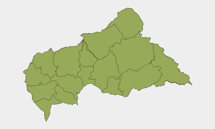
Central African Republic remains at moderate global risk (rank #29, composite score 69) with no tracked security events recorded as of 2026-06-06. However, recent event signals suggest emerging political friction—including Central Election Commission rejection activity and government–central bank disagreement—coupled with persistent rebel-led territory occupation and arrest/detention incidents. All 12 sub-national regions carry identical composite risk scores (48.3), indicating either systemic nationwide instability or data limitations; eastern and northeastern prefectures (Bamingui-Bangoran, Vakaga, Haute-Kotto, Haut-Mbomou, Mbomou) traditionally harbor armed groups and remain priority zones for duty-of-care oversight.
Key Developments
- 2026-06-06 · Central Election Commission rejects action: Rejection activity at the electoral body signals possible dispute over candidate registration, ballot procedures, or observer access; implications for political stability and rule-of-law confidence require clarification.
- 2026-06-05 · Africa-level threat: Unnamed threat directed at continental actors may reflect spillover from neighboring conflicts (DRC, Chad, South Sudan) or transnational criminal activity; scope and target remain unclear pending corroboration.
- 2026-06-05 · Rebel-led territory occupation vs. Ministry: Armed group occupation of government-controlled or contested territory indicates active territorial contest; location and group identity not yet confirmed.
- 2026-06-04 · Government–Central Bank disagreement: Disapproval signals between executive and monetary authority suggest policy conflict or institutional tension; economic or currency stability may be at risk.
- 2026-06-04 · Central Bank arrest/detain activity: Detention action involving Central Bank actors or related parties; relationship to government disagreement above unclear.
Note: Raw event signals lack sufficient geographic specificity and causal detail. Verification through OSINT and cross-corroboration is essential before operational decisions.
Highest-Risk Areas
All 12 prefectures show uniform composite risk (48.3), a pattern suggesting either genuinely distributed nationwide instability or incomplete granular data. Operationally, eastern and southeastern zones—Bamingui-Bangoran, Vakaga, Haute-Kotto, Haut-Mbomou, and Mbomou—remain historically volatile due to cross-border armed group presence, trafficking corridors, and weak state capacity. Western prefectures (Ouham, Ouham-Pendé, Nana-Mambéré) and the southern tier (Sangha-Mbaéré, Mambéré-Kadéï) have experienced cyclical communal and criminal violence. Kémo and Nana-Grébizi present lower absolute incident density but similar composite scores, warranting targeted intelligence review to confirm risk calibration.
How GeoBit Would Assist
Security and risk teams should deploy Intel Sweep and multi-language OSINT (X, Telegram, news, radio SIGINT) to close the 24–48-hour reporting gap and validate event signals with source attribution and specificity. AOI Monitoring & Early Warning with persistent watch on eastern prefectures and Bangui will flag territory occupation, displacement, and armed movement in near-real time. Network & Actor Analysis will map rebel, militia, and government entity relationships to clarify the government–Central Bank dispute and electoral rejection, informing threat trajectory and duty-of-care posture.
7-Day Outlook
Political friction around electoral procedures and monetary policy, combined with ongoing rebel presence in remote eastern zones, suggests a stable but fragile near-term outlook. Escalation risk remains contingent on electoral transparency and central bank independence; any further institutional breakdown or cross-border spillover from DRC instability could accelerate deterioration. Continuous OSINT corroboration and scenario planning are advised for personnel and asset protection.
Highest-Risk Areas — Ranked
| # | State / Region | Risk |
|---|---|---|
| 1 | Bamingui-Bangoran | 48.3 |
| 2 | Vakaga | 48.3 |
| 3 | Haute-Kotto | 48.3 |
| 4 | Haut-Mbomou | 48.3 |
| 5 | Mbomou | 48.3 |
| 6 | Nana-Mambéré | 48.3 |
| 7 | Ouham-Pendé | 48.3 |
| 8 | Mambéré-Kadéï | 48.3 |
| 9 | Sangha-Mbaéré | 48.3 |
| 10 | Ouham | 48.3 |
| 11 | Nana-Grébizi | 48.3 |
| 12 | Kémo | 48.3 |
Sources
Previous Daily Briefs
A new Central African Republic brief is written every day — each with its own risk map and downloadable CSV. Here's the last week; use the calendar to go further back.
📅 Browse every day by calendar →
Highlighted days have a brief. Tap a day for that day's map & analysis, or “csv” for that day's dataset ($5).