Situation Summary
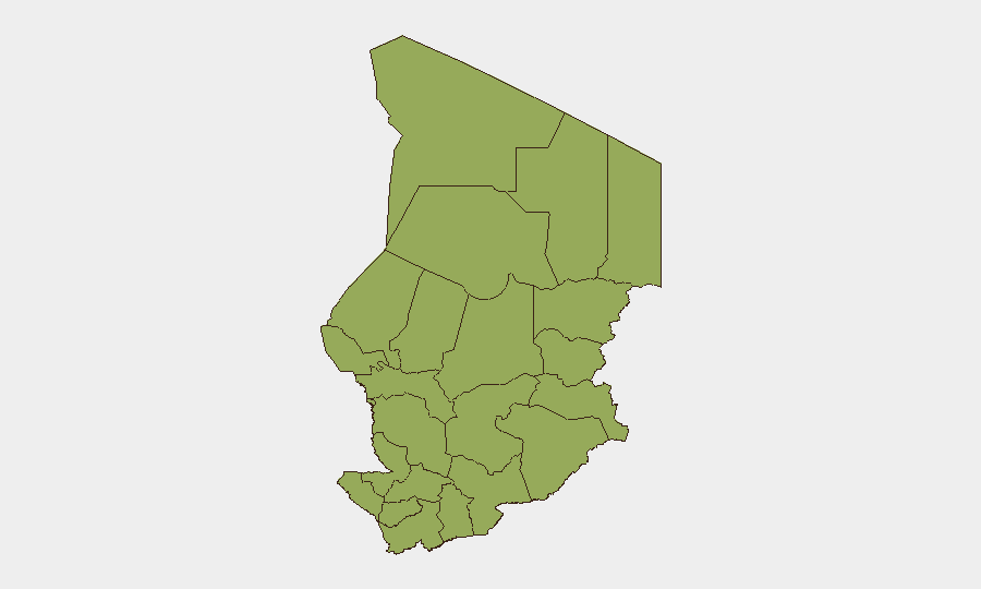
Chad remains a composite threat level 69 (#32 globally), with uniform high risk distributed across all 12 tracked regions. Recent event signals (arrests, detentions, and public statements on 13–15 June) suggest heightened government or security-sector activity, though available open-source reporting does not yet clarify the operational context, scale, or implications for expatriate or corporate operations. The absence of localized sub-national differentiation in the risk matrix indicates systemic, rather than conflict-zone-specific, pressure across the country.
Key Developments
- 2026-06-15 · Public Statement (Chad) — Government or official body issued public statement(s); specific subject matter and addressee not yet determined from available reporting.
- 2026-06-13 · Arrest/Detention (Chad) — One or more arrest or detention events recorded; details including location within Chad, number of persons, and stated reason are not yet available.
- 2026-06-13 · Arrest/Detention (United States vs. Chad) — Detention event with bilateral or transnational dimension involving U.S. and Chad; jurisdiction, accused party, and cause remain unclear.
- 2026-06-13 · Arrest/Detention (Florida vs. Chad) — Detention event with apparent Florida-Chad nexus; likely involves either a U.S. national detained in Chad or extradition/enforcement matter.
- 2026-06-13 · Demonstrate/Rally (Chad context) — Public demonstration or rally signal indexed to Chad; participant groups, location, and grievance not yet specified in current reporting.
Note on Research Limitations: Current open-source search results do not contain Chad-specific breaking news, social-media reporting, or wire updates from the 24–48 hour window. The event signals above are recorded in the GeoBit platform but lack the granular detail (location, actors, scope, motivation) normally required to brief operational risk. Security teams should request an expanded OSINT sweep (news feeds, X/Twitter, Telegram, and multi-language sources) to clarify whether these signals reflect routine administrative action, political detention, or escalating instability.
Highest-Risk Areas
All 12 regions of Chad carry equal composite risk (48), indicating that insecurity is national in character rather than regionally concentrated. This uniform distribution suggests either widespread governance fragility, multi-directional security pressures (banditry, militant activity, inter-communal tension), or incomplete sub-national data resolution. The inclusion of N'Djamena (the capital and primary business/diplomatic hub) in the highest-risk tier is noteworthy and signals that even central institutions and urban areas are subject to the same threat drivers affecting peripheral zones.
How GeoBit Would Assist
Intel Sweep & OSINT Fusion would consolidate real-time event feeds, X/Twitter, and Telegram activity to clarify the arrests and detention signals and identify any coordination or escalation. AOI Monitoring & Early Warning on N'Djamena and key economic zones (oil facilities, ports, transport corridors) would provide persistent alerting if the current activity pattern shifts toward wider instability. Conflict & Military analysis and regime-stability monitoring would help teams distinguish routine law enforcement from potential political crisis or security-force factionalism.
7-Day Outlook
The cluster of detention and public-statement events on 13–15 June warrants close observation over the next 7 days to determine whether this represents isolated incidents or the onset of broader security or political movement. Teams with personnel or assets in Chad should confirm current status, communication protocols, and evacuation readiness pending clarification of the underlying driver and scope of these signals.
Highest-Risk Areas — Ranked
| # | State / Region | Risk |
|---|---|---|
| 1 | Ennedi-Ouest | 48 |
| 2 | Wadi Fira | 48 |
| 3 | Ouaddaï | 48 |
| 4 | Sila | 48 |
| 5 | Salamat | 48 |
| 6 | East Ennedi | 48 |
| 7 | Kanem | 48 |
| 8 | Lac | 48 |
| 9 | N'Djamena | 48 |
| 10 | Hadjer-Lamis | 48 |
| 11 | Chari-Baguirmi | 48 |
| 12 | Tibesti | 48 |
Previous Daily Briefs
A new Chad brief is written every day — each with its own risk map and downloadable CSV. Here's the last week; use the calendar to go further back.
📅 Browse every day by calendar →
Highlighted days have a brief. Tap a day for that day's map & analysis, or “csv” for that day's dataset ($5).