Situation Summary
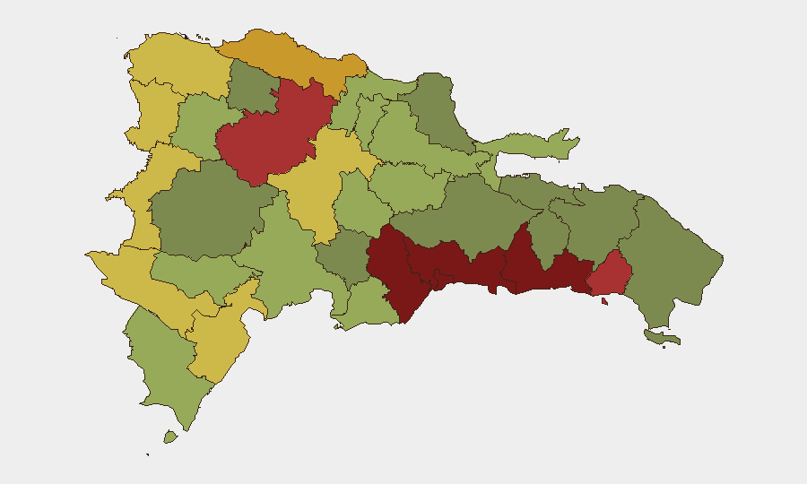
The Dominican Republic remains under baseline elevated risk, with a composite threat score of 19 and no tracked security events in the current 24-48 hour window. Sub-national risk concentration is acute: Santo Domingo and Nacional District (the capital region) together account for the highest threat density, driven by persistent crime and gang activity rather than acute instability or political rupture. The security environment shows no signs of imminent deterioration, though chronic vulnerabilities in urban centers and border zones persist.
Key Developments
No discrete security, civil-unrest, conflict, crime, or infrastructure incidents were identified with reliable timestamps placing them within the last 24–48 hours. Recent news coverage of a significant hotel fire at Viva Wyndham Dominicus Beach in La Romana circulated widely but is dated several days prior to this reporting window and does not meet recency criteria for inclusion as a current development.
Highest-Risk Areas
Santo Domingo (risk 92) and Nacional District (risk 88) dominate the risk landscape, reflecting the capital metropolitan area's exposure to organized crime, gang violence, and armed robbery—patterns endemic to large Caribbean urban centers with high population density and economic inequality. San Cristóbal, San Pedro de Macorís, and La Romana (risks 85, 83, 78 respectively) represent a secondary tier of concern, particularly along the south-central coast where drug trafficking activity and street crime create elevated danger. Border provinces (Elías Piña, Dajabón, Independencia) register moderate-to-elevated scores reflecting traditional smuggling and contraband movement; these zones warrant monitoring but do not currently show signs of acute destabilization.
How GeoBit Would Assist
Teams with personnel or assets in Dominican Republic should employ AOI Monitoring & Early Warning on high-risk urban zones (Santo Domingo, Nacional District) and border crossings to detect emerging gang activity, roadblock incidents, or protest activity before they disrupt operations. OSINT fusion and multi-language search (X, Telegram, local news feeds, radio SIGINT) provide continuous low-level signal detection of criminal organization movements and kidnapping threats; entity extraction and network analysis map gang and trafficking networks active in specific corridors. Routing & Network Analysis enables security teams to identify and pre-plan alternative travel routes and safe zones in high-risk provinces ahead of personnel deployment.
7-Day Outlook
No specific threat escalation is anticipated in the near term. Baseline crime and gang activity will persist in urban centers; operational security protocols for Santo Domingo, Santiago, and coastal commercial zones should remain in effect. Security teams should maintain routine monitoring for any sudden clustering of incidents (armed robbery, express kidnappings, or roadblocks) that might signal localized gang conflict or a shift in criminal targeting patterns.
Highest-Risk Areas — Ranked
| # | State / Region | Risk |
|---|---|---|
| 1 | Santo Domingo | 92 |
| 2 | Nacional District | 88 |
| 3 | San Cristóbal | 85 |
| 4 | San Pedro de Macorís | 83 |
| 5 | La Romana | 78 |
| 6 | Santiago | 76 |
| 7 | Puerto Plata | 72 |
| 8 | Elías Piña | 70 |
| 9 | Dajabón | 68 |
| 10 | Barahona | 65 |
| 11 | Independencia Province | 64 |
| 12 | La Vega | 62 |
Sources
Previous Daily Briefs
A new Dominican Republic brief is written every day — each with its own risk map and downloadable CSV. Here's the last week; use the calendar to go further back.
📅 Browse every day by calendar →
Highlighted days have a brief. Tap a day for that day's map & analysis, or “csv” for that day's dataset ($5).