Situation Summary
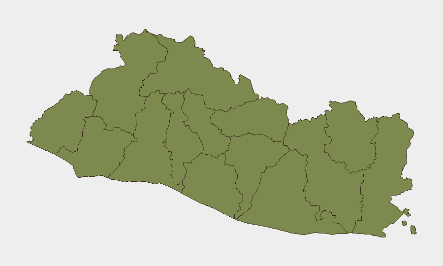
El Salvador remains a low-threat environment by global standards (composite threat score 7), but sub-national variation is pronounced, with Santa Ana Department registering significantly elevated risk (31.3) compared to all other regions (1.3 each). Recent activity reflects sustained counternarcotics and organized-crime enforcement by state authorities, particularly at sea and border points, rather than a spike in violence or instability. The security picture is stable but fragmented geographically.
Key Developments
- Maritime interdiction operation (nationwide maritime zone, 2026-07-30): Salvadoran Navy executed what authorities describe as the largest anti-drug operation in national history, intercepting two drug-trafficking vessels and seizing a major narcotics cargo at sea. This signals intensified maritime enforcement and may affect legitimate shipping and port operations.
- Electronics smuggling dismantling (U.S.–El Salvador routes, 2026-07-30): Fiscalía General de la República and Policía Nacional Civil shut down a structure smuggling cellphones and gaming consoles from the United States into El Salvador, indicating active customs and border enforcement that could result in increased inspections and delays at ports of entry.
- Forensic cocaine valuation (maritime seizure, 2026-07-30): Following a high-seas cocaine seizure, the Fiscalía initiated forensic analysis to establish exact weight and value, reflecting ongoing judicial processing of major interdictions.
- Narcotics destruction operation (Centro de Investigación Forense, 2026-07-30): State authorities destroyed over 50 kg of marijuana, cocaine, and methamphetamine seized in prior operations—a routine but significant indicator of sustained drug-control institutional activity.
- Organized-crime trial (Suchitoto, San Salvador, 2026-07-30): Tribunal Tercero contra el Crimen Organizado is conducting hearings against 32 gang members accused of operating an "18 sureños" structure in Suchitoto district, reflecting ongoing gang-focused prosecution.
- Construction fatality (Santa Ana, 2026-07-30): A talud collapse at a construction site killed one worker and injured another, underscoring occupational and infrastructure-safety risk in Santa Ana, consistent with the department's elevated risk profile.
Highest-Risk Areas
Santa Ana Department stands alone with a composite risk score of 31.3—more than 24 times higher than any other region. All remaining eleven departments cluster at 1.3, indicating either lower activity density or more stable conditions. Santa Ana's elevated profile warrants priority attention from security teams with personnel, assets, or supply chains in the department; risk drivers likely include gang activity, trafficking routes, and occupational hazards (as evidenced by the recent construction incident). The stark disparity suggests risk concentration rather than nationwide instability.
How GeoBit Would Assist
Security teams should employ AOI Monitoring & Early Warning to track Santa Ana and maritime zones for gang, trafficking, or enforcement activity with automated alerting. Intel Sweep and multi-language OSINT fusion provide real-time aggregation of Salvadoran media, official releases, and open sources to distinguish current developments from historical incidents—critical for duty-of-care decisions. GIS & Spatial Analysis combined with Routing & Network Analysis enables identification of safer transit corridors and ports least affected by enforcement operations or gang presence.
7-Day Outlook
Counternarcotics and border-enforcement operations are likely to continue at current intensity, reflecting state institutional capacity and international pressure. Santa Ana Department will remain the geographic focus for corporate security vigilance. No indicators suggest imminent nationwide destabilization or a significant escalation in organized violence.
Highest-Risk Areas — Ranked
| # | State / Region | Risk |
|---|---|---|
| 1 | Santa Ana Department | 31.3 |
| 2 | Ahuachapán Department | 1.3 |
| 3 | Sonsonate Department | 1.3 |
| 4 | Chalatenango Department | 1.3 |
| 5 | La Libertad Department | 1.3 |
| 6 | San Salvador Department | 1.3 |
| 7 | Cuscatlán Department | 1.3 |
| 8 | La Paz Department | 1.3 |
| 9 | Cabañas Department | 1.3 |
| 10 | San Vicente Department | 1.3 |
| 11 | Usulután Department | 1.3 |
| 12 | San Miguel Department | 1.3 |
Sources
Previous Daily Briefs
A new El Salvador brief is written every day — each with its own risk map and downloadable CSV. Here's the last week; use the calendar to go further back.
📅 Browse every day by calendar →
Highlighted days have a brief. Tap a day for that day's map & analysis, or “csv” for that day's dataset ($5).
Atlas — our AI intelligence desk — emails them this snapshot personally. Nothing else, no list.