Situation Summary
Eritrea remains a low-frequency event environment with composite threat ranking at 147 globally and zero tracked incidents in the current monitoring window. The country's political and security posture remains stable at the national level, though subnational risk concentration in the western and southern borderlands reflects persistent vulnerabilities linked to cross-border tensions, informal armed activity, and limited state capacity in remote regions. No new security incidents, civil unrest, or infrastructure failures have been corroborated in open sources over the last 24–48 hours.
Key Developments
No discrete, verifiable security incidents meeting recency and corroboration thresholds have been identified in the last 24–48 hours. Open-source reporting on Eritrea in the current window focuses on longer-running regional geopolitical dynamics (Horn of Africa diplomacy, Red Sea shipping security, and Ethiopia–Eritrea relations) rather than new domestic incidents. Should new developments emerge over the next 24–72 hours, they will be captured and flagged via GeoBit's persistent monitoring and alerting infrastructure.
Highest-Risk Areas
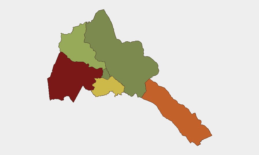
Gash-Barka (risk 92) and Southern Red Sea Region (risk 75) account for the vast majority of subnational threat concentration, reflecting their proximity to Sudan and the Red Sea's strategic corridor. Gash-Barka's risk profile stems from cross-border smuggling networks, informal armed groups, and limited government presence; the Southern Red Sea Region faces comparable vulnerabilities plus exposure to maritime and regional state-actor tensions. Debub Region (risk 68) retains elevated risk from similar dynamics. By contrast, Maekel Region (risk 18, centered on the capital, Asmara) and Northern Red Sea Region (risk 0) present significantly lower operational risk, reflecting stronger state control and lower incident frequency.
How GeoBit Would Assist
Corporate security teams with personnel or assets in Eritrea should employ GeoBit's AOI (area-of-interest) monitoring and alerting on Gash-Barka and Southern Red Sea Region to detect early indicators of cross-border activity, informal armed movement, or infrastructure disruption; multi-language open-source intelligence (OSINT) fusion, including social media, regional news, and diaspora networks, to surface emerging incidents faster than traditional reporting; and conflict and military network analysis to track regime stability, factional shifts, and changes in state security posture that could affect duty-of-care protocols. Routing and network analysis can support alternative journey planning for personnel transiting higher-risk zones.
7-Day Outlook
No imminent shifts in Eritrea's security baseline are evident from current intelligence. The country's trajectory remains one of low-frequency domestic events and stable (if rigid) state control, though subnational risk in western and southern regions will persist as structural features of cross-border exposure and limited capacity. Persistent monitoring for signals of regional escalation (Red Sea tensions, Ethiopia–Sudan developments) or diaspora-driven civil unrest remains prudent for any organization with sustained presence.
Highest-Risk Areas — Ranked
| # | State / Region | Risk |
|---|---|---|
| 1 | Gash-Barka | 92 |
| 2 | Southern Red Sea Region | 75 |
| 3 | Debub Region | 68 |
| 4 | Anseba | 55 |
| 5 | Maekel Region | 18 |
| 6 | Northen Red Sea Region | 0 |
Sources
Previous Daily Briefs
A new Eritrea brief is written every day — each with its own risk map and downloadable CSV. Here's the last week; use the calendar to go further back.
📅 Browse every day by calendar →
Highlighted days have a brief. Tap a day for that day's map & analysis, or “csv” for that day's dataset ($5).
Atlas — our AI intelligence desk — emails them this snapshot personally. Nothing else, no list.