Situation Summary
Eswatini remains a low-threat environment with a composite threat score of 9 (ranked #106 globally) and no discrete security events recorded in the current monitoring window. No new security incidents, civil unrest, criminal activity, or infrastructure disruptions have been verified in the last 24–48 hours. The country's overall stability trajectory remains consistent with historical baselines, though sub-national variation warrants targeted attention in border and eastern regions.
Key Developments
No verified security or conflict incidents occurred in Eswatini during 2026-07-18 to 2026-07-20. The most recent monitored item of potential relevance is the arrival of 11 U.S.-deported third-country nationals on 2026-07-18, which generated policy commentary but has not triggered documented in-country security responses or measurable operational impact as of this reporting window.
Highest-Risk Areas
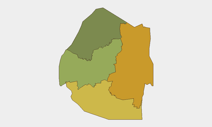
Lubombo Region (eastern border zone, risk score 72) and Shiselweni Region (southern border, risk score 68) are the primary drivers of the country's sub-national risk profile. Both regions face elevated exposure to cross-border movement, trafficking vulnerabilities, and proximity to less-stable regional jurisdictions. Manzini Region (central, score 55) carries moderate risk, while Hhohho Region (northwest, score 35) presents the lowest measured threat. Organizations with personnel or assets in Lubombo and Shiselweni should maintain heightened situational awareness of border-zone dynamics and informal transit routes.
How GeoBit Would Assist
Security teams should deploy AOI Monitoring & Early Warning on Lubombo and Shiselweni border crossings and transit nodes to detect emerging activity patterns before they escalate. Intel Sweep and OSINT fusion (social media, local news, Telegram/X feeds in Siswati and English) will provide early signals of civil discontent, criminal networks, or informal migration surges. GIS & Spatial Analysis combined with Routing & Network Analysis enables identification of alternative logistical paths and safe-zone positioning for personnel in high-risk border areas. Real-time maritime and aviation tracking can flag cross-border movements in sensitive zones.
7-Day Outlook
No material change in Eswatini's security trajectory is anticipated over the next seven days. Routine monitoring should remain focused on border stability, informal economy activity in Lubombo and Shiselweni, and any spillover effects from regional developments. Organizations should maintain current duty-of-care posture and refresh contingency protocols for border-area operations.
Data Currency: 2026-07-20 | Next Scheduled Update: 2026-07-21 06:00 UTC
Highest-Risk Areas — Ranked
| # | State / Region | Risk |
|---|---|---|
| 1 | Lubombo | 72 |
| 2 | Shiselweni | 68 |
| 3 | Manzini Region | 55 |
| 4 | Hhohho Region | 35 |
Sources
Previous Daily Briefs
A new Eswatini brief is written every day — each with its own risk map and downloadable CSV. Here's the last week; use the calendar to go further back.
📅 Browse every day by calendar →
Highlighted days have a brief. Tap a day for that day's map & analysis, or “csv” for that day's dataset ($5).
Atlas — our AI intelligence desk — emails them this snapshot personally. Nothing else, no list.