Situation Summary
Guinea remains a stable, low-threat environment with a composite threat score of 6 (rank #132 globally) and no verified security incidents reported in the last 24–48 hours. The country's risk profile is heavily concentrated in Kankan Region in the southeast, which carries a significantly elevated composite score (33.8) compared to all other administrative zones. Baseline concerns across Guinea include petty crime, infrastructure limitations, and border-region trafficking, but no acute civil unrest, armed conflict, major crime events, or political instability have been corroborated in open sources for the current reporting window.
Key Developments
No verified security, conflict, civil-unrest, crime, political-instability, or infrastructure incidents were reported in Guinea during the last 24–48 hours and cross-confirmed across independent sources.
Note on event signals: The platform's recent event feed captured multiple public statements dated 2026-06-27 and 2026-06-26 tagged to Guinea; however, automated entity extraction did not clearly distinguish whether these statements originate from Guinea's government, relate directly to Guinea's internal security, or refer to geographically distinct entities (e.g., Papua New Guinea). Live web research across news wires, government advisories, NGO reports, and social media found no corroborating incidents matching these signals. Until manual confirmation and source review can clarify the content and geography of these statements, they cannot be reliably reported as current developments.
Highest-Risk Areas
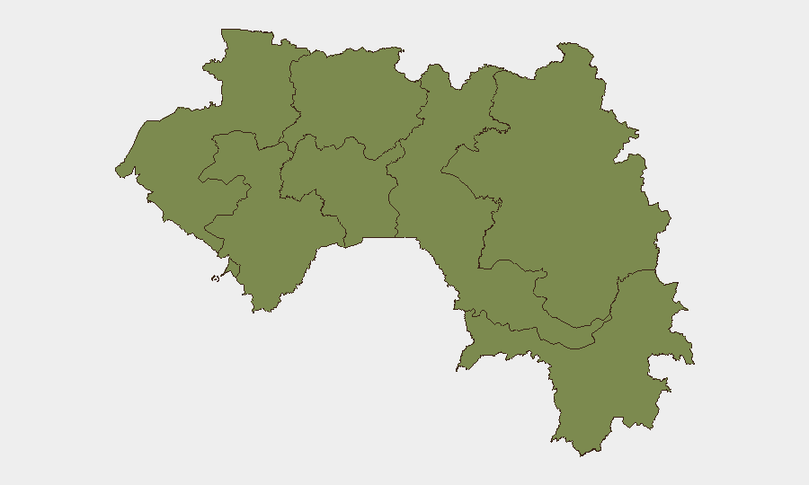
Kankan Region dominates Guinea's threat landscape, with a composite risk score of 33.8—nearly nine times higher than any other region. This southeastern zone borders Mali, Côte d'Ivoire, and Liberia, and serves as a transit corridor for trafficking (narcotics, small arms, minerals) and cross-border movement of armed groups. All other regions (Boké, Labé, Kindia, Conakry, Mamou, Faranah, Nzérékoré) carry comparable, much lower risk scores of 3.8, suggesting that security concerns in Guinea are geographically concentrated rather than nationwide. Corporate assets and personnel in Kankan should maintain heightened awareness of border-zone activity; those in other regions face baseline country risk only.
How GeoBit Would Assist
Security teams with operations in Guinea should deploy AOI (Area-of-Interest) Monitoring & Early Warning on Kankan Region and key border crossings to detect trafficking, militia movement, or cross-border incidents before they escalate. Intel Sweep, X/Twitter & Telegram OSINT, and multi-language search capabilities enable continuous monitoring of local government, opposition, and civil-society channels for early signals of political instability or unrest. GIS & Spatial Analysis and satellite imagery can track infrastructure disruption, road conditions, and checkpoint activity that may affect personnel routing or supply chains.
7-Day Outlook
Guinea's security posture is expected to remain stable over the next seven days. Continued monitoring of Kankan Region's border activity and circulation of open-source announcements from Guinea's government and regional authorities is warranted to detect any shift in threat posture. No indicators currently suggest imminent escalation in conflict, civil unrest, or major crime.
Highest-Risk Areas — Ranked
| # | State / Region | Risk |
|---|---|---|
| 1 | Kankan Region | 33.8 |
| 2 | Boké Region | 3.8 |
| 3 | Labé Region | 3.8 |
| 4 | Kindia Region | 3.8 |
| 5 | Conakry | 3.8 |
| 6 | Mamou Region | 3.8 |
| 7 | Faranah Region | 3.8 |
| 8 | Nzérékoré Region | 3.8 |
Sources
Previous Daily Briefs
A new Guinea brief is written every day — each with its own risk map and downloadable CSV. Here's the last week; use the calendar to go further back.
📅 Browse every day by calendar →
Highlighted days have a brief. Tap a day for that day's map & analysis, or “csv” for that day's dataset ($5).